- Sweetser, Indiana
Infobox Settlement
official_name = Sweetser, Indiana
settlement_type =Town
nickname =
motto =
imagesize =
image_caption =
image_
imagesize =
image_caption =
image_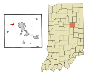
mapsize = 250x200px
map_caption = Location of Sweetser in the state ofIndiana
mapsize1 =
map_caption1 =subdivision_type = Country
subdivision_name =United States
subdivision_type1 = State
subdivision_name1 =Indiana
subdivision_type2 = County
subdivision_name2 = Grant
subdivision_type3 = Township
subdivision_name3 = Franklin, Pleasant, Richland
government_footnotes =
government_type =
leader_title =
leader_name =
leader_title1 =
leader_name1 =
established_title =
established_date =area_footnotes =
unit_pref = Imperial
area_magnitude =
area_total_km2 = 2.5
area_land_km2 = 2.5
area_water_km2 = 0.0
area_total_sq_mi = 1.0
area_land_sq_mi = 1.0
area_water_sq_mi = 0.0population_as_of = 2006
population_footnotes =
population_total = 857
population_density_km2 = 358.8
population_density_sq_mi = 929.2timezone = Eastern (EST)
utc_offset = -5
timezone_DST = EDT
utc_offset_DST = -4
elevation_footnotes =
elevation_m = 257
elevation_ft = 843
latd = 40 |latm = 34 |lats = 11 |latNS = N
longd = 85 |longm = 46 |longs = 1 |longEW = Wpostal_code_type =
ZIP code
postal_code = 46987
area_code = 765
blank_name = FIPS code
blank_info = 18-74546GR|2
blank1_name = GNIS feature ID
blank1_info = 0444483GR|3
website =
footnotes =Sweetser is a town in Franklin, Pleasant and Richland townships, Grant County,
Indiana ,United States . The population was 857 at the 2006 census.Geography
Sweetser is located at coor dms|40|34|11|N|85|46|1|W|city (40.569731, -85.766972)GR|1 on State Road 18 between the town of Converse and the city of Marion. According to the
United States Census Bureau , the town has a total area of 1.0square mile s (2.5km² ), of which, 1.0 square miles (2.5 km²) of it is land and 1.02% is water. Although most of the town is either houses or cornfields, there are many other features to this small, quiet town.Running through the edge of Sweetser is a small body of water, or creek, known as Pipe Creek. Pipe Creek is one of the sites that can be seen from the Sweetser Switch Trail. Known as one of Sweetser’s main attractions, the trail is a walking trail that stretches throughout the whole town and is expanded three miles outside of the town’s outer limits. Although this trail is intended for walking, there are signs posted that allow bicyclists, cross country skiers, runners, wheel chairs and various other ways of exercise permitted on the trail. There are no motor vehicles allowed on the trail, so walkers have no fear of being hit or run off the road by scooters. There are many benches and shelters along the trail to give visitors a chance to take a break from a brisk walk or a chance to sit back, relax, and enjoy the scenery. Most of the benches, shelters, trees, and even a water pump were donated by families in honor of a loved one that has passed on. The entrance to the trail off of Main Street has a beautiful set up at the Jamie Duggan Memorial Garden and features benches and flowers donated by the Duggan family. The trail, place over an old railroad track places history at the hands of its viewers. One of the original trains that ran on the tracks is located at the beginning of the trail, welcoming everyone to the trail. A new addition to the trail is a statue of one of Grant County’s celebrities, Garfield. Sweetser is home to the artist, Eric Reaves, who assists creator Jim Davis on the comic strip. The trail is lit at night for safety for its’ travelers by solar panels.
Demographics
As of the
census GR|2 of 2000, there were 906 people, 357 households, and 269 families residing in the town. Thepopulation density was 929.2 people per square mile (356.9/km²). There were 371 housing units at an average density of 380.5/sq mi (146.2/km²). The racial makeup of the town was 97.68% White, 0.44% Native American, 0.11% Asian, 0.33% from other races, and 1.43% from two or more races. Hispanic or Latino of any race were 2.10% of the population.There were 357 households out of which 33.6% had children under the age of 18 living with them, 62.7% were married couples living together, 10.1% had a female householder with no husband present, and 24.4% were non-families. 22.4% of all households were made up of individuals and 14.3% had someone living alone who was 65 years of age or older. The average household size was 2.54 and the average family size was 2.97.
In the town the population was spread out with 26.5% under the age of 18, 6.5% from 18 to 24, 26.3% from 25 to 44, 24.7% from 45 to 64, and 16.0% who were 65 years of age or older. The median age was 40 years. For every 100 females there were 94.0 males. For every 100 females age 18 and over, there were 92.5 males.
The median income for a household in the town was $39,722, and the median income for a family was $49,327. Males had a median income of $43,542 versus $22,054 for females. The
per capita income for the town was $19,907. About 3.9% of families and 5.0% of the population were below thepoverty line , including 6.1% of those under age 18 and 5.7% of those age 65 or over.Business
Although Sweetser is a small town, many businesses are thriving in this area. Sweetser has its own gas station, C&J’s, where many people can fill up a tank of gas. If there is any need for auto body repair, Thompson and Son’s is located just on the north side of town. Sweetser has also has its own diner known as The Cove. The Cove is a hit with the middle age group of the town. It’s simplistic yet elegant atmosphere sets the mood for a group dinner, but it can also transform into a sports haven to help celebrate area coaches after a big win. Also, Sweetser has a new Subway that is located on State Road 18. Other businesses owned by the town’s people include an Antique shop, Pipe Creek Animal Hospital, Sweetser Hairport, and Tan, and Jan’s Floral design where you can find anything from floral arrangements to small trinkets that add just the right touch of country side to a room in your home. Sweetser also has its own telephone company, internet service provider and a popular bank around town, Farmer’s State bank. For the most part though, people in Sweetser rely on Marion for their needs.
Sweetser is part of the Oak Hill School District and home to the Sweetser Elementary school. It is home to three churches of different denominations of Christianity including Sweetser United Methodist Church, Sweetser Wesleyan Church, and Liberty Baptist.
Athletics
Sweetser is home of the Braves. The Braves are known for soccer and baseball. The colors of the Braves are blue and yellow. They are in the Oak Hill District with the Converse Cougars and the Swayzee Kings.
References
External links
Wikimedia Foundation. 2010.