- Mokulē'ia, Hawai'i
Infobox Settlement
official_name = Mokuleia, Hawaii
other_name =
native_name =
nickname =
settlement_type = CDP
motto =
imagesize =
image_caption =
flag_size =
image_
seal_size =
image_shield =
shield_size =
image_blank_emblem =
blank_emblem_type =
blank_emblem_size =
imagesize =
image_caption =
flag_size =
image_
seal_size =
image_shield =
shield_size =
image_blank_emblem =
blank_emblem_type =
blank_emblem_size =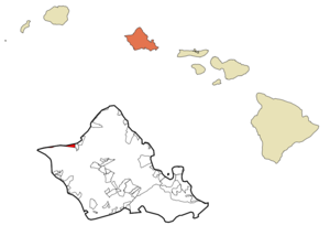
mapsize =
map_caption = Location in Honolulu County and the state ofHawaii
mapsize1 =
map_caption1 =
image_dot_
dot_mapsize =
dot_map_caption =
dot_x =
dot_y =
pushpin_
pushpin_label_position =
pushpin_map_caption =
pushpin_mapsize =
subdivision_type = Country
subdivision_name =United States
subdivision_type1 = State
subdivision_name1 =Hawaii
subdivision_type2 = Counties
subdivision_name2 = Honolulu
subdivision_type3 =
subdivision_name3 =
subdivision_type4 =
subdivision_name4 =
government_footnotes =
government_type =
leader_title =
leader_name =
leader_title1 =
leader_name1 =
leader_title2 =
leader_name2 =
leader_title3 =
leader_name3 =
leader_title4 =
leader_name4 =
established_title =
established_date =
established_title2 =
established_date2 =
established_title3 =
established_date3 =
area_magnitude =
unit_pref = Imperial
area_footnotes =
area_total_km2 = 13.2
area_land_km2 = 5.2
area_water_km2 = 8
area_total_sq_mi = 5.1
area_land_sq_mi = 2
area_water_sq_mi = 3.1
area_water_percent =
area_urban_km2 =
area_urban_sq_mi =
area_metro_km2 =
area_metro_sq_mi =
area_blank1_title =
area_blank1_km2 =
area_blank1_sq_mi =
population_as_of = 2000
population_footnotes =
population_note =
population_total = 1839
population_density_km2 = 139.3
population_density_sq_mi = 360.6
population_metro =
population_density_metro_km2 =
population_density_metro_sq_mi =
population_urban =
population_density_urban_km2 =
population_density_urban_sq_mi =
population_blank1_title =
population_blank1 =
population_density_blank1_km2 =
population_density_blank1_sq_mi =
timezone =
utc_offset =
timezone_DST =
utc_offset_DST =
latd=
latm=
lats=
latNS=
longd=
longm=
longs=
longEW=
elevation_footnotes =
elevation_m =
elevation_ft =
postal_code_type =
postal_code =
area_code =
blank_name =
blank_info =
blank1_name =
blank1_info =
website =
footnotes =Mokulēokinaia is a North Shore community and
census-designated place (CDP) in the Waialua District on the Island of Ookinaahu, City & County of Honolulu, Hawaiokinai. Mokulēokinaia means "isle (of) abundance" in Hawaiian. As of the 2000 Census, the CDP had a total population of 1,839. Features of interest here include Mokulēokinaia Beach, Mokulēokinaia Polo Field, and Dillingham Airfield located west of the town.At the western end of Farrington Highway, approximately 1 mile beyond Dillingham Airfield entrance, begins the track (trail) to Kaokinaena Point, the western-most tip of Ookinaahu.
The U.S.
postal code for Mokulēokinaia is 96791.Geography
Mokulēokinaia is located at 21°34'57" North, 158°10'31" West (21.582523, -158.175141)GR|1, immediately west of Waialua along Farrington Highway and State Rte. 82 (Waialua Beach Road).
According to the
United States Census Bureau , the CDP has a total area of 5.1square mile s (13.2km² ), of which, 2.0 square miles (5.2 km²) of it is land and 3.1 square miles (8.1 km²) of it is water. The total area is 60.98% water, which is apparently a quirk of the way the census tracks are configured, as no significant part of Mokulē'ia is actually water, assuming as would be logical that the "town" ends at the beach (shoreline).Demographics
As of the
Census of 2000, there were 1,839 people, 709 households, and 384 families residing in Mokulēokinaia. Thepopulation density was 923.2 people per square mile (356.8/km²). There were 883 housing units at an average density of 443.3/sq mi (171.3/km²). The racial makeup of the CDP was 57.21% White, 1.47% Black or African American, 0.27% Native American, 11.36% Asian, 5.60% Pacific Islander, 0.60% from other races, and 23.49% from two or more races. 7.29% of the population were Hispanic or Latino of any race.There were 709 households out of which 25.7% had children under the age of 18 living with them, 37.8% were married couples living together, 11.4% had a female householder with no husband present, and 45.7% were non-families. 31.3% of all households were made up of individuals and 2.5% had someone living alone who was 65 years of age or older. The average household size was 2.38 and the average family size was 3.04.
In the CDP the population was spread out with 21.5% under the age of 18, 16.1% from 18 to 24, 36.1% from 25 to 44, 20.3% from 45 to 64, and 6.0% who were 65 years of age or older. The median age was 30 years. For every 100 females there were 134.0 males. For every 100 females age 18 and over, there were 139.7 males.
The median income for a household in the CDP is $50,100, and the median income for a family is $57,917. Males have a median income of $36,458 versus $27,317 for females. The
per capita income for the CDP is $24,643. 10.7% of the population and 10.5% of families are below thepoverty line . Out of the total population, 15.1% of those under the age of 18 and 7.8% of those 65 and older are living below the poverty line.References
External links
Wikimedia Foundation. 2010.