- Nānāwale Estates, Hawai'i
Infobox Settlement
official_name = Nanawale Estates, Hawaii
other_name =
native_name =
nickname =
settlement_type = CDP
motto =
imagesize =
image_caption =
flag_size =
image_
seal_size =
image_shield =
shield_size =
image_blank_emblem =
blank_emblem_type =
blank_emblem_size =
imagesize =
image_caption =
flag_size =
image_
seal_size =
image_shield =
shield_size =
image_blank_emblem =
blank_emblem_type =
blank_emblem_size =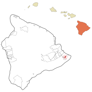
mapsize =
map_caption = Location in Hawaii County and the state ofHawaii
mapsize1 =
map_caption1 =
image_dot_
dot_mapsize =
dot_map_caption =
dot_x =
dot_y =
pushpin_
pushpin_label_position =
pushpin_map_caption =
pushpin_mapsize =
subdivision_type = Country
subdivision_name =United States
subdivision_type1 = State
subdivision_name1 =Hawaii
subdivision_type2 = County
subdivision_name2 = Hawaii
subdivision_type3 =
subdivision_name3 =
subdivision_type4 =
subdivision_name4 =
government_footnotes =
government_type =
leader_title =
leader_name =
leader_title1 =
leader_name1 =
leader_title2 =
leader_name2 =
leader_title3 =
leader_name3 =
leader_title4 =
leader_name4 =
established_title =
established_date =
established_title2 =
established_date2 =
established_title3 =
established_date3 =
area_magnitude =
unit_pref = Imperial
area_footnotes =
area_total_km2 = 5.0
area_land_km2 = 5.0
area_water_km2 = 0.0
area_total_sq_mi = 1.9
area_land_sq_mi = 1.9
area_water_sq_mi = 0.0
area_water_percent =
area_urban_km2 =
area_urban_sq_mi =
area_metro_km2 =
area_metro_sq_mi =
area_blank1_title =
area_blank1_km2 =
area_blank1_sq_mi =
population_as_of = 2000
population_footnotes =
population_note =
population_total = 1073
population_density_km2 = 216.4
population_density_sq_mi = 560.5
population_metro =
population_density_metro_km2 =
population_density_metro_sq_mi =
population_urban =
population_density_urban_km2 =
population_density_urban_sq_mi =
population_blank1_title =
population_blank1 =
population_density_blank1_km2 =
population_density_blank1_sq_mi =
timezone = Hawaii-Aleutian
utc_offset = -10
timezone_DST =
utc_offset_DST =
latd = 19
latm = 30
lats = 26
latNS = N
longd = 154
longm = 54
longs = 49
longEW = W
elevation_footnotes =
elevation_m = 128
elevation_ft = 420
postal_code_type =
postal_code =
area_code = 808
blank_name = FIPS code
blank_info = 15-53975
blank1_name = GNIS feature ID
blank1_info = 1852581
website =
footnotes = Nānāwale Estates is acensus-designated place (CDP) in Hawaiokinai County, Hawaiokinai,United States . The population was 1,073 at the 2000 census.Geography
Nānāwale Estates is located at coor dms|19|30|26|N|154|54|49|W|city (19.507139, -154.913726)GR|1.
According to the
United States Census Bureau , the CDP has a total area of 1.9square mile s (4.9km² ), all of it land.Demographics
As of the
census GR|2 of 2000, there were 1,073 people, 356 households, and 247 families residing in the CDP. Thepopulation density was 560.5 people per square mile (216.9/km²). There were 433 housing units at an average density of 226.2/sq mi (87.5/km²). The racial makeup of the CDP was 31.50% White, 1.68% African American, 0.28% Native American, 16.03% Asian, 16.31% Pacific Islander, 1.30% from other races, and 32.90% from two or more races. Hispanic or Latino of any race were 16.22% of the population.There were 356 households out of which 42.1% had children under the age of 18 living with them, 42.7% were married couples living together, 18.8% had a female householder with no husband present, and 30.6% were non-families. 23.0% of all households were made up of individuals and 9.6% had someone living alone who was 65 years of age or older. The average household size was 3.01 and the average family size was 3.57.
In the CDP the population was spread out with 34.7% under the age of 18, 8.8% from 18 to 24, 26.1% from 25 to 44, 21.2% from 45 to 64, and 9.2% who were 65 years of age or older. The median age was 32 years. For every 100 females there were 99.4 males. For every 100 females age 18 and over, there were 95.8 males.
The median income for a household in the CDP was $35,703, and the median income for a family was $36,875. Males had a median income of $21,250 versus $24,531 for females. The
per capita income for the CDP was $11,524. About 28.9% of families and 31.0% of the population were below thepoverty line , including 38.1% of those under age 18 and 8.7% of those age 65 or over.Community Association
The Nanawale Community Association monthly board meetings happen at 6:30pm on the second Wednesday of the month.
References
External links
* [http://www.nanawale.com/ Nanawale Community Association (NCA)]
Wikimedia Foundation. 2010.