- Deenwood, Georgia
-
Deenwood, Georgia — CDP — Location in Ware County and the state of Georgia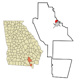
Coordinates: 31°14′20″N 82°22′18″W / 31.23889°N 82.37167°WCoordinates: 31°14′20″N 82°22′18″W / 31.23889°N 82.37167°W Country United States State Georgia County Ware Area – Total 3.4 sq mi (8.7 km2) – Land 3.4 sq mi (8.7 km2) – Water 0 sq mi (0 km2) Elevation 135 ft (41 m) Population (2000) – Total 1,836 – Density 540/sq mi (211/km2) Time zone Eastern (EST) (UTC-5) – Summer (DST) EDT (UTC-4) FIPS code 13-22080[1] GNIS feature ID 0357663[2] Deenwood is a census-designated place (CDP) in Ware County, Georgia, United States. The population was 1,836 at the 2000 census. It is part of the Waycross Micropolitan Statistical Area.
Geography
Deenwood is located at 31°14′20″N 82°22′18″W / 31.23889°N 82.37167°W (31.238993, -82.371540)[3].
According to the United States Census Bureau, the CDP has a total area of 3.4 square miles (8.8 km2), all of it land.
Demographics
At the 2000 census[1], there were 1,836 people, 761 households and 554 families residing in the CDP. The population density was 545.2 per square mile (210.4/km²). There were 856 housing units at an average density of 254.2/sq mi (98.1/km²). The racial makeup of the CDP was 91.45% White, 7.46% African American, 0.54% Asian, 0.11% Pacific Islander, 0.22% from other races, and 0.22% from two or more races. Hispanic or Latino of any race were 0.71% of the population.
There were 761 households of which 29.2% had children under the age of 18 living with them, 58.9% were married couples living together, 10.8% had a female householder with no husband present, and 27.2% were non-families. 25.2% of all households were made up of individuals and 10.1% had someone living alone who was 65 years of age or older. The average household size was 2.40 and the average family size was 2.84.
Age distribution was 22.7% under the age of 18, 8.1% from 18 to 24, 26.3% from 25 to 44, 25.9% from 45 to 64, and 17.0% who were 65 years of age or older. The median age was 41 years. For every 100 females there were 91.1 males. For every 100 females age 18 and over, there were 86.4 males.
The median household income was $35,559, and the median family income was $44,167. Males had a median income of $32,250 versus $25,446 for females. The per capita income for the CDP was $17,074. About 10.4% of families and 14.9% of the population were below the poverty line, including 15.2% of those under age 18 and 21.6% of those age 65 or over.
References
- ^ a b "American FactFinder". United States Census Bureau. http://factfinder.census.gov. Retrieved 2008-01-31.
- ^ "US Board on Geographic Names". United States Geological Survey. 2007-10-25. http://geonames.usgs.gov. Retrieved 2008-01-31.
- ^ "US Gazetteer files: 2010, 2000, and 1990". United States Census Bureau. 2011-02-12. http://www.census.gov/geo/www/gazetteer/gazette.html. Retrieved 2011-04-23.
Municipalities and communities of Ware County, Georgia City 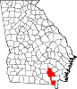
CDPs Deenwood | Sunnyside
Unincorporated
communitiesDixie Union | Manor | Millwood | Ruskin | Waresboro
Footnotes ‡This populated place also has portions in an adjacent county or counties
Categories:- Census-designated places in Georgia (U.S. state)
- Populated places in Ware County, Georgia
- Waycross micropolitan area


Wikimedia Foundation. 2010.