- Sunnyside, Georgia
Infobox Settlement
official_name = Sunnyside, Georgia
other_name =
native_name =
nickname =
settlement_type = CDP
motto =
imagesize =
image_caption =
flag_size =
image_
seal_size =
image_shield =
shield_size =
image_blank_emblem =
blank_emblem_type =
blank_emblem_size =
imagesize =
image_caption =
flag_size =
image_
seal_size =
image_shield =
shield_size =
image_blank_emblem =
blank_emblem_type =
blank_emblem_size =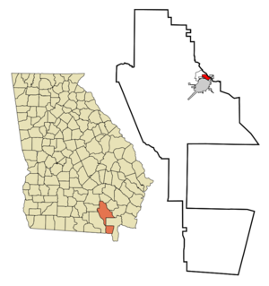
mapsize = 250px
map_caption = Location in Ware County and the state of Georgia
mapsize1 =
map_caption1 =
image_dot_
dot_mapsize =
dot_map_caption =
dot_x =
dot_y =
pushpin_
pushpin_label_position =
pushpin_map_caption =
pushpin_mapsize =
subdivision_type = Country
subdivision_name =United States
subdivision_type1 = State
subdivision_name1 = Georgia
subdivision_type2 = Counties
subdivision_name2 = Ware
subdivision_type3 =
subdivision_name3 =
subdivision_type4 =
subdivision_name4 =
government_footnotes =
government_type =
leader_title =
leader_name =
leader_title1 =
leader_name1 =
leader_title2 =
leader_name2 =
leader_title3 =
leader_name3 =
leader_title4 =
leader_name4 =
established_title =
established_date =
established_title2 =
established_date2 =
established_title3 =
established_date3 =
area_magnitude =
unit_pref = Imperial
area_footnotes =
area_total_km2 = 3.8
area_land_km2 = 3.7
area_water_km2 = 0.1
area_total_sq_mi = 1.5
area_land_sq_mi = 1.4
area_water_sq_mi = 0.1
area_water_percent =
area_urban_km2 =
area_urban_sq_mi =
area_metro_km2 =
area_metro_sq_mi =
area_blank1_title =
area_blank1_km2 =
area_blank1_sq_mi =
population_as_of = 2000
population_footnotes =
population_note =
population_total = 1385
population_density_km2 = 364.5
population_density_sq_mi = 923.3
population_metro =
population_density_metro_km2 =
population_density_metro_sq_mi =
population_urban =
population_density_urban_km2 =
population_density_urban_sq_mi =
population_blank1_title =
population_blank1 =
population_density_blank1_km2 =
population_density_blank1_sq_mi =
timezone =
utc_offset =
timezone_DST =
utc_offset_DST =
latd=
latm=
lats=
latNS=
longd=
longm=
longs=
longEW=
elevation_footnotes =
elevation_m =
elevation_ft =
postal_code_type =
postal_code =
area_code =
blank_name =
blank_info =
blank1_name =
blank1_info =
website =
footnotes = Sunnyside is acensus-designated place (CDP) in Ware County, Georgia,United States . The population was 1,385 at the 2000 census. It is part of the Waycross Micropolitan Statistical Area.Geography
Sunnyside is located at coor dms|31|14|13|N|82|20|22|W|city (31.236885, -82.339446)GR|1.
According to the
United States Census Bureau , the CDP has a total area of 1.5square mile s (3.8km² ), of which, 1.4 square miles (3.7 km²) of it is land and 0.1 square miles (0.2 km²) of it (4.08%) is water.Demographics
As of the
census GR|2 of 2000, there were 1,385 people, 561 households, and 420 families residing in the CDP. Thepopulation density was 976.9 people per square mile (376.6/km²). There were 600 housing units at an average density of 423.2/sq mi (163.1/km²). The racial makeup of the CDP was 93.29% White, 5.42% African American, 0.22% Native American, 0.36% Asian, 0.29% from other races, and 0.43% from two or more races. Hispanic or Latino of any race were 0.58% of the population.There were 561 households out of which 28.5% had children under the age of 18 living with them, 61.5% were married couples living together, 11.4% had a female householder with no husband present, and 25.1% were non-families. 23.2% of all households were made up of individuals and 12.7% had someone living alone who was 65 years of age or older. The average household size was 2.46 and the average family size was 2.88.
In the CDP the population was spread out with 22.8% under the age of 18, 7.4% from 18 to 24, 23.5% from 25 to 44, 25.1% from 45 to 64, and 21.2% who were 65 years of age or older. The median age was 42 years. For every 100 females there were 88.7 males. For every 100 females age 18 and over, there were 78.5 males.
The median income for a household in the CDP was $35,500, and the median income for a family was $50,000. Males had a median income of $40,795 versus $22,083 for females. The
per capita income for the CDP was $19,852. About 8.4% of families and 10.0% of the population were below thepoverty line , including 24.3% of those under age 18 and 8.1% of those age 65 or over.References
External links
Wikimedia Foundation. 2010.