- Camilla, Georgia
Infobox Settlement
official_name = Camilla, Georgia
other_name =
native_name =
nickname =
settlement_type =City
motto =
imagesize =
image_caption =
flag_size =
image_
seal_size =
image_shield =
shield_size =
image_blank_emblem =
blank_emblem_type =
blank_emblem_size =
imagesize =
image_caption =
flag_size =
image_
seal_size =
image_shield =
shield_size =
image_blank_emblem =
blank_emblem_type =
blank_emblem_size =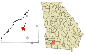
mapsize = 250px
map_caption = Location in Mitchell County and the state of Georgia
mapsize1 =
map_caption1 =
image_dot_
dot_mapsize =
dot_map_caption =
dot_x =
dot_y =
pushpin_
pushpin_label_position =
pushpin_map_caption =
pushpin_mapsize =
subdivision_type = Country
subdivision_name =United States
subdivision_type1 = State
subdivision_name1 = Georgia
subdivision_type2 = County
subdivision_name2 = Mitchell
subdivision_type3 =
subdivision_name3 =
subdivision_type4 =
subdivision_name4 =
government_footnotes =
government_type =
leader_title =
leader_name =
leader_title1 =
leader_name1 =
leader_title2 =
leader_name2 =
leader_title3 =
leader_name3 =
leader_title4 =
leader_name4 =
established_title =
established_date =
established_title2 =
established_date2 =
established_title3 =
established_date3 =
area_magnitude =
unit_pref = Imperial
area_footnotes =
area_total_km2 = 15.8
area_land_km2 = 15.8
area_water_km2 = 0
area_total_sq_mi = 6.1
area_land_sq_mi = 6.1
area_water_sq_mi = 0
area_water_percent =
area_urban_km2 =
area_urban_sq_mi =
area_metro_km2 =
area_metro_sq_mi =
area_blank1_title =
area_blank1_km2 =
area_blank1_sq_mi =
population_as_of = 2000
population_footnotes =
population_note =
population_total = 5669
population_density_km2 = 358.8
population_density_sq_mi = 929.3
population_metro =
population_density_metro_km2 =
population_density_metro_sq_mi =
population_urban =
population_density_urban_km2 =
population_density_urban_sq_mi =
population_blank1_title =
population_blank1 =
population_density_blank1_km2 =
population_density_blank1_sq_mi =
timezone = Eastern (EST)
utc_offset = -5
timezone_DST = EDT
utc_offset_DST = -4
latd = 31 |latm = 13 |lats = 49 |latNS = N
longd = 84 |longm = 12 |longs = 33 |longEW = W
elevation_footnotes =
elevation_m = 54
elevation_ft = 177
postal_code_type =ZIP code
postal_code = 31730
area_code = 229
blank_name = FIPS code
blank_info = 13-12624GR|2
blank1_name = GNIS feature ID
blank1_info = 0331312GR|3
website =
footnotes =Camilla is a city in Mitchell County, Georgia,
United States , and is itscounty seat GR|6. As of the 2000census , the city had a totalpopulation of 5,669.In the early 2000s, the city became known for being hit by two disastrous sets of
tornado es, both occurring in the dark hours of the early morning and both going through roughly the same area. The [http://www.srh.noaa.gov/tlh/tlh/mm5/SLS/gould_sls/Svrstmshtml_gould.htm first outbreak] was onFebruary 14 ,2000 ; the [http://www.srh.noaa.gov/tlh/mar20event/ second outbreak] was onMarch 20 ,2003 .Geography
Camilla is located at coor dms|31|13|49|N|84|12|33|W|city (31.230243, -84.209102)GR|1.
According to the
United States Census Bureau , the city has a total area of 6.1square mile s (15.8km² ), of which, 6.1 square miles (15.8 km²) of it is land and 0.16% is water.Demographics
As of the
census GR|2 of 2000, there were 5,669 people, 1,994 households, and 1,405 families residing in the city. Thepopulation density was 929.4 people per square mile (358.8/km²). There were 2,128 housing units at an average density of 348.9/sq mi (134.7/km²). The racial makeup of the city was 65.23% African American, 32.30% White, 0.12% Native American, 0.44% Asian, 0.04% Pacific Islander, 1.25% from other races, and 0.62% from two or more races. Hispanic or Latino of any race were 2.20% of the population.There were 1,994 households out of which 34.1% had children under the age of 18 living with them, 33.5% were married couples living together, 33.1% had a female householder with no husband present, and 29.5% were non-families. 26.3% of all households were made up of individuals and 11.4% had someone living alone who was 65 years of age or older. The average household size was 2.76 and the average family size was 3.32.
In the city the population was spread out with 30.3% under the age of 18, 10.6% from 18 to 24, 26.8% from 25 to 44, 18.9% from 45 to 64, and 13.5% who were 65 years of age or older. The median age was 31 years. For every 100 females there were 81.1 males. For every 100 females age 18 and over, there were 73.0 males.
The median income for a household in the city was $22,485, and the median income for a family was $24,232. Males had a median income of $23,581 versus $20,000 for females. The
per capita income for the city was $13,117. About 34.3% of families and 37.7% of the population were below thepoverty line , including 54.9% of those under age 18 and 20.0% of those age 65 or over.Transportation
Camilla is centrally located within 25-35 miles of several other major Southwest Georgia towns and cities.
U.S. Highway 19 is the major route through the city, connecting Camilla to Albany in the north and Thomasville to the south. During inclement weather,Interstate 75 is detoured through Camilla via Hwy. 19.Georgia State Route 112 connects Cairo to the south and Sylvester to the northeast.Georgia State Route 37 connects Moultrie to the east, whileGeorgia State Route 97 connects Bainbridge to the southwest.Education
The [http://mitchell.schooldesk.net Mitchell County School system] serves Camilla students (and, until recently, some students from the nearby town of Newton), as well as students from neighboring Pelham and Baconton. The Mitchell County Head Start Center, opened in 2001, is also located in the city. Westwood Schools is a private school located on the southern edge of Camilla.
References
External links
* [http://www.camillaga.com Unofficial Camilla history website]
* [http://www.camillageorgia.com/ Camilla Chamber of Commerce website]
* [http://www.camillaga.net/ City of Camilla government website]
* [http://www.mitchellcountyga.net/ Mitchell County government website]
* [http://www.galileo.usg.edu/express?link=zlcu "Civil Unrest in Camilla, Georgia, 1868 : Reconstruction, Republicanism, and Race"] in the [http://dlg.galileo.usg.edu/ Digital Library of Georgia]
Wikimedia Foundation. 2010.