- Fairmount, Georgia
Infobox Settlement
official_name = Fairmount, Georgia
other_name =
native_name =
nickname =
settlement_type =City
motto =
imagesize =
image_caption =
flag_size =
image_
seal_size =
image_shield =
shield_size =
image_blank_emblem =
blank_emblem_type =
blank_emblem_size =
imagesize =
image_caption =
flag_size =
image_
seal_size =
image_shield =
shield_size =
image_blank_emblem =
blank_emblem_type =
blank_emblem_size =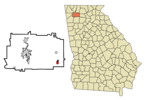
mapsize = 250px
map_caption = Location in Gordon County and the state of Georgia
mapsize1 =
map_caption1 =
image_dot_
dot_mapsize =
dot_map_caption =
dot_x =
dot_y =
pushpin_
pushpin_label_position =
pushpin_map_caption =
pushpin_mapsize =
subdivision_type = Country
subdivision_name =United States
subdivision_type1 = State
subdivision_name1 = Georgia
subdivision_type2 = County
subdivision_name2 = Gordon
subdivision_type3 =
subdivision_name3 =
subdivision_type4 =
subdivision_name4 =
government_footnotes =
government_type =
leader_title =
leader_name =
leader_title1 =
leader_name1 =
leader_title2 =
leader_name2 =
leader_title3 =
leader_name3 =
leader_title4 =
leader_name4 =
established_title =
established_date =
established_title2 =
established_date2 =
established_title3 =
established_date3 =
area_magnitude =
unit_pref = Imperial
area_footnotes =
area_total_km2 = 3.1
area_land_km2 = 3.1
area_water_km2 = 0
area_total_sq_mi = 1.2
area_land_sq_mi = 1.2
area_water_sq_mi = 0
area_water_percent =
area_urban_km2 =
area_urban_sq_mi =
area_metro_km2 =
area_metro_sq_mi =
area_blank1_title =
area_blank1_km2 =
area_blank1_sq_mi =
population_as_of = 2000
population_footnotes =
population_note =
population_total = 745
population_density_km2 = 240.3
population_density_sq_mi = 620.8
population_metro =
population_density_metro_km2 =
population_density_metro_sq_mi =
population_urban =
population_density_urban_km2 =
population_density_urban_sq_mi =
population_blank1_title =
population_blank1 =
population_density_blank1_km2 =
population_density_blank1_sq_mi =
timezone = Eastern (EST)
utc_offset = -5
timezone_DST = EDT
utc_offset_DST = -4
latd = 34 |latm = 26 |lats = 19 |latNS = N
longd = 84 |longm = 41 |longs = 58 |longEW = W
elevation_footnotes =
elevation_m = 227
elevation_ft = 745
postal_code_type =ZIP code
postal_code = 30139
area_code = 706
blank_name = FIPS code
blank_info = 13-28492GR|2
blank1_name = GNIS feature ID
blank1_info = 0355758GR|3
website =
footnotes =Fairmount is a city in Gordon County, Georgia,
United States . The population was 745 at the 2000 census.Geography
Fairmount is located at coor dms|34|26|19|N|84|41|58|W|city (34.438510, -84.699371)GR|1.
According to the
United States Census Bureau , the city has a total area of 1.2square mile s (3.1km² ), all of it land.Demographics
As of the
census GR|2 of 2000, there were 745 people, 307 households, and 220 families residing in the city. Thepopulation density was 619.9 people per square mile (239.7/km²). There were 334 housing units at an average density of 277.9/sq mi (107.5/km²). The racial makeup of the city was 95.70% White, 3.22% African American, 0.27% from other races, and 0.81% from two or more races. Hispanic or Latino of any race were 1.21% of the population.There were 307 households out of which 30.0% had children under the age of 18 living with them, 57.3% were married couples living together, 10.4% had a female householder with no husband present, and 28.3% were non-families. 26.1% of all households were made up of individuals and 13.7% had someone living alone who was 65 years of age or older. The average household size was 2.43 and the average family size was 2.91.
In the city the population was spread out with 23.2% under the age of 18, 9.1% from 18 to 24, 26.3% from 25 to 44, 26.7% from 45 to 64, and 14.6% who were 65 years of age or older. The median age was 39 years. For every 100 females there were 94.0 males. For every 100 females age 18 and over, there were 94.6 males.
The median income for a household in the city was $35,893, and the median income for a family was $40,568. Males had a median income of $25,833 versus $22,083 for females. The
per capita income for the city was $16,508. About 5.2% of families and 7.4% of the population were below thepoverty line , including 9.0% of those under age 18 and 12.8% of those age 65 or over.Schools
*Fairmount Elementary School
*Sonoraville Middle School
*Sonoraville High SchoolReferences
4.http://www.gcbe.org External links
Wikimedia Foundation. 2010.