- East Ellijay, Georgia
Infobox Settlement
official_name = East Ellijay, Georgia
other_name =
native_name =
nickname =
settlement_type =City
motto =
imagesize =
image_caption =
flag_size =
image_
seal_size =
image_shield =
shield_size =
image_blank_emblem =
blank_emblem_type =
blank_emblem_size =
imagesize =
image_caption =
flag_size =
image_
seal_size =
image_shield =
shield_size =
image_blank_emblem =
blank_emblem_type =
blank_emblem_size =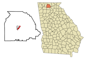
mapsize = 250px
map_caption = Location in Gilmer County and the state of Georgia
mapsize1 =
map_caption1 =
image_dot_
dot_mapsize =
dot_map_caption =
dot_x =
dot_y =
pushpin_
pushpin_label_position =
pushpin_map_caption =
pushpin_mapsize =
subdivision_type = Country
subdivision_name =United States
subdivision_type1 = State
subdivision_name1 = Georgia
subdivision_type2 = County
subdivision_name2 = Gilmer
subdivision_type3 =
subdivision_name3 =
subdivision_type4 =
subdivision_name4 =
government_footnotes =
government_type =
leader_title =
leader_name =
leader_title1 =
leader_name1 =
leader_title2 =
leader_name2 =
leader_title3 =
leader_name3 =
leader_title4 =
leader_name4 =
established_title =
established_date =
established_title2 =
established_date2 =
established_title3 =
established_date3 =
area_magnitude =
unit_pref = Imperial
area_footnotes =
area_total_km2 = 5.1
area_land_km2 = 5.1
area_water_km2 = 0
area_total_sq_mi = 2
area_land_sq_mi = 2
area_water_sq_mi = 0
area_water_percent =
area_urban_km2 =
area_urban_sq_mi =
area_metro_km2 =
area_metro_sq_mi =
area_blank1_title =
area_blank1_km2 =
area_blank1_sq_mi =
population_as_of = 2000
population_footnotes =
population_note =
population_total = 707
population_density_km2 = 138.6
population_density_sq_mi = 353.5
population_metro =
population_density_metro_km2 =
population_density_metro_sq_mi =
population_urban =
population_density_urban_km2 =
population_density_urban_sq_mi =
population_blank1_title =
population_blank1 =
population_density_blank1_km2 =
population_density_blank1_sq_mi =
timezone = Eastern (EST)
utc_offset = -5
timezone_DST = EDT
utc_offset_DST = -4
latd = 34 |latm = 41 |lats = 5 |latNS = N
longd = 84 |longm = 28 |longs = 21 |longEW = W
elevation_footnotes =
elevation_m = 388
elevation_ft = 1273
postal_code_type =ZIP code s
postal_code = 30539-30540
area_code = 706
blank_name = FIPS code
blank_info = 13-25356GR|2
blank1_name = GNIS feature ID
blank1_info = 0331619GR|3
website =
footnotes =East Ellijay is a city in Gilmer County, Georgia,
United States . The population was 707 at the 2000 census.As its name suggests, it is just east of
Ellijay, Georgia , the site of aCherokee settlement, one of several with the name. In Cherokee the name is properly rendered "Elatseyi" (abbreviated to "Elatse"), which can be translated as "green verdant earth", suggesting fresh-springing vegetation. It was variously spelled Ellijay, Elejoy, and Allagae. In addition to the Cherokee town in Georgia, there were Cherokee towns of this name on, one, theKeowee River inSouth Carolina , two, on theLittle Tennessee River at Ellijay Creek, and three, on Ellejoy Creek of the Little River near present-dayMaryville, Tennessee .East Ellijay was originally the location of Fort Hetzel, one of the
Cherokee removal fort s built in1838 to house the Cherokee people before sending them on the "Trail of Tears ".Geography
East Ellijay is located at coor dms|34|41|5|N|84|28|21|W|city (34.684668, -84.472434)GR|1.
According to the
United States Census Bureau , the city has a total area of 2.0square mile s (5.1km² ), all of it land.The town lies on the southern border of the
Chattahoochee National Forest .Demographics
As of the
census GR|2 of 2000, there were 707 people, 251 households, and 159 families residing in the city. Thepopulation density was 357.6 people per square mile (137.9/km²). There were 265 housing units at an average density of 134.0/sq mi (51.7/km²). The racial makeup of the city was 68.60% White, 2.26% Native American, 2.97% Pacific Islander, 22.35% from other races, and 3.82% from two or more races. Hispanic or Latino of any race were 33.38% of the population.There were 251 households out of which 31.1% had children under the age of 18 living with them, 43.0% were married couples living together, 11.6% had a female householder with no husband present, and 36.3% were non-families. 28.3% of all households were made up of individuals and 15.1% had someone living alone who was 65 years of age or older. The average household size was 2.82 and the average family size was 3.18.
In the city the population was spread out with 24.5% under the age of 18, 16.0% from 18 to 24, 29.6% from 25 to 44, 17.3% from 45 to 64, and 12.7% who were 65 years of age or older. The median age was 30 years. For every 100 females there were 120.9 males. For every 100 females age 18 and over, there were 127.2 males.
The median income for a household in the city was $35,875, and the median income for a family was $38,594. Males had a median income of $20,341 versus $20,000 for females. The
per capita income for the city was $13,934. About 14.6% of families and 19.5% of the population were below thepoverty line , including 16.8% of those under age 18 and 15.9% of those age 65 or over.References
*Mooney, James. "Myths of the Cherokee" (1900, reprint 1995).External links
* [http://ngeorgia.com/history/cherokeeforts.html Cherokee removal forts]
* [http://blueridge.name Blue Ridge Mountain News]
Wikimedia Foundation. 2010.