- Brooklet, Georgia
Infobox Settlement
official_name = Brooklet, Georgia
other_name =
native_name =
nickname =
settlement_type =Town
motto =
imagesize =
image_caption =
flag_size =
image_
seal_size =
image_shield =
shield_size =
image_blank_emblem =
blank_emblem_type =
blank_emblem_size =
imagesize =
image_caption =
flag_size =
image_
seal_size =
image_shield =
shield_size =
image_blank_emblem =
blank_emblem_type =
blank_emblem_size =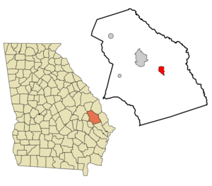
mapsize = 250px
map_caption = Location in Bulloch County and the state of Georgia
mapsize1 =
map_caption1 =
image_dot_
dot_mapsize =
dot_map_caption =
dot_x =
dot_y =
pushpin_
pushpin_label_position =
pushpin_map_caption =
pushpin_mapsize =
subdivision_type = Country
subdivision_name =United States
subdivision_type1 = State
subdivision_name1 = Georgia
subdivision_type2 = County
subdivision_name2 = Bulloch
subdivision_type3 =
subdivision_name3 =
subdivision_type4 =
subdivision_name4 =
government_footnotes =
government_type =
leader_title =
leader_name =
leader_title1 =
leader_name1 =
leader_title2 =
leader_name2 =
leader_title3 =
leader_name3 =
leader_title4 =
leader_name4 =
established_title =
established_date =
established_title2 =
established_date2 =
established_title3 =
established_date3 =
area_magnitude =
unit_pref = Imperial
area_footnotes =
area_total_km2 = 8
area_land_km2 = 7.9
area_water_km2 = 0.1
area_total_sq_mi = 3.1
area_land_sq_mi = 3.1
area_water_sq_mi = 0
area_water_percent =
area_urban_km2 =
area_urban_sq_mi =
area_metro_km2 =
area_metro_sq_mi =
area_blank1_title =
area_blank1_km2 =
area_blank1_sq_mi =
population_as_of = 2000
population_footnotes =
population_note =
population_total = 1113
population_density_km2 = 139.1
population_density_sq_mi = 359
population_metro =
population_density_metro_km2 =
population_density_metro_sq_mi =
population_urban =
population_density_urban_km2 =
population_density_urban_sq_mi =
population_blank1_title =
population_blank1 =
population_density_blank1_km2 =
population_density_blank1_sq_mi =
timezone = Eastern (EST)
utc_offset = -5
timezone_DST = EDT
utc_offset_DST = -4
latd = 32 |latm = 22 |lats = 56 |latNS = N
longd = 81 |longm = 39 |longs = 53 |longEW = W
elevation_footnotes =
elevation_m = 46
elevation_ft = 151
postal_code_type =ZIP code
postal_code = 30415
area_code = 912
blank_name = FIPS code
blank_info = 13-11000GR|2
blank1_name = GNIS feature ID
blank1_info = 0311827GR|3
website =
footnotes =Brooklet is a town in Bulloch County, Georgia,
United States . It is located roughly 6 miles east of Statesboro. The population was 1,113 at the 2000 census. It is the home of the Southeast Bulloch School system. It is located along US Highway 80.Brooklet holds the Peanut Festival every year in August.
Geography
Brooklet is located at coor dms|32|22|56|N|81|39|53|W|city (32.382175, -81.664695)GR|1.
According to the
United States Census Bureau , the town has a total area of 3.1square mile s (8.0km² ), of which, 3.1 square miles (7.9 km²) of it is land and 0.04 square miles (0.1 km²) of it (1.29%) is water.Demographics
As of the
census GR|2 of 2000, there were 1,113 people, 422 households, and 302 families residing in the town. Thepopulation density was 364.0 people per square mile (140.4/km²). There were 467 housing units at an average density of 152.7/sq mi (58.9/km²). The racial makeup of the town was 79.96% White, 19.59% African American, 0.09% Native American, 0.36% from other races. Hispanic or Latino of any race were 1.44% of the population.There were 422 households out of which 33.4% had children under the age of 18 living with them, 59.5% were married couples living together, 11.8% had a female householder with no husband present, and 28.2% were non-families. 23.9% of all households were made up of individuals and 10.9% had someone living alone who was 65 years of age or older. The average household size was 2.64 and the average family size was 3.16.
In the town the population was spread out with 26.2% under the age of 18, 8.8% from 18 to 24, 28.2% from 25 to 44, 21.3% from 45 to 64, and 15.5% who were 65 years of age or older. The median age was 36 years. For every 100 females there were 84.6 males. For every 100 females age 18 and over, there were 83.7 males.
The median income for a household in the town was $34,438, and the median income for a family was $39,250. Males had a median income of $30,972 versus $21,667 for females. The
per capita income for the town was $16,793. About 6.9% of families and 10.7% of the population were below thepoverty line , including 8.4% of those under age 18 and 17.7% of those age 65 or over.References
External links
Wikimedia Foundation. 2010.