- Pace, Florida
Infobox Settlement
official_name = Pace, Florida
other_name =
native_name =
nickname =
settlement_type = CDP
motto =
imagesize =
image_caption =
flag_size =
image_
seal_size =
image_shield =
shield_size =
image_blank_emblem =
blank_emblem_type =
blank_emblem_size =
imagesize =
image_caption =
flag_size =
image_
seal_size =
image_shield =
shield_size =
image_blank_emblem =
blank_emblem_type =
blank_emblem_size =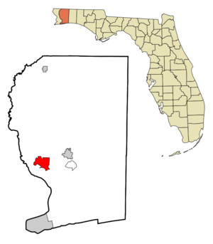
mapsize = 250x200px
map_caption = Location in Santa Rosa County and the state ofFlorida
mapsize1 =
map_caption1 =
image_dot_
dot_mapsize =
dot_map_caption =
dot_x =
dot_y =
pushpin_
pushpin_label_position =
pushpin_map_caption =
pushpin_mapsize =
subdivision_type = Country
subdivision_name = flag|United States
subdivision_type1 = State
subdivision_name1 = flag|Florida
subdivision_type2 = County
subdivision_name2 = noflag|Santa Rosa
subdivision_type3 =
subdivision_name3 =
subdivision_type4 =
subdivision_name4 =
government_footnotes =
government_type =
leader_title =
leader_name =
leader_title1 =
leader_name1 =
leader_title2 =
leader_name2 =
leader_title3 =
leader_name3 =
leader_title4 =
leader_name4 =
established_title =
established_date =
established_title2 =
established_date2 =
established_title3 =
established_date3 =
area_magnitude =
unit_pref = Imperial
area_footnotes =
area_total_km2 = 24.3
area_land_km2 = 24.3
area_water_km2 = 0
area_total_sq_mi = 9.4
area_land_sq_mi = 9.4
area_water_sq_mi = 0
area_water_percent =
area_urban_km2 =
area_urban_sq_mi =
area_metro_km2 =
area_metro_sq_mi =
area_blank1_title =
area_blank1_km2 =
area_blank1_sq_mi =
population_as_of = 2000
population_footnotes =
population_note =
population_total = 7393
population_density_km2 = 304.2
population_density_sq_mi = 786.5
population_metro =
population_density_metro_km2 =
population_density_metro_sq_mi =
population_urban =
population_density_urban_km2 =
population_density_urban_sq_mi =
population_blank1_title =
population_blank1 =
population_density_blank1_km2 =
population_density_blank1_sq_mi =
timezone = Central (CST)
utc_offset = -6
timezone_DST = CDT
utc_offset_DST = -5
latd = 30 |latm = 35 |lats = 44 |latNS = N
longd = 87 |longm = 9 |longs = 13 |longEW = W
elevation_footnotes =
elevation_m = 20
elevation_ft = 66
postal_code_type =ZIP code
postal_code = 32571
area_code = 850
blank_name = FIPS code
blank_info = 12-53725GR|2
blank1_name = GNIS feature ID
blank1_info = 0288352GR|3
website =
footnotes =Pace is a
census-designated place (CDP) in Santa Rosa County,Florida ,United States . The population was 7,393 at the 2000 census.Geography
Pace is located at coor dms|30|35|44|N|87|9|13|W|city (30.595593, -87.153712)GR|1.
According to the
United States Census Bureau , the CDP has a total area of 9.4square mile s (24.3km² ), all of it land.History
Pace is named after
James G. Pace , who owned large lumber, paper, and turpentine productions that operated in the Pace area and throughout the Southeast [http://www.epodunk.com/cgi-bin/genInfo.php?locIndex=8808] . Originally just a strip of land north of Floridatown, by the 1912 census the area was known as Pace [http://www.friendsofpacelibrary.org/History/historical_sketch.htm] . Afterwards, the Pace's growth was slow and it remained a small,rural community throughout the last half of thetwentieth century . Despite local efforts, incorporation failed at least once and has not been re-attempted recently. Within the last decade, however, growth has increased and Pace has become moresuburban , surpassing its predecessors Floridatown and Pea Ridge in population, commercial activity, and notoriety.Demographics
As of the
census GR|2 of 2000, there were 7,393 people, 2,805 households, and 2,092 families residing in the CDP. Thepopulation density was 788.0 people per square mile (304.3/km²). There were 3,096 housing units at an average density of 330.0/sq mi (127.4/km²). The racial makeup of the CDP was 93.76% White, 1.33% African American, 1.57% Native American, 1.04% Asian, 0.04% Pacific Islander, 0.49% from other races, and 1.77% from two or more races. Hispanic or Latino of any race were 1.89% of the population.There were 2,805 households out of which 37.6% had children under the age of 18 living with them, 56.4% were married couples living together, 13.9% had a female householder with no husband present, and 25.4% were non-families. 20.2% of all households were made up of individuals and 6.6% had someone living alone who was 65 years of age or older. The average household size was 2.64 and the average family size was 3.01.
In the CDP the population was spread out with 27.1% under the age of 18, 9.0% from 18 to 24, 30.8% from 25 to 44, 23.5% from 45 to 64, and 9.6% who were 65 years of age or older. The median age was 35 years. For every 100 females there were 95.9 males. For every 100 females age 18 and over, there were 91.3 males.
The median income for a household in the CDP was $36,538, and the median income for a family was $41,878. Males had a median income of $31,195 versus $21,648 for females. The
per capita income for the CDP was $16,591. About 10.5% of families and 12.3% of the population were below thepoverty line , including 13.5% of those under age 18 and 12.8% of those age 65 or over.References
External links
Wikimedia Foundation. 2010.