- Loughman, Florida
Infobox Settlement
official_name = Loughman, Florida
other_name =
native_name =
nickname =
settlement_type = CDP
motto =
imagesize =
image_caption =
flag_size =
image_
seal_size =
image_shield =
shield_size =
image_blank_emblem =
blank_emblem_type =
blank_emblem_size =
imagesize =
image_caption =
flag_size =
image_
seal_size =
image_shield =
shield_size =
image_blank_emblem =
blank_emblem_type =
blank_emblem_size =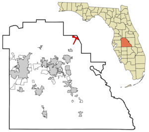
mapsize = 250x200px
map_caption = Location in Polk County and the state ofFlorida
mapsize1 =
map_caption1 =
image_dot_
dot_mapsize =
dot_map_caption =
dot_x =
dot_y =
pushpin_
pushpin_label_position =
pushpin_map_caption =
pushpin_mapsize =
subdivision_type = Country
subdivision_name = flag|United States
subdivision_type1 = State
subdivision_name1 = flag|Florida
subdivision_type2 = County
subdivision_name2 = noflag|Polk
subdivision_type3 =
subdivision_name3 =
subdivision_type4 =
subdivision_name4 =
government_footnotes =
government_type =
leader_title =
leader_name =
leader_title1 =
leader_name1 =
leader_title2 =
leader_name2 =
leader_title3 =
leader_name3 =
leader_title4 =
leader_name4 =
established_title =
established_date =
established_title2 =
established_date2 =
established_title3 =
established_date3 =
area_magnitude =
unit_pref = Imperial
area_footnotes =
area_total_km2 = 9.7
area_land_km2 = 9.6
area_water_km2 = 0.1
area_total_sq_mi = 3.7
area_land_sq_mi = 3.7
area_water_sq_mi = 0
area_water_percent =
area_urban_km2 =
area_urban_sq_mi =
area_metro_km2 =
area_metro_sq_mi =
area_blank1_title =
area_blank1_km2 =
area_blank1_sq_mi =
population_as_of = 2000
population_footnotes =
population_note =
population_total = 1385
population_density_km2 = 142.8
population_density_sq_mi = 374.3
population_metro =
population_density_metro_km2 =
population_density_metro_sq_mi =
population_urban =
population_density_urban_km2 =
population_density_urban_sq_mi =
population_blank1_title =
population_blank1 =
population_density_blank1_km2 =
population_density_blank1_sq_mi =
timezone = Eastern (EST)
utc_offset = -5
timezone_DST = EDT
utc_offset_DST = -4
latd = 28 |latm = 14 |lats = 46 |latNS = N
longd = 81 |longm = 34 |longs = 6 |longEW = W
elevation_footnotes =
elevation_m = 31
elevation_ft = 102
postal_code_type =ZIP code
postal_code = 33858
area_code = 863
blank_name = FIPS code
blank_info = 12-41400GR|2
blank1_name = GNIS feature ID
blank1_info = 0286130GR|3
website =
footnotes =Loughman is a
census-designated place (CDP) in the north-east corner of Polk County,Florida ,United States , near the Osceola county line. The population was 1,385 at the 2000 census. This area has grown rapidly since 2000 due, in large part, to its proximity toWalt Disney World and theOrlando, Florida areaGeography
Loughman is located at coor dms|28|14|46|N|81|34|6|W|city (28.246002, -81.568470)GR|1.
According to the
United States Census Bureau , the CDP has a total area of 3.8square mile s (9.8km² ), of which, 3.7 square miles (9.6 km²) of it is land and 0.1 square miles (0.1 km²) of it (1.33%) is water.History
Loughman was settled shortly after the
South Florida Railroad reached the area in 1883. The place was originally named Lake Locke. [Frisbie, L.K. (1976) "Yesterday's Polk County" Imperial Publishing Company, p. 21-23]Loughman was on the route of the
Dixie Highway , which ran parallel to the line of US 17/92 and is now Old Kissimmee Road (Old Tampa Highway north of the Osceola County line). A monument dated 1930 marks the Polk county line. Nearby, some of the brick-paved highway remains.Demographics
As of the
census GR|2 of 2000, there were 1,385 people, 546 households, and 369 families residing in the CDP. Thepopulation density was 372.0 people per square mile (143.8/km²). There were 1,088 housing units at an average density of 292.2/sq mi (112.9/km²). The racial makeup of the CDP was 80.65% White, 13.14% African American, 0.07% Native American, 0.51% Asian, 3.83% from other races, and 1.81% from two or more races. Hispanic or Latino of any race were 10.47% of the population.There were 546 households out of which 25.6% had children under the age of 18 living with them, 52.9% were married couples living together, 10.4% had a female householder with no husband present, and 32.4% were non-families. 23.8% of all households were made up of individuals and 6.8% had someone living alone who was 65 years of age or older. The average household size was 2.54 and the average family size was 3.00.
In the CDP the population was spread out with 23.7% under the age of 18, 7.1% from 18 to 24, 29.5% from 25 to 44, 23.6% from 45 to 64, and 16.0% who were 65 years of age or older. The median age was 38 years. For every 100 females there were 96.2 males. For every 100 females age 18 and over, there were 100.6 males.
The median income for a household in the CDP was $31,445, and the median income for a family was $34,063. Males had a median income of $20,160 versus $15,565 for females. The
per capita income for the CDP was $14,205. About 14.0% of families and 18.0% of the population were below thepoverty line , including 39.0% of those under age 18 and 6.6% of those age 65 or over.Transportation
Loughman is on US Highway 17/92, at the junction with County Road 54.
There is no public transportation in Loughman.
External links
References
Wikimedia Foundation. 2010.