- Hobe Sound, Florida
Infobox Settlement
official_name = Hobe Sound, Florida
other_name =
native_name =
nickname =
settlement_type = CDP
motto =
imagesize =
image_caption =
flag_size =
image_
seal_size =
image_shield =
shield_size =
image_blank_emblem =
blank_emblem_type =
blank_emblem_size =
imagesize =
image_caption =
flag_size =
image_
seal_size =
image_shield =
shield_size =
image_blank_emblem =
blank_emblem_type =
blank_emblem_size =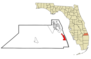
mapsize = 250x200px
map_caption = Location in Martin County and the state ofFlorida
mapsize1 =
map_caption1 =
image_dot_
dot_mapsize =
dot_map_caption =
dot_x =
dot_y =
pushpin_
pushpin_label_position =
pushpin_map_caption =
pushpin_mapsize =
subdivision_type = Country
subdivision_name = flag|United States
subdivision_type1 = State
subdivision_name1 = flag|Florida
subdivision_type2 = County
subdivision_name2 = noflag|Martin
subdivision_type3 =
subdivision_name3 =
subdivision_type4 =
subdivision_name4 =
government_footnotes =
government_type =
leader_title =
leader_name =
leader_title1 =
leader_name1 =
leader_title2 =
leader_name2 =
leader_title3 =
leader_name3 =
leader_title4 =
leader_name4 =
established_title =
established_date =
established_title2 =
established_date2 =
established_title3 =
established_date3 =
area_magnitude =
unit_pref = Imperial
area_footnotes =
area_total_km2 = 14.8
area_land_km2 = 14.1
area_water_km2 = 0.7
area_total_sq_mi = 5.7
area_land_sq_mi = 5.5
area_water_sq_mi = 0.3
area_water_percent =
area_urban_km2 =
area_urban_sq_mi =
area_metro_km2 =
area_metro_sq_mi =
area_blank1_title =
area_blank1_km2 =
area_blank1_sq_mi =
population_as_of = 2000
population_footnotes =
population_note =
population_total = 11376
population_density_km2 = 804.5
population_density_sq_mi = 2082.8
population_metro =
population_density_metro_km2 =
population_density_metro_sq_mi =
population_urban =
population_density_urban_km2 =
population_density_urban_sq_mi =
population_blank1_title =
population_blank1 =
population_density_blank1_km2 =
population_density_blank1_sq_mi =
timezone = Eastern (EST)
utc_offset = -5
timezone_DST = EDT
utc_offset_DST = -4
latd = 27 |latm = 04 |lats = 36 |latNS = N
longd = 80 |longm = 08 |longs = 31 |longEW = W
elevation_footnotes =
elevation_m = 6
elevation_ft = 20
postal_code_type =ZIP code s
postal_code = 33455, 33475
area_code = 772
blank_name = FIPS code
blank_info = 12-30975GR|2
blank1_name = GNIS feature ID
blank1_info = 0284064GR|3
website =
footnotes =Hobe Sound is an unincorporated town and
census-designated place (CDP) in Martin County,Florida ,United States . The population was 11,376 at the 2000 census.Geography and Climate
Hobe Sound is located at coor dms|27|4|36|N|80|8|31|W|city (27.076737, -80.142076)GR|1.
Hobe Sound is an exurban area in southern Martin County near the
Atlantic Ocean . It stretches along the coast betweenPort Salerno andJonathan Dickinson State Park but does not includeJupiter Island . Its western border is not clearly defined though most development drops off only a few miles inland at Powerline Road.According to the
United States Census Bureau , Hobe Sound has a total area of 5.7 square miles (14.8km² )— 5.5 square miles (14.1 km²) of it is land and 0.3 square miles (0.7 km²) of it (4.71%) is water.Hobe Sound has a
subtropical climate . The average high in January is 74 °F; in July and August it is 90 °F.History
The name of Hobe Sound comes from the name of the Jove or
Jobe Indians , one of the Native American groups that lived in the area before European settlement. The Spanish pronounced the name "Ho-bay," which has evolved into the current name "Hobe" (which sounds like "robe").The earliest recorded European contact occurred in 1696 when a British ship, the
barkentine (three-masted ship) "Reformation", sailing fromJamaica toPhiladelphia sank close to the shore north of Jupiter Inlet, carrying 25 passengers and crew and a cargo of sugar, rum, beef, molasses, and Spanish currency. The smallQuaker party, including its most notable passenger,Jonathan Dickinson , encountered and received aid from the Jove Indians. Hobe Sound received its name by 1699, according to the Florida WPA Guide.Parts of Hobe Sound were included in the convert|12000|acre|km2|0 of the
Gomez grant given bySpain toDon Eusebio in 1815. In 1821, Gomez sold convert|8000|acre|km2|0, including Jupiter Island, toJoseph Delespine for $1 per acre.Shortly after the turn of the 20th century,
Henry Flagler built his railroad along the east coast of Florida passing through Hobe Sound. This gradually created many opportunities including jobs, the birth of tourism, and other related industries.During the land boom of the 1920s elaborate plans were announced for Hobe Sound by the Olympia Improvement Corporation. Their goal was to create a town, in Greek style, where motion pictures could be produced. Street names bore the Greek theme with names such as Zeus, Saturn, Mercury, Mars, Olympus, Pluto and Athena. For a brief time Hobe Sound was renamed "Picture City" and plans were presented for a movie picture production center. The boom collapsed after a devastating hurricane in 1928 and the original name was restored. Street names remained, however, as did the cement streetlights along Dixie Highway.
In 1924, the building which soon would become the new schoolhouse in Hobe Sound was constructed. The Martin County Board of Public Instruction secured the use of the new school building from the Picture City Corporation in 1925, and in October of that year, the Olympia School opened. The school was designated the “Picture City School” of Martin County. It remained in use as a school until 1962. There is currently a local interest in restoring the school, now known as the Apollo School.
Other mementos of the past are gone, including the ice plant, which was south of Bridge Road, and the old train station, which now, refurbished and relocated west of Hobe Sound, serves as an office building for Becker Groves and the Texaco station east of the Winn-Dixie plaza.
Hobe Sound is positioned at the southern end of environmentally-sensitive Martin (named after Governor Martin) County. It has been stated that at Hobe Sound’s front door lies the Gold Coast and that at her back door lies the Treasure Coast. Thus, Hobe Sound can lend to both while retaining its proud heritage and unique personality. Hobe Sound’s proximity to the coast affords immediate access to the Atlantic Ocean and the deep-channeled
Intracoastal Waterway , a convert|1200|mi|km|-2|sing=on water route that provides a sheltered passage for boats along the eastern seaboard.Another significant historical association possessed by Hobe Sound is the stay there of former Defense Secretary
James Forrestal in1949 between his resignation from that post and his death.Hobe Sound has been part of the following counties:
St. John’s County 1821-1824
Mosquito County 1824-1844
St. Lucie County 1844-1855
Brevard County 1855-1866
Dade County 1866-1909
Palm Beach County 1909-1924
Martin County 1924-Present
Government
Hobe Sound is an unincorporated town located in Martin County. Governed by County Commissioners, Martin County is divided into 5 districts. Hobe Sound is located in district 3 and the county commissioner is Lee Weberman. The Tax Collector, Supervisor of Elections, Clerk of Circuit Court and Property Appraiser each have satellite offices in Hobe Sound at the Publix Plaza
Demographics
As of the
census GR|2 of 2000, there were 11,376 people, 5,176 households, and 3,266 families residing in the CDP. Thepopulation density was 2,082.8 persons per square mile (804.5/km²). There were 6,042 housing units at an average density of 1,106.2 houses per square mile (427.3/km²). The racial makeup of the CDP was 91.98% White, 5.79% African American, 0.15% Native American, 0.60% Asian, 0.03% Pacific Islander, 0.64% from other races, and 0.81% from two or more races. Hispanic or Latino of any race were 2.22% of the population.There were 5,176 households out of which 18.7% had children under the age of 18 living with them, 54.1% were married couples living together, 6.4% had a female householder with no husband present, and 36.9% were non-families. 31.2% of all households were made up of individuals and 17.0% had someone living alone who was 65 years of age or older. The average household size was 2.14 and the average family size was 2.66.
In the CDP the population was spread out with 16.8% under the age of 18, 4.8% from 18 to 24, 20.5% from 25 to 44, 24.9% from 45 to 64, and 33.0% who were 65 years of age or older. The median age was 51 years. For every 100 females there were 93.3 males. For every 100 females age 18 and over, there were 90.6 males.
The median income for a household in the CDP was $36,541, and the median income for a family was $45,412. Males had a median income of $36,943 versus $27,773 for females. The
per capita income for the CDP was $21,603. About 3.7% of families and 5.5% of the population were below thepoverty line , including 3.7% of those under age 18 and 6.0% of those age 65 or over.Transportation
Travel in Hobe Sound is predominantly done by private automobile. There are no interstate highways in Hobe Sound. The nearest, Interstate 95, is 7 miles (11 km) west. Hobe Sound is dominated by US-1, a four- and six-lane
arterial road that runs from north to south. Other important throughways include A1A (locally known as Dixie Highway), Bridge Road, Gomez Avenue, and Osprey Street. US-1 arguably represents the central business district though some commercial activity occurs on Dixe Highway (A1A) near Bridge Road.Mass transit
As in most of Florida, only a very limited public transport system exists in Hobe Sound. No fixed-route services exist in Hobe Sound. The Community Coach, a service of the Council on Aging of Martin County, is the public transportation service for Martin County. It operates a curb-to-curb, advance reservation, shared ride service and also operates fixed-route services in other parts of the county. All residents can use Community Coach at a cost of $1 per trip.
Railroads
The
Florida East Coast Railway runs through Hobe Sound parallel toA1A . At-grade crossings can be found at (from north to south) A1A, Osprey Street, Crossrip Street, Pettway Street, Bridge Road, and Gleason Street.Education
The
Hobe Sound Bible College is the only place of higher education in Hobe Sound. Publicly run schools include Hobe Sound Elementary and Seawind Elementary Schools. Residents of Hobe Sound attend Murray Middle School and South Fork High School.The Pine School (formerly St. Michael’s Independent) is now located on its new campus in Hobe Sound. This private school has a college preparatory program and educational opportunities for 7th through 12th grade students. The campus offers education covering the basic arts (graphics, music, and media).
Groups
A certain large band of people who call themselves "HSL", term used to describe a resident of Hobe Sound. HSL stands for Hobe Sound Local(s), which is an unofficial and unorganized group from Hobe Sound. Any long-time resident of Hobe Sound can call him or herself an HSL, however, it is used mostly by surfers in the area. Although, the exact date of origin is unknown, the term HSL is known to date back more than 25 years in the Hobe Sound area.
ources
* [http://www.hobesound.org/community/history.asp History] , by Hobe Sound Chamber of Commerce
References
External links
*
* [http://www.hobesound.org/Hobe Sound Chamber of Commerce]
Wikimedia Foundation. 2010.