- Warrington, Florida
Infobox Settlement
official_name = Warrington, Florida
other_name =
native_name =
nickname =
settlement_type = CDP
motto =
imagesize =
image_caption =
flag_size =
image_
seal_size =
image_shield =
shield_size =
image_blank_emblem =
blank_emblem_type =
blank_emblem_size =
imagesize =
image_caption =
flag_size =
image_
seal_size =
image_shield =
shield_size =
image_blank_emblem =
blank_emblem_type =
blank_emblem_size =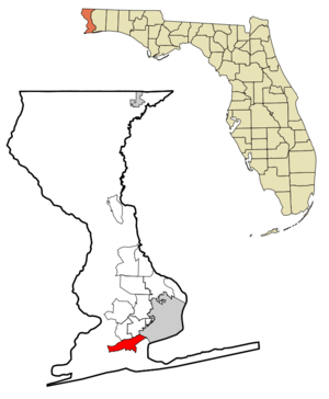
mapsize = 250x200px
map_caption = Location in Escambia County and the state ofFlorida
mapsize1 =
map_caption1 =
image_dot_
dot_mapsize =
dot_map_caption =
dot_x =
dot_y =
pushpin_
pushpin_label_position =
pushpin_map_caption =
pushpin_mapsize =
subdivision_type = Country
subdivision_name = flag|United States
subdivision_type1 = State
subdivision_name1 = flag|Florida
subdivision_type2 = County
subdivision_name2 = noflag|Escambia
subdivision_type3 =
subdivision_name3 =
subdivision_type4 =
subdivision_name4 =
government_footnotes =
government_type =
leader_title =
leader_name =
leader_title1 =
leader_name1 =
leader_title2 =
leader_name2 =
leader_title3 =
leader_name3 =
leader_title4 =
leader_name4 =
established_title =
established_date =
established_title2 =
established_date2 =
established_title3 =
established_date3 =
area_magnitude =
unit_pref = Imperial
area_footnotes =
area_total_km2 = 22
area_land_km2 = 17
area_water_km2 = 5
area_total_sq_mi = 8.5
area_land_sq_mi = 6.6
area_water_sq_mi = 1.9
area_water_percent =
area_urban_km2 =
area_urban_sq_mi =
area_metro_km2 =
area_metro_sq_mi =
area_blank1_title =
area_blank1_km2 =
area_blank1_sq_mi =
population_as_of = 2000
population_footnotes =
population_note =
population_total = 15207
population_density_km2 = 691.2
population_density_sq_mi = 1789.1
population_metro =
population_density_metro_km2 =
population_density_metro_sq_mi =
population_urban =
population_density_urban_km2 =
population_density_urban_sq_mi =
population_blank1_title =
population_blank1 =
population_density_blank1_km2 =
population_density_blank1_sq_mi =
timezone = Central (CST)
utc_offset = -6
timezone_DST = CDT
utc_offset_DST = -5
latd = 30 |latm = 23 |lats = 9 |latNS = N
longd = 87 |longm = 17 |longs = 23 |longEW = W
elevation_footnotes =
elevation_m = 16
elevation_ft = 52
postal_code_type =
postal_code =
area_code =
blank_name = FIPS code
blank_info = 12-75200GR|2
blank1_name = GNIS feature ID
blank1_info = 0292895GR|3
website =
footnotes =Warrington is a
census-designated place (CDP) in Escambia County,Florida ,United States . The population was 15,207 at the 2000 census. Warrington is located six miles (10 km) fromPensacola, Florida .Formerly designated as a town, a change in state incorporation standards in 1975 caused Warrington to lose incorporated status. A referendum was held that year to regain the status, which failed. [http://www.fsu.edu/~localgov/readings_papers/Boundaries%20of%20Government/Munincipal_Incorporations_in_Florida.pdf] Since then attempts at incorporation have not presented themselves. Despite falling outside of city limits, and having a post office explicitly named "Warrington," [http://www.city-data.com/zips/32507.html] mail going to the addresses in the Warrington
ZIP code (32507) fall under the jurisdiction of Pensacola.Naval Air Station Pensacola is located in Warrington (albeit with their own ZIP code, 32508, which corresponds to the mailing city "Naval Air Station Pensacola, FL").Geography
Warrington is located at coor dms|30|23|9|N|87|17|23|W|city (30.385698, -87.289594)GR|1.
According to the
United States Census Bureau , the CDP has a total area of 8.5square mile s (22.0km² ), of which, 6.6 square miles (17.0 km²) of it is land and 1.9 square miles (5.0 km²) of it (22.80%) is water.Demographics
As of the
census GR|2 of 2000, there were 15,207 people, 6,547 households, and 4,046 families residing in the CDP. Thepopulation density was 2,314.1 people per square mile (893.7/km²). There were 7,582 housing units at an average density of 1,153.8/sq mi (445.6/km²). The racial makeup of the CDP was 71.57% White, 21.69% African American, 1.05% Native American, 2.08% Asian, 0.16% Pacific Islander, 0.91% from other races, and 2.54% from two or more races. Hispanic or Latino of any race were 2.88% of the population.There were 6,547 households out of which 28.4% had children under the age of 18 living with them, 38.7% were married couples living together, 18.5% had a female householder with no husband present, and 38.2% were non-families. 31.3% of all households were made up of individuals and 12.0% had someone living alone who was 65 years of age or older. The average household size was 2.32 and the average family size was 2.89.
In the CDP the population was spread out with 25.7% under the age of 18, 9.4% from 18 to 24, 27.7% from 25 to 44, 21.8% from 45 to 64, and 15.4% who were 65 years of age or older. The median age was 36 years. For every 100 females there were 92.3 males. For every 100 females age 18 and over, there were 87.2 males.
The median income for a household in the CDP was $30,459, and the median income for a family was $35,892. Males had a median income of $29,083 versus $19,375 for females. The
per capita income for the CDP was $17,876. About 17.5% of families and 20.6% of the population were below thepoverty line , including 33.8% of those under age 18 and 6.0% of those age 65 or over.References
External links
Wikimedia Foundation. 2010.