- Goodland, Florida
Infobox Settlement
official_name = Goodland, Florida
other_name =
native_name =
nickname =
settlement_type = CDP
motto =
imagesize =
image_caption =
flag_size =
image_
seal_size =
image_shield =
shield_size =
image_blank_emblem =
blank_emblem_type =
blank_emblem_size =
imagesize =
image_caption =
flag_size =
image_
seal_size =
image_shield =
shield_size =
image_blank_emblem =
blank_emblem_type =
blank_emblem_size =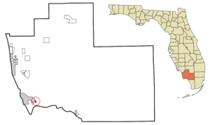
mapsize = 250x200px
map_caption = Location in Collier County and the state ofFlorida
mapsize1 =
map_caption1 =
image_dot_
dot_mapsize =
dot_map_caption =
dot_x =
dot_y =
pushpin_
pushpin_label_position =
pushpin_map_caption =
pushpin_mapsize =
subdivision_type = Country
subdivision_name = flag|United States
subdivision_type1 = State
subdivision_name1 = flag|Florida
subdivision_type2 = County
subdivision_name2 = noflag|Collier
subdivision_type3 =
subdivision_name3 =
subdivision_type4 =
subdivision_name4 =
government_footnotes =
government_type =
leader_title =
leader_name =
leader_title1 =
leader_name1 =
leader_title2 =
leader_name2 =
leader_title3 =
leader_name3 =
leader_title4 =
leader_name4 =
established_title =
established_date =
established_title2 =
established_date2 =
established_title3 =
established_date3 =
area_magnitude =
unit_pref = Imperial
area_footnotes =
area_total_km2 = 1
area_land_km2 = 0.5
area_water_km2 = 0.5
area_total_sq_mi = 0.4
area_land_sq_mi = 0.2
area_water_sq_mi = 0.2
area_water_percent =
area_urban_km2 =
area_urban_sq_mi =
area_metro_km2 =
area_metro_sq_mi =
area_blank1_title =
area_blank1_km2 =
area_blank1_sq_mi =
population_as_of = 2000
population_footnotes =
population_note =
population_total = 320
population_density_km2 = 320
population_density_sq_mi = 800
population_metro =
population_density_metro_km2 =
population_density_metro_sq_mi =
population_urban =
population_density_urban_km2 =
population_density_urban_sq_mi =
population_blank1_title =
population_blank1 =
population_density_blank1_km2 =
population_density_blank1_sq_mi =
timezone = Eastern (EST)
utc_offset = -5
timezone_DST = EDT
utc_offset_DST = -4
latd = 25 |latm = 55 |lats = 28 |latNS = N
longd = 81 |longm = 38 |longs = 49 |longEW = W
elevation_footnotes =
elevation_m = 2
elevation_ft = 7
postal_code_type =ZIP code
postal_code = 34140
area_code = 239
blank_name = FIPS code
blank_info = 12-26775GR|2
blank1_name = GNIS feature ID
blank1_info = 0283178GR|3
website =
footnotes =Goodland is a
census-designated place (CDP) in Collier County,Florida ,United States . The population was 320 at the 2000 census. Located on an outlying portion of Marco Island, it is the closest community to Cape Romano, the southern tip of a nearby island that was the official site of theFlorida landfall ofHurricane Wilma .Geography
Goodland is located at coor dms|25|55|28|N|81|38|49|W|city (25.924478, -81.646876)GR|1.
According to the
United States Census Bureau , the CDP has a total area of 0.4square mile s (1.0km² ), of which, 0.2 square miles (0.5 km²) of it is land and 0.2 square miles (0.5 km²) of it (47.50%) is water.Demographics
As of the
census GR|2 of 2000, there were 320 people, 186 households, and 88 families residing in the CDP. Thepopulation density was 1,512.0 people per square mile (588.3/km²). There were 317 housing units at an average density of 1,497.8/sq mi (582.8/km²). The racial makeup of the CDP was 98.75% White, 0.31% African American, 0.31% Native American, 0.31% Asian, and 0.31% from two or more races. Hispanic or Latino of any race were 1.56% of the population.There were 186 households out of which 8.1% had children under the age of 18 living with them, 43.0% were married couples living together, 2.2% had a female householder with no husband present, and 52.2% were non-families. 41.4% of all households were made up of individuals and 19.4% had someone living alone who was 65 years of age or older. The average household size was 1.72 and the average family size was 2.25.
In the CDP the population was spread out with 7.2% under the age of 18, 2.2% from 18 to 24, 25.0% from 25 to 44, 33.1% from 45 to 64, and 32.5% who were 65 years of age or older. The median age was 53 years. For every 100 females there were 107.8 males. For every 100 females age 18 and over, there were 110.6 males.
The median income for a household in the CDP was $26,739, and the median income for a family was $27,279. Males had a median income of $22,083 versus $27,059 for females. The
per capita income for the CDP was $22,893. About 13.0% of families and 14.0% of the population were below thepoverty line , including 28.1% of those under age 18 and 15.3% of those age 65 or over.References
External links
* [http://www.goodlandfla.com/ Goodland Homepage]
* [http://www.goodland.com/ Goodland information]
Wikimedia Foundation. 2010.