- Springfield, Florida
Infobox Settlement
official_name = Springfield, Florida
other_name =
native_name =
nickname =
settlement_type =City
motto =
imagesize =
image_caption =
flag_size =
image_
seal_size =
image_shield =
shield_size =
image_blank_emblem =
blank_emblem_type =
blank_emblem_size =
imagesize =
image_caption =
flag_size =
image_
seal_size =
image_shield =
shield_size =
image_blank_emblem =
blank_emblem_type =
blank_emblem_size =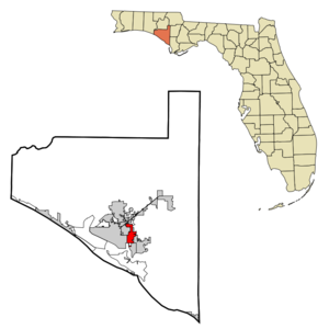
mapsize = 250x200px
map_caption = Location in Bay County and the state ofFlorida
mapsize1 =
map_caption1 =
image_dot_
dot_mapsize =
dot_map_caption =
dot_x =
dot_y =
pushpin_
pushpin_label_position =
pushpin_map_caption =
pushpin_mapsize =
subdivision_type = Country
subdivision_name = flag|United States
subdivision_type1 = State
subdivision_name1 = flag|Florida
subdivision_type2 = County
subdivision_name2 = noflag|Bay
subdivision_type3 =
subdivision_name3 =
subdivision_type4 =
subdivision_name4 =
government_footnotes =
government_type =
leader_title = Mayor
leader_name = Robert Walker
leader_title1 =
leader_name1 =
leader_title2 =
leader_name2 =
leader_title3 =
leader_name3 =
leader_title4 =
leader_name4 =
established_title =
established_date =
established_title2 =
established_date2 =
established_title3 = Incorporated
established_date3 = 1935
area_magnitude =
unit_pref =
area_footnotes =
area_total_km2 = 10.7
area_land_km2 = 10.3
area_water_km2 = 0.4
area_total_sq_mi = 4.2
area_land_sq_mi = 4
area_water_sq_mi = 0.2
area_water_percent =
area_urban_km2 =
area_urban_sq_mi =
area_metro_km2 =
area_metro_sq_mi =
area_blank1_title =
area_blank1_km2 =
area_blank1_sq_mi =
population_as_of = 2000
population_footnotes =
population_note =
population_total = 8810
population_density_km2 = 823.4
population_density_sq_mi = 2097.6
population_metro =
population_density_metro_km2 =
population_density_metro_sq_mi =
population_urban =
population_density_urban_km2 =
population_density_urban_sq_mi =
population_blank1_title =
population_blank1 =
population_density_blank1_km2 =
population_density_blank1_sq_mi =
timezone = Central (CST)
utc_offset = -6
timezone_DST = CDT
utc_offset_DST = -5
latd = 30 |latm = 9 |lats = 56 |latNS = N
longd = 85 |longm = 36 |longs = 38 |longEW = W
elevation_footnotes =
elevation_m = 8
elevation_ft = 26
postal_code_type =
postal_code =
area_code =
blank_name = FIPS code
blank_info = 12-68275GR|2
blank1_name = GNIS feature ID
blank1_info = 0291570GR|3
website =
footnotes =Springfield is a city in Bay County,
Florida ,United States , east of Panama City. The population was 8,810 at the 2000 census. As of2005 , the population recorded by theU.S. Census Bureau is 9,043 [http://www.census.gov/popest/cities/tables/SUB-EST2004-04-12.xls] . Springfield was incorporated onFebruary 12 ,1935 . [http://www.springfieldfl.org/]Unlike much of Bay County, Springfield has been mostly left out of the recent real estate boom, possibly due to the large and odiferous chemical mill and paper plant on the city's waterfront.
Geography
Springfield is located at coor dms|30|9|56|N|85|36|38|W|city (30.165451, -85.610525)GR|1.
According to the
United States Census Bureau , the city has a total area of 10.7km² (4.1 mi²). 10.3 km² (4.0 mi²) of it is land and 0.4 km² (0.2 mi²) of it (3.88%) is water.Demographics
As of the
census GR|2 of 2000, there were 8,810 people, 3,427 households, and 2,350 families residing in the city. Thepopulation density was 859.0/km² (2,223.6/mi²). There were 3,946 housing units at an average density of 384.7/km² (996.0/mi²). The racial makeup of the city was 67.43% White, 23.34% African American, 0.85% Native American, 4.26% Asian, 0.12% Pacific Islander, 0.96% from other races, and 3.03% from two or more races. Hispanic or Latino of any race were 2.55% of the population.There were 3,427 households out of which 33.6% had children under the age of 18 living with them, 45.1% were married couples living together, 18.1% had a female householder with no husband present, and 31.4% were non-families. 25.9% of all households were made up of individuals and 8.1% had someone living alone who was 65 years of age or older. The average household size was 2.56 and the average family size was 3.05.
In the city the population was spread out with 28.4% under the age of 18, 10.0% from 18 to 24, 29.0% from 25 to 44, 21.2% from 45 to 64, and 11.4% who were 65 years of age or older. The median age was 33 years. For every 100 females there were 91.6 males. For every 100 females age 18 and over, there were 88.1 males.
The median income for a household in the city was $27,844, and the median income for a family was $34,665. Males had a median income of $25,417 versus $19,916 for females. The
per capita income for the city was $12,689. About 15.3% of families and 21.5% of the population were below thepoverty line , including 29.7% of those under age 18 and 15.1% of those age 65 or over.Education
Springfield is home to [http://150.176.163.119/rhs/ Rutherford High School] , [http://150.176.163.119/ems/ Everitt Middle School] , [http://150.176.163.119/spe/ Springfield Elementary School] , and [http://150.176.163.119/shaw/ Shaw Adult Learning Center] . The city is part of the [http://www.bay.k12.fl.us/ Bay County School District] .
References
External links
* [http://www.springfieldfl.org/ City of Springfield official website]
Wikimedia Foundation. 2010.