- Bear, Delaware
Infobox Settlement
official_name = Bear, Delaware
settlement_type = CDP
nickname =
motto =
imagesize =
image_caption =
image_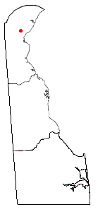
mapsize = 250px
map_caption = Location of Bear, Delaware
mapsize1 =
map_caption1 =subdivision_type = Country
subdivision_name =United States
subdivision_type1 = State
subdivision_name1 =Delaware
subdivision_type2 = County
subdivision_name2 = New Castle
government_footnotes =
government_type =
leader_title =
leader_name =
leader_title1 =
leader_name1 =
established_title =
established_date =area_footnotes =
unit_pref = Imperial
area_magnitude =
area_total_km2 = 14.9
area_land_km2 = 14.9
area_water_km2 = 0.0
area_total_sq_mi = 5.7
area_land_sq_mi = 5.7
area_water_sq_mi = 0.0population_as_of = 2000
population_footnotes =
population_total = 17593
population_density_km2 = 1182.8
population_density_sq_mi = 3063.4timezone = Eastern (EST)
utc_offset = -5
timezone_DST = EDT
utc_offset_DST = -4
elevation_footnotes =
elevation_m = 21
elevation_ft = 69
latd = 39 |latm = 37 |lats = 13 |latNS = N
longd = 75 |longm = 41 |longs = 5 |longEW = Wpostal_code_type =
ZIP code
postal_code = 19701
area_code = 302
blank_name = FIPS code
blank_info = 10-04130
blank1_name = GNIS feature ID
blank1_info = 0216026
website =
footnotes =Bear is a
census-designated place (CDP) in New Castle County,Delaware ,United States . The population was 17,593 at the 2000 census.Originally a small crossroads in a rural area south of Wilmington, the area supported small farms growing mainly corn and cattle. In the late 1980s and 1990s Bear became a popular location for the construction of sprawling
housing development s and shopping center along US Route 40. Bear is not an incorporated municipality or strictly delineated area in the county, but instead a general reference to the collection of communities in the USZIP code s 19701-19702.According to common legend, the name "Bear" originated from a tavern located along the roadway from Wilmington to
Dover, Delaware (at the intersection now formed by US 40 and State Route 7), whose sign was decorated with the image of a large bear.Geography
Bear is located at coor dms|39|37|13|N|75|41|5|W|city (39.620362, -75.684776)GR|1.
According to the
United States Census Bureau , the CDP has a total area of 5.7 square miles (14.9 km²), all of it land.Demographics
As of the
census GR|2 of 2000, there were 17,593 people, 6,027 households, and 4,544 families residing in the CDP. Thepopulation density was 3,063.4 people per square mile (1,183.4/km²). There were 6,265 housing units at an average density of 1,090.9/sq mi (421.4/km²). The racial makeup of the CDP was 66.91% White, 26.79% African American, 0.22% Native American, 2.03% Asian, 0.02% Pacific Islander, 1.78% from other races, and 2.25% from two or more races. Hispanic or Latino of any race were 5.50% of the population.There were 6,027 households out of which 46.6% had children under the age of 18 living with them, 51.4% were married couples living together, 18.2% had a female householder with no husband present, and 24.6% were non-families. 18.2% of all households were made up of individuals and 2.5% had someone living alone who was 65 years of age or older. The average household size was 2.92 and the average family size was 3.30.
In the CDP the population was spread out with 33.0% under the age of 18, 8.5% from 18 to 24, 36.7% from 25 to 44, 17.7% from 45 to 64, and 4.1% who were 65 years of age or older. The median age was 30 years. For every 100 females there were 95.2 males. For every 100 females age 18 and over, there were 90.7 males.
The median income for a household in the CDP was $53,240, and the median income for a family was $57,509. Males had a median income of $40,115 versus $30,231 for females. The
per capita income for the CDP was $20,715. About 4.3% of families and 5.4% of the population were below thepoverty line , including 6.7% of those under age 18 and 7.3% of those age 65 or over.Education
Education for Bear is provided by three public school districts and numerous private schools. The public districts are:Colonial School District, Christina School District, and [http://www.apposchooldistrict.com/ Appoquinimink School District] , which also serves Middletown. Most people living in Bear attend William Penn High School.
References
External links
Wikimedia Foundation. 2010.