Deir Ballut

Deir Ballut
Deir Ballut
Other transcription(s)
 - Arabic دير بلّوط
 - Also spelled Dayr Ballout (official)
Deir al-Ballut (unofficial)
Deir Ballut is located in the Palestinian territories
Deir Ballut
Location of Deir Ballut within the Palestinian territories
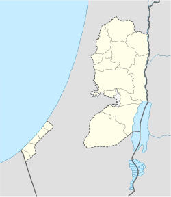
Coordinates: 32°03′55.51″N 35°01′30.01″E / 32.0654194°N 35.0250028°E / 32.0654194; 35.0250028Coordinates: 32°03′55.51″N 35°01′30.01″E / 32.0654194°N 35.0250028°E / 32.0654194; 35.0250028
Governorate Salfit
Government
 - Type Village Council
Population (2006)
 - Jurisdiction 3,700
Name meaning "Monastery (or Convent) of the Oak"

Deir Ballut (Arabic: دير بلّوط‎) is a Palestinian town located in the Salfit Governorate in the northern West Bank, 41 kilometers (25 mi) south west of Nablus. According to the Palestinian Central Bureau of Statistics, it had a population of approximately 3,700 in mid-year 2006.[1]

Arab geographer Yaqut al-Hamawi records in 1226, while Deir Ballut was under Mamluk rule, "Deir al-Ballut was a village of district around ar-Ramla."[2] Deir Ballut was the site of minor engagement between Turkish and British troops on the March 12, 1918.

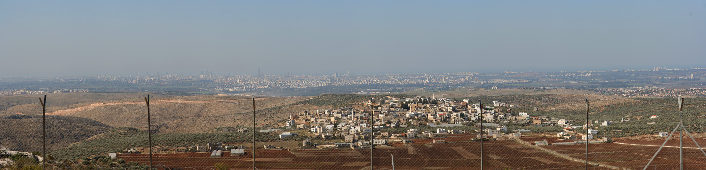
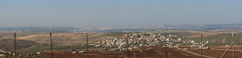
View of Deir Ballut (foreground) from Peduel

References

Bibliography


Wikimedia Foundation. 2010.

Игры ⚽ Нужно решить контрольную?

Look at other dictionaries:

  • Deir Istiya — Other transcription(s)  – Arabic دير إسيتا  – Also spelled Deir Istya (official) Dayr Istiya (unofficial) …   Wikipedia

  • Deir Ghassana — Infobox Palestinian Authority muni name=Deir Ghassaneh imgsize=250 caption= arname=ديرغسانة meaning= Monastery of Christians founded= typefrom= altOffSp=Deir Ghassana altUnoSp= governorate=rb population=1,800 popyear=2006 area=12,795 areakm=12.8… …   Wikipedia

  • Dayr Ballut — Original name in latin Dayr Ball Name in other language Dair Balut, Dayr Ballut, Dayr Ball Deir Ballut, Deir Ballu dyr blwt State code PS Continent/City Asia/Hebron longitude 32.06551 latitude 35.02451 altitude 284 Population 3566 Date 2012 02 28 …   Cities with a population over 1000 database

  • District of Nablus — The District of Nablus also known as Sanjak Nablus is a historical administrative area that existed throughout Ottoman rule of Palestine and to a lesser extent during British rule. It exists today as the Nablus Governorate of the Palestinian… …   Wikipedia

  • Salfit Governorate — The Salfit Governorate ( ar. محافظة سلفيت) is one of 16 Governorates of the Palestinian National Authority. It is located in the northwestern West Bank, bordered by the governorates of Ramallah and al Bireh to the south, Nablus to the east and… …   Wikipedia

  • Marda, Salfit — Marda Other transcription(s)    Arabic مرده …   Wikipedia

  • Mas-ha — Other transcription(s)    Arabic مسحة    Also spelled Mas ha (official) …   Wikipedia

  • Gobernación de Salfit — سلفيت محافظة Organización territorial de Palestina Ca …   Wikipedia Español

  • Judea — • It designates the part of Palestine adjacent to Jerusalem and inhabited by the Jewish community after their return from captivity Catholic Encyclopedia. Kevin Knight. 2006. Judea     Judea …   Catholic encyclopedia

  • YARKON or ME-YARKON — (Jarkon; Heb. מֵי (הַ)יַּרְקוֹן), river on the border of the tribe of Dan, which is described as passing Bene Berak, Gath Rimmon, and Me Jarkon, and Rakkon, with the border over against Joppa (Josh. 19:45–46). The majority of scholars, regarding… …   Encyclopedia of Judaism

Share the article and excerpts

Direct link
Do a right-click on the link above
and select “Copy Link”