- Marda, Salfit
-
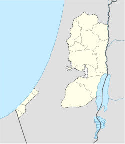
Marda Other transcription(s) - Arabic مرده Location of Marda within the Palestinian territories Coordinates: 32°06′46.91″N 35°11′44.47″E / 32.1130306°N 35.1956861°ECoordinates: 32°06′46.91″N 35°11′44.47″E / 32.1130306°N 35.1956861°E Governorate Salfit Government - Type Village Council Population (2006) - Jurisdiction 2,211 Marda (Arabic: مرده) is a Palestinian town located in the Salfit Governorate in the northern West Bank, 18 kilometers Southwest of Nablus. The Israeli settlement of Ariel lies immediately south of Marda. According to the Palestinian Central Bureau of Statistics, it had a population of 2,211 approximately in mid-year 2006.[1]
References
Bibliography
- Guérin, M. V.: (1875): Description Géographique, Historique et Archéologique de la Palestine. Samarie, 2 pt. ("Seconde partie -Samarie")("Tome II") (p. 162)
Salfit Governorate Municipalities 

Villages Bruqin · Deir Ballut · Deir Istiya · Farkha · Haris · Iskaka · Kifl Hares · Marda · Mas-ha · Qarawat Bani Hassan · Qira · Rafat · Sarta · YasufCategories:- Salfit Governorate
- Palestine geography stubs
- Villages in the West Bank
Wikimedia Foundation. 2010.

