- Mount Takahe
-
Mount Takahe 
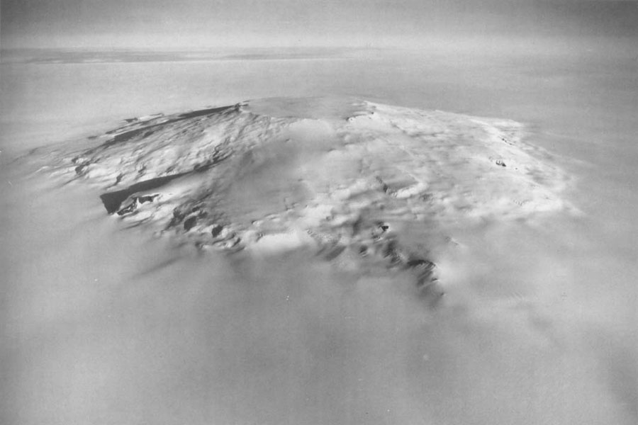
Aerial view of Mt. Takahe from the west.Elevation 3,460 m (11,352 ft) Prominence 2,134 m (7,001 ft) Listing Ultra Location Location Marie Byrd Land, Antarctica Coordinates 76°18′S 112°06′W / 76.3°S 112.1°W Geology Type Shield volcano Last eruption 5550 BC (?) Mount Takahe is a large, snow covered shield volcano standing 64 km SE of Toney Mountain in Marie Byrd Land, Antarctica. It is roughly circular, about 29 km across, and has a caldera up to 8 km wide. At 780 cubic km, it is a massive volcano. The volcano may have last erupted during the Holocene, and thus it is probably a potentially active volcano.
Takahe was probably among those viewed from a distance by Admiral Byrd and other members of the USAS in plane flights from the ship Bear on Feb. 24 and 25, 1940. It was visited in December 1957 by members of the Marie Byrd Land Traverse Party, 1957–58, who applied the name. "Takahe," the Māori name for a flightless, almost extinct New Zealand bird, is the nickname of the U.S. Navy LC-47 aircraft whose crew resupplied the traverse party near this mountain and assisted by providing aerial reconnaissance to locate passable routes.[1]
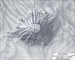 Topographic map of Mount Takahe (1:250,000 scale).
Contents
Gill Bluff
Gill Bluff (76°14′S 112°33′W / 76.233°S 112.55°W) is a rock bluff on the northwest side of Mount Takahe, in Marie Byrd Land. Mapped by United States Geological Survey (USGS) from ground surveys and U.S. Navy air photos, 1959-66. Named by Advisory Committee on Antarctic Names (US-ACAN) for Allan Gill, aurora researcher at Byrd Station in 1963.[2]
See also
References
- ^ "Mount Takahe". Geographic Names Information System. United States Geological Survey. http://geonames.usgs.gov/pls/gnispublic/f?p=gnispq:5:::NO::P5_ANTAR_ID:14967. Retrieved 2009-07-06.
- ^ "Gill Bluff". Geographic Names Information System. United States Geological Survey. http://geonames.usgs.gov/pls/gnispublic/f?p=gnispq:5:::NO::P5_ANTAR_ID:5680. Retrieved 2009-07-06.
Sources
- "Takahe". Global Volcanism Program, Smithsonian Institution. http://www.volcano.si.edu/world/volcano.cfm?vnum=1900-027.
- LeMasurier, W. E.; Thomson, J. W. (eds.) (1990). Volcanoes of the Antarctic Plate and Southern Oceans. American Geophysical Union. p. 512 pp. ISBN 0-87590-172-7.
- "Amar Andalkar's Ski Mountaineering and Climbing Site. Skiing the Pacific Ring of Fire and Beyond". 1997–2007. http://www.skimountaineer.com/ROF/RingOfFire.html. Retrieved 2005-01-14.

This Marie Byrd Land location article is a stub. You can help Wikipedia by expanding it.