- Mount Murphy
-
Mount Murphy 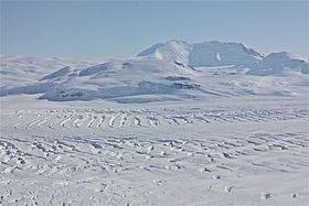
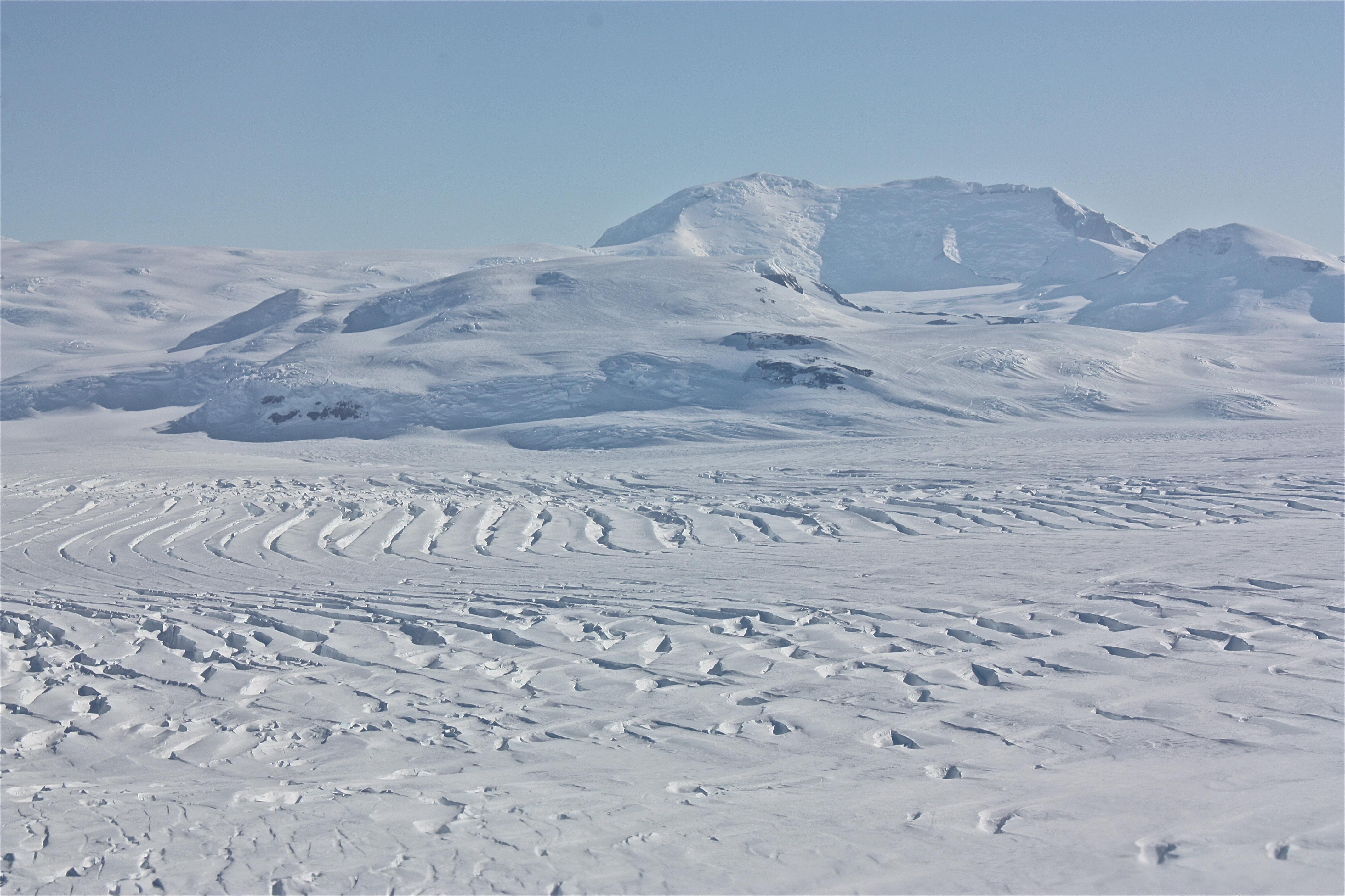
Aerial view of Mt. MurphyElevation 2,705 m (8,875 ft) Prominence 2,055 m (6,742 ft) Listing Ultra Location Location Marie Byrd Land, Antarctica Coordinates 75°18′S 110°42′W / 75.3°S 110.7°W Geology Type Shield volcano Age of rock Unknown Last eruption Late Miocene Mount Murphy is a massive, snow-covered and highly eroded shield volcano with steep, rocky slopes. It is directly south of Bear Peninsula, Marie Byrd Land. The mountain is bounded by the Smith, Pope and Haynes Glaciers.
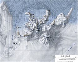 Topographic map of Mount Murphy (1:250,000 scale)
Delineated from aerial photographs taken by US Navy Operation Highjump in January 1947. Named by US-ACAN for Robert Cushman Murphy of the American Museum of Natural History, noted authority on Antarctic and sub-Antarctic bird life. While serving on the whaler, he charted the Bay of Isles region of South Georgia.
See also
Sources
- LeMasurier, W. E.; Thomson, J. W. (eds.) (1990). Volcanoes of the Antarctic Plate and Southern Oceans. American Geophysical Union. p. 512 pp. ISBN 0-87590-172-7.
- "Amar Andalkar's Ski Mountaineering and Climbing Site. Skiing the Pacific Ring of Fire and Beyond". 1997–2007. http://www.skimountaineer.com/ROF/RingOfFire.html. Retrieved 2005-01-14.

This Marie Byrd Land location article is a stub. You can help Wikipedia by expanding it.