- Salt Creek, Colorado
Infobox Settlement
official_name = Salt Creek, Colorado
other_name =
native_name =
nickname =
settlement_type = CDP
motto =
imagesize =
image_caption =
flag_size =
image_
seal_size =
image_shield =
shield_size =
image_blank_emblem =
blank_emblem_type =
blank_emblem_size =
imagesize =
image_caption =
flag_size =
image_
seal_size =
image_shield =
shield_size =
image_blank_emblem =
blank_emblem_type =
blank_emblem_size =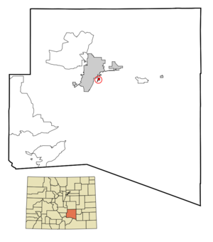
mapsize = 250px
map_caption = Location in Pueblo County and the state ofColorado
mapsize1 =
map_caption1 =
image_dot_
dot_mapsize =
dot_map_caption =
dot_x =
dot_y =
pushpin_
pushpin_label_position =
pushpin_map_caption =
pushpin_mapsize =
subdivision_type = Country
subdivision_name = USA
subdivision_type1 = State
subdivision_name1 = flag|Colorado|name=State of Colorado
subdivision_type2 = County
subdivision_name2 = Pueblo CountyGR|3
subdivision_type3 =
subdivision_name3 =
subdivision_type4 =
subdivision_name4 =
government_footnotes =
government_type =unincorporated community
leader_title =
leader_name =
leader_title1 =
leader_name1 =
leader_title2 =
leader_name2 =
leader_title3 =
leader_name3 =
leader_title4 =
leader_name4 =
established_title =
established_date =
established_title2 =
established_date2 =
established_title3 =
established_date3 =
area_magnitude =
unit_pref = Imperial
area_footnotes =
area_total_km2 = 1.1
area_land_km2 = 1.1
area_water_km2 = 0
area_total_sq_mi = 0.4
area_land_sq_mi = 0.4
area_water_sq_mi = 0
area_water_percent =
area_urban_km2 =
area_urban_sq_mi =
area_metro_km2 =
area_metro_sq_mi =
area_blank1_title =
area_blank1_km2 =
area_blank1_sq_mi =
population_as_of = 2000
population_footnotes =
population_note =
population_total = 648
population_density_km2 = 589.1
population_density_sq_mi = 1620
population_metro =
population_density_metro_km2 =
population_density_metro_sq_mi =
population_urban =
population_density_urban_km2 =
population_density_urban_sq_mi =
population_blank1_title =
population_blank1 =
population_density_blank1_km2 =
population_density_blank1_sq_mi =
timezone = MST
utc_offset = -7
timezone_DST = MDT
utc_offset_DST = -6
latd = 38 |latm = 14 |lats = 31 |latNS = N
longd = 104 |longm = 35 |longs = 5 |longEW = W
elevation_footnotes =
elevation_m = 1448
elevation_ft = 4751
postal_code_type =ZIP code
postal_code = Pueblo 81006
area_code = 719
blank_name = FIPS code
blank_info = 08-67445
blank1_name = GNIS feature ID
blank1_info = [http://geonames.usgs.gov/pls/gnispublic/f?p=gnispq:3:::NO::P3_FID:0193786 0193786]
website =
footnotes =Salt Creek is a
census-designated place (CDP) in Pueblo County,Colorado ,United States . It is part of thePueblo, Colorado Metropolitan Statistical Area . The population was 648 at the 2000 census.Geography
Salt Creek is located at coor dms|38|14|31|N|104|35|5|W|city (38.241903, -104.584805)GR|1.
According to the
United States Census Bureau , the CDP has a total area of 0.4square mile s (1.1km² ), all of it land.Demographics
As of the
census GR|2 of 2000, there were 648 people, 225 households, and 166 families residing in the CDP. Thepopulation density was 1,567.8 people per square mile (610.2/km²). There were 245 housing units at an average density of 592.8/sq mi (230.7/km²). The racial makeup of the CDP was 55.71% White, 0.77% African American, 4.48% Native American, 0.62% Asian, 35.49% from other races, and 2.93% from two or more races. Hispanic or Latino of any race were 79.32% of the population.There were 225 households out of which 29.3% had children under the age of 18 living with them, 46.2% were married couples living together, 19.1% had a female householder with no husband present, and 25.8% were non-families. 20.0% of all households were made up of individuals and 8.4% had someone living alone who was 65 years of age or older. The average household size was 2.70 and the average family size was 3.10.
In the CDP the population was spread out with 29.0% under the age of 18, 9.4% from 18 to 24, 23.1% from 25 to 44, 21.9% from 45 to 64, and 16.5% who were 65 years of age or older. The median age was 36 years. For every 100 females there were 126.6 males. For every 100 females age 18 and over, there were 117.0 males.
The median income for a household in the CDP was $30,234, and the median income for a family was $32,031. Males had a median income of $26,339 versus $16,563 for females. The
per capita income for the CDP was $12,591. About 21.8% of families and 23.4% of the population were below thepoverty line , including 19.2% of those under age 18 and 28.7% of those age 65 or over.ee also
*
List of cities and towns in Colorado
*Pueblo County, Colorado
*State of Colorado References
External links
Wikimedia Foundation. 2010.