- Snowmass Village, Colorado
Infobox Settlement
official_name = Town of Snowmass Village, Colorado
other_name =
native_name =
nickname =
settlement_type =Town
motto =
imagesize =
image_caption =
flag_size =
image_
seal_size =
image_shield =
shield_size =
image_blank_emblem =
blank_emblem_type =
blank_emblem_size =
flag_size =
image_
seal_size =
image_shield =
shield_size =
image_blank_emblem =
blank_emblem_type =
blank_emblem_size =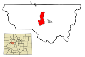
mapsize = 250px
map_caption = Location in Pitkin County and the state ofColorado
mapsize1 =
map_caption1 =
image_dot_
dot_mapsize =
dot_map_caption =
dot_x =
dot_y =
pushpin_
pushpin_label_position =
pushpin_map_caption =
pushpin_mapsize =
subdivision_type = Country
subdivision_name = USA
subdivision_type1 = State
subdivision_name1 = flag|Colorado
subdivision_type2 = Countycite web | url = http://www.dola.state.co.us/dlg/local_governments/municipalities.html | title = Active Colorado Municipalities | format =HTML | publisher = State of Colorado, Department of Local Affairs | accessdate = 2007-09-01]
subdivision_name2 = Pitkin County
subdivision_type3 =
subdivision_name3 =
subdivision_type4 =
subdivision_name4 =
government_footnotes =
government_type = Home Rule Municipality
leader_title =
leader_name =
leader_title1 =
leader_name1 =
leader_title2 =
leader_name2 =
leader_title3 =
leader_name3 =
leader_title4 =
leader_name4 =
established_title = Settled
established_date = Abt. 1910
established_title2 = Incorporated
established_date2 = 1977cite web | url = http://www.colorado.gov/dpa/doit/archives/muninc.html | title = Colorado Municipal Incorporations | format =HTML | publisher = State of Colorado, Department of Personnel & Administration, Colorado State Archives | date =2004-12-01 | accessdate = 2007-09-02]
established_title3 =
established_date3 =
area_magnitude =
unit_pref = Imperial
area_footnotes =
area_total_km2 = 66.2
area_land_km2 = 66
area_water_km2 = 0.2
area_total_sq_mi = 25.6
area_land_sq_mi = 25.5
area_water_sq_mi = 0.1
area_water_percent =
area_urban_km2 =
area_urban_sq_mi =
area_metro_km2 =
area_metro_sq_mi =
area_blank1_title =
area_blank1_km2 =
area_blank1_sq_mi =
population_as_of = 2000
population_footnotes =
population_note =
population_total = 1822
population_density_km2 = 27.5
population_density_sq_mi = 71.2
population_metro =
population_density_metro_km2 =
population_density_metro_sq_mi =
population_urban =
population_density_urban_km2 =
population_density_urban_sq_mi =
population_blank1_title =
population_blank1 =
population_density_blank1_km2 =
population_density_blank1_sq_mi =
timezone = Mountain (MST)
utc_offset = -7
timezone_DST = MDT
utc_offset_DST = -6
latd = 39 |latm = 12 |lats = 51 |latNS = N
longd = 106 |longm = 56 |longs = 43 |longEW = W
elevation_footnotes = GR|3
elevation_m = 2502
elevation_ft = 8209
postal_code_type =ZIP code cite web|url = http://zip4.usps.com/zip4/citytown.jsp | title = ZIP Code Lookup| format =JavaScript /HTML | publisher =United States Postal Service | accessdate=2008-01-03]
postal_code = 81615 (PO Box )
area_code = 970
blank_name = FIPS code
blank_info = 08-71755
blank1_name = GNIS feature ID
blank1_info = [http://geonames.usgs.gov/pls/gnispublic/f?p=gnispq:3:::NO::P3_FID:0204832 0204832]
blank2_name = Highways
blank2_info = none
website = [http://www.tosv.com/ Town of Snowmass Village]
footnotes =Snowmass Village is a Home Rule Municipality in Pitkin County,
Colorado ,United States . The population was 1,822 at the 2000 census. A popular winter resort location forskiing andsnowboarding , the town is best known as the location of the Snowmass ski area, the largest of the four nearby ski areas operated collectively asAspen/Snowmass .Geography
Snowmass Village is located at coor dms|39|12|51|N|106|56|43|W|city (39.214104, -106.945288)GR|1.
According to the
United States Census Bureau , the town has a total area of 25.6square mile s (66.2km² ), of which, 25.5 square miles (66.0 km²) of it is land and 0.1 square miles (0.2 km²) of it (0.35%) is water.Snowmass Village is to the north and at the base of the Snowmass Ski Area. It is on Brush Creek, not on
Snowmass Creek , and takes its name from the ski area. Within the area of the town, Owl Creek and Brush Creek confluence then flow north into theRoaring Fork River . Visible from the village from east to west is: Burnt Mountain Ridge,Burnt Mountain ,Baldy Mountain , Chapel Peak,Garret Peak , Clark Peak,Mount Daly , andCapitol Peak . NeitherSnowmass Mountain norSnowmass Peak , at the headwaters ofSnowmass Creek , are visible from Snowmass Village. The rock of the Snowmass Village area is predominantlyMancos Shale . On south-facing slopes, this alkaline soil supportsGambel oak ,Sagebrush ,Serviceberry , andChokecherry . The north-facing slopes featureAspen ,Subalpine fir ,Douglas fir ,Engelmann spruce , andBlue spruce .Snowmass Village and adjacent Wildcat have a huge population of black bears which feed on the acorns and berries of the south-facing slopes.History
The Brush Creek Valley was settled in about 1910 by ranching families including: Sinclair, Melton, Stapleton, and Hoaglund. * [http://www.snowmassvillagesun.com/home.php?content=article&article=3148] As a child, Hilder Hoaglund would ride her horse into Aspen to go to school. Her father, Charles Hoaglund immigrated from
Sweden in the 1800s. After a school was built in Brush Creek, she attended school at the Brush Creek Frontier School, now called the Little Red Schoolhouse, located on Owl Creek Road. She became a teacher at that school and then at the Red Brick School inAspen . At the schoolhouse, she would play the accordion or piano for community dances. When she married Bill Anderson, the Hoaglund Ranch became the Anderson Ranch.Paul Soldner , a ceramic artist noted for developing AmericanRaku , established a studio in the Anderson Ranch buildings in 1966. In 1968, he founded theAnderson Ranch Art Center and it incorporated in 1973. The Anderson Ranch Art Center on Owl Creek Road uses many of the original buildings from the Hoaglund Ranch, although not in their original location, farther down stream on what is now Snowmass Club Circle.Under the leadership of
Bill Janss andDRC Brown , theAmerican Cement Company developed Snowmass Village as a ski resort starting in 1966. * [ [http://www.snowmassvillage.com/snowmass-a-history-beyond-and-between-the-slopes Snowmass: A History Beyond and Between the Slopes | Snowmass Village ] ] Hayfields were subdivided and the lots sold for houses. Brush Creek is an unappealing name for a ski area, so they named the resort Snowmass after the valley to the west of Brush Creek.Fritz Benidict acted as the architect of the Snowmass ski area. The west part of ski area, Campground, actually does extend into the Snowmass Valley. Five chairlifts were installed: Fanny Hill, Burlingame, and Sam's Knob, the Big Burn, and Campground. Brush Creek Road was paved in 1968. The former hayfield still had mostly alfalfa into the 1970s. The Snowmass Golf Course was first laid out with nine holes in (need date). It was expanded and redesigned several times (need dates), the latest in 2001 byJames Engh . The periodic re-landscaping of the golf course led to the relocation of ranch houses and to changes in the valley floor from flat or slopping fields to rolling hills with ponds.The Snowmass Wildcat Fire Protection District was founded in 1971 and the firehouse built on Owl Creek Road.
In 1977, the community incorporated as the Town of Snowmass Village. The Snowmass Chapel was built near the firehouse on Owl Creek Road in 1988. Previous to this time, church services were held in the Optigon Movie Theatre or in the open air Aspen Grove Chapel, located at what is now condominiums off Wood Road.
Demographics
As of the
census GR|2 of 2000, there were 1,822 people, 864 households, and 393 families residing in the town. Thepopulation density was 71.5 people per square mile (27.6/km²). There were 1,734 housing units at an average density of 68.0/sq mi (26.3/km²). The racial makeup of the town was 97.37% White, 0.16% African American, 0.05% Native American, 0.71% Asian, 0.66% from other races, and 1.04% from two or more races. Hispanic or Latino of any race were 2.63% of the population.There were 864 households out of which 19.7% had children under the age of 18 living with them, 41.1% were married couples living together, 2.7% had a female householder with no husband present, and 54.4% were non-families. 36.0% of all households were made up of individuals and 2.8% had someone living alone who was 65 years of age or older. The average household size was 2.09 and the average family size was 2.74.
In the town the population was spread out with 15.8% under the age of 18, 7.6% from 18 to 24, 41.6% from 25 to 44, 28.7% from 45 to 64, and 6.3% who were 65 years of age or older. The median age was 37 years. For every 100 females there were 128.6 males. For every 100 females age 18 and over, there were 132.4 males.
The median income for a household in the town was $57,059, and the median income for a family was $86,338. Males had a median income of $40,625 versus $37,500 for females. The
per capita income for the town was $35,224. About 1.7% of families and 4.4% of the population were below thepoverty line , including 1.5% of those under age 18 and none of those age 65 or over.References
External links
* [http://www.tosv.com/ Town of Snowmass Village website]
** [http://www.dot.state.co.us/App_DTD_DataAccess/Downloads/CityMaps/Snowmass%20Village.pdf CDOT map of the Town of Snowmass Village]
* [http://www.snowmasspress.com/ Snowmass Village Press] (official website)
* [http://www.areamaps.org/findcity.cfm/_Aspen_CO_n Snowmass Village City Guide]
* [http://www.snowmassreview.com/index.html Snowmass Ski Resort] (Snowmass articles and reviews)
* [http://www.swfpd.com/ Snowmass-Wildcat Fire Protection District]
* [http://www.crown-golf.com/snowmass.html Snowmass Golf Club]
* [http://www.andersonranch.org/ Anderson Ranch Arts Center]
* [http://www.snowmasschapel.org/index.html The Snowmass Chapel]
* [http://www.allaspen.com/snowmass_village/snowmass_village.php Snowmass Colorado] (part of AllApsen.com travel guide)
Wikimedia Foundation. 2010.