- Roxborough Park, Colorado
Infobox Settlement
official_name = Roxborough Park, Colorado
other_name =
native_name =
nickname =
settlement_type = CDP
motto =
imagesize =
image_caption =
flag_size =
image_
seal_size =
image_shield =
shield_size =
image_blank_emblem =
blank_emblem_type =
blank_emblem_size =
imagesize =
image_caption =
flag_size =
image_
seal_size =
image_shield =
shield_size =
image_blank_emblem =
blank_emblem_type =
blank_emblem_size =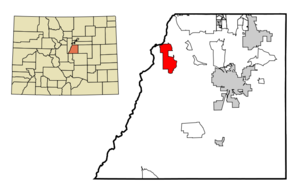
mapsize = 250px
map_caption = Location in Douglas County and the state ofColorado
mapsize1 =
map_caption1 =
image_dot_
dot_mapsize =
dot_map_caption =
dot_x =
dot_y =
pushpin_
pushpin_label_position =
pushpin_map_caption =
pushpin_mapsize =
subdivision_type = Country
subdivision_name = USA
subdivision_type1 = State
subdivision_name1 = flag|Colorado|name=State of Colorado
subdivision_type2 = County
subdivision_name2 = Douglas CountyGR|3
subdivision_type3 =
subdivision_name3 =
subdivision_type4 =
subdivision_name4 =
government_footnotes =
government_type =unincorporated community
leader_title =
leader_name =
leader_title1 =
leader_name1 =
leader_title2 =
leader_name2 =
leader_title3 =
leader_name3 =
leader_title4 =
leader_name4 =
established_title =
established_date =
established_title2 =
established_date2 =
established_title3 =
established_date3 =
area_magnitude =
unit_pref = Imperial
area_footnotes =
area_total_km2 = 25.4
area_land_km2 = 25.1
area_water_km2 = 0.3
area_total_sq_mi = 9.8
area_land_sq_mi = 9.7
area_water_sq_mi = 0.1
area_water_percent =
area_urban_km2 =
area_urban_sq_mi =
area_metro_km2 =
area_metro_sq_mi =
area_blank1_title =
area_blank1_km2 =
area_blank1_sq_mi =
population_as_of = 2000
population_footnotes =
population_note =
population_total = 4446
population_density_km2 = 175
population_density_sq_mi = 453.7
population_metro =
population_density_metro_km2 =
population_density_metro_sq_mi =
population_urban =
population_density_urban_km2 =
population_density_urban_sq_mi =
population_blank1_title =
population_blank1 =
population_density_blank1_km2 =
population_density_blank1_sq_mi =
timezone = Mountain (MST)
utc_offset = -7
timezone_DST = MDT
utc_offset_DST = -6
latd = 39 |latm = 27 |lats = 33 |latNS = N
longd = 105 |longm = 4 |longs = 43 |longEW = W
elevation_footnotes = GR|3
elevation_m = 1753
elevation_ft = 5751
postal_code_type =ZIP code
postal_code = 80125
area_code =
blank_name = FIPS code
blank_info = 08-66197
blank1_name = GNIS feature ID
blank1_info = [http://geonames.usgs.gov/pls/gnispublic/f?p=gnispq:3:::NO::P3_FID:1852848 1852848]
website =
footnotes =Roxborough Park is a
census-designated place (CDP) in Douglas County,Colorado ,United States . The population was 4,446 at the 2000 census.Geography
Roxborough Park is located at coor dms|39|27|33|N|105|4|43|W|city (39.459235, -105.078524)GR|1.
According to the
United States Census Bureau , the CDP has a total area of 9.8square mile s (25.5km² ), of which, 9.7 square miles (25.1 km²) of it is land and 0.1 square miles (0.3 km²) of it (1.32%) is water.Demographics
As of the
census GR|2 of 2000, there were 4,446 people, 1,587 households, and 1,328 families residing in the CDP. Thepopulation density was 457.9 people per square mile (176.8/km²). There were 1,637 housing units at an average density of 168.6/sq mi (65.1/km²). The racial makeup of the CDP was 93.88% White, 0.47% African American, 0.47% Native American, 1.42% Asian, 0.09% Pacific Islander, 1.71% from other races, and 1.96% from two or more races. Hispanic or Latino of any race were 5.58% of the population.There were 1,587 households out of which 43.9% had children under the age of 18 living with them, 77.1% were married couples living together, 4.2% had a female householder with no husband present, and 16.3% were non-families. 10.3% of all households were made up of individuals and 0.8% had someone living alone who was 65 years of age or older. The average household size was 2.80 and the average family size was 3.03.
In the CDP the population was spread out with 29.4% under the age of 18, 4.0% from 18 to 24, 41.9% from 25 to 44, 21.8% from 45 to 64, and 2.9% who were 65 years of age or older. The median age was 34 years. For every 100 females there were 104.6 males. For every 100 females age 18 and over, there were 103.5 males.
The median income for a household in the CDP was $78,607, and the median income for a family was $81,281. Males had a median income of $51,543 versus $35,968 for females. The
per capita income for the CDP was $36,300. About 2.0% of families and 1.7% of the population were below thepoverty line , including 1.2% of those under age 18 and none of those age 65 or over.ee also
*
List of cities and towns in Colorado References
External links
* [http://www.southofdenver.com/schools.html Douglas County School Info]
Wikimedia Foundation. 2010.