- Franktown, Colorado
Infobox Settlement
official_name = Franktown, Colorado
other_name =
native_name =
nickname =
settlement_type =town
motto =
imagesize =
image_caption =
flag_size =
image_
seal_size =
image_shield =
shield_size =
image_blank_emblem =
blank_emblem_type =
blank_emblem_size =
imagesize =
image_caption =
flag_size =
image_
seal_size =
image_shield =
shield_size =
image_blank_emblem =
blank_emblem_type =
blank_emblem_size =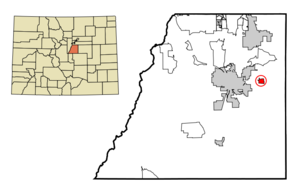
mapsize = 250px
map_caption = Location in Douglas County and the state ofColorado
mapsize1 =
map_caption1 =
image_dot_
dot_mapsize =
dot_map_caption =
dot_x =
dot_y =
pushpin_
pushpin_label_position =
pushpin_map_caption =
pushpin_mapsize =
subdivision_type = Country
subdivision_name = Click-Inline|
United States
subdivision_type1 = State
subdivision_name1 = Click-Inline|
Colorado
subdivision_type2 = County
subdivision_name2 = DouglasGR|3
subdivision_type3 =
subdivision_name3 =
subdivision_type4 =
subdivision_name4 =
government_footnotes =
government_type =
leader_title =
leader_name =
leader_title1 =
leader_name1 =
leader_title2 =
leader_name2 =
leader_title3 =
leader_name3 =
leader_title4 =
leader_name4 =
established_title =
established_date =
established_title2 = July 3, 1877
established_date2 =
established_title3 =
established_date3 =
area_magnitude =
unit_pref = Imperial
area_footnotes =
area_total_km2 = 2.2
area_land_km2 = 2.2
area_water_km2 = 0
area_total_sq_mi = 0.8
area_land_sq_mi = 0.8
area_water_sq_mi = 0
area_water_percent =
area_urban_km2 =
area_urban_sq_mi =
area_metro_km2 =
area_metro_sq_mi =
area_blank1_title =
area_blank1_km2 =
area_blank1_sq_mi =
population_as_of = 2000
population_footnotes =
population_note =
population_total = 99
population_density_km2 = 45
population_density_sq_mi = 123.8
population_metro =
population_density_metro_km2 =
population_density_metro_sq_mi =
population_urban =
population_density_urban_km2 =
population_density_urban_sq_mi =
population_blank1_title =
population_blank1 =
population_density_blank1_km2 =
population_density_blank1_sq_mi =
timezone = MST
utc_offset = -7
timezone_DST = MDT
utc_offset_DST = -6
latd = 39 |latm = 23 |lats = 25 |latNS = N
longd = 104 |longm = 45 |longs = 14 |longEW = W
elevation_footnotes = GR|3
elevation_m = 1878
elevation_ft = 6161
postal_code_type =ZIP code cite web | date =December 14 2006 | url = http://zip4.usps.com/zip4/citytown.jsp | title = ZIP Code Lookup| format =JavaScript /HTML | publisher = United States Postal Service | accessdate = December 14 | accessyear = 2006]
postal_code = 80116
area_code = 303
blank_name = FIPS code
blank_info = 08-28250
blank1_name = GNIS feature ID
blank1_info = 0204741
website =
footnotes =Franktown is a
census-designated place (CDP) in Douglas County,Colorado , in theUnited States . The population was 99 at the 2000 census.GR|2 The Franktown Post Office has theZIP Code 80116.Geography
Franktown is located at coor dms|39|23|25|N|104|45|14|W|city (39.390378, -104.753961)GR|1.
According to the
United States Census Bureau , the CDP has a total area of 0.9square mile s (2.2km² ), all of it land.Demographics
As of the
census GR|2 of 2000, there were 99 people, 38 households, and 29 families residing in the CDP. Thepopulation density was 116.8 people per square mile (45.0/km²). There were 38 housing units at an average density of 44.8/sq mi (17.3/km²). The racial makeup of the CDP was 97.98% White, 1.01% from other races, and 1.01% from two or more races. Hispanic or Latino of any race were 1.01% of the population.There were 38 households out of which 28.9% had children under the age of 18 living with them, 73.7% were married couples living together, 2.6% had a female householder with no husband present, and 21.1% were non-families. 21.1% of all households were made up of individuals and 7.9% had someone living alone who was 65 years of age or older. The average household size was 2.61 and the average family size was 3.00.
In the CDP the population was spread out with 21.2% under the age of 18, 8.1% from 18 to 24, 26.3% from 25 to 44, 36.4% from 45 to 64, and 8.1% who were 65 years of age or older. The median age was 43 years. For every 100 females there were 94.1 males. For every 100 females age 18 and over, there were 85.7 males.
The median income for a household in the CDP was $60,375, and the median income for a family was $61,500. Males had a median income of $61,528 versus $30,139 for females. The
per capita income for the CDP was $25,744. None of the population was below thepoverty line .References
External links
* [http://denver.yourhub.com/FRANKTOWN/ YourHub.com/Franktown]
* [http://www.douglas.co.us/commissioners/documents/BM5_30_06_itemf.pdf]
* [http://www.southofdenver.com/schools.html Douglas County School Info]
Wikimedia Foundation. 2010.