- Westcliffe, Colorado
Infobox Settlement
official_name = Town of Westcliffe, Colorado
other_name =
native_name =
nickname =
settlement_type =Town
motto =
imagesize =
image_caption =
flag_size =
image_
seal_size =
image_shield =
shield_size =
image_blank_emblem =
blank_emblem_type =
blank_emblem_size =
imagesize =
image_caption =
flag_size =
image_
seal_size =
image_shield =
shield_size =
image_blank_emblem =
blank_emblem_type =
blank_emblem_size =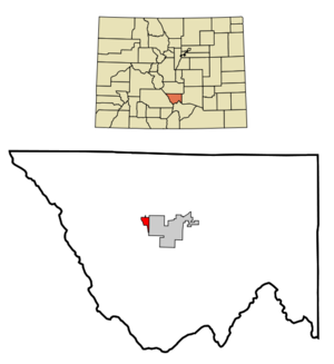
mapsize = 250x200px
map_caption = Location in Custer County and the state ofColorado
mapsize1 =
map_caption1 =
image_dot_
dot_mapsize =
dot_map_caption =
dot_x =
dot_y =
pushpin_
pushpin_label_position =
pushpin_map_caption =
pushpin_mapsize =
subdivision_type = Country
subdivision_name = USA
subdivision_type1 = State
subdivision_name1 = flag|Colorado|name=State of Colorado
subdivision_type2 = Countycite web | url = http://www.dola.state.co.us/dlg/local_governments/municipalities.html | title = Active Colorado Municipalities | format =HTML | publisher = State of Colorado, Department of Local Affairs | accessdate = 2007-09-01]
subdivision_name2 = Custer County - seatcite web|url=http://www.cdphe.state.co.us/hs/cntyseat.html|title=Colorado County Seats|format=HTML |publisher=State of Colorado , Department of Public Health and Environment|accessdate=2007-12-31]
subdivision_type3 =
subdivision_name3 =
subdivision_type4 =
subdivision_name4 =
government_footnotes =
government_type = Statutory Town
leader_title =Mayor
leader_name = Jess Price
leader_title1 =
leader_name1 =
leader_title2 =
leader_name2 =
leader_title3 =
leader_name3 =
leader_title4 =
leader_name4 =
established_title =
established_date =
established_title2 =
established_date2 =
established_title3 = Incorporated
established_date3 =November 21 ,1887 cite web | url = http://www.colorado.gov/dpa/doit/archives/muninc.html | title = Colorado Municipal Incorporations | format =HTML | publisher = State of Colorado, Department of Personnel & Administration, Colorado State Archives | date =2004-12-01 | accessdate = 2007-09-02]
area_magnitude =
unit_pref = Imperial
area_footnotes =
area_total_km2 = 2.9
area_land_km2 = 2.9
area_water_km2 = 0
area_total_sq_mi = 1.1
area_land_sq_mi = 1.1
area_water_sq_mi = 0
area_water_percent =
area_urban_km2 =
area_urban_sq_mi =
area_metro_km2 =
area_metro_sq_mi =
area_blank1_title =
area_blank1_km2 =
area_blank1_sq_mi =
population_as_of = 2000
population_footnotes =
population_note =
population_total = 417
population_density_km2 = 143.8
population_density_sq_mi = 379.1
population_metro =
population_density_metro_km2 =
population_density_metro_sq_mi =
population_urban =
population_density_urban_km2 =
population_density_urban_sq_mi =
population_blank1_title =
population_blank1 =
population_density_blank1_km2 =
population_density_blank1_sq_mi =
timezone = Mountain (MST)
utc_offset = -7
timezone_DST = MDT
utc_offset_DST = -6
latd = 38 |latm = 7 |lats = 58 |latNS = N
longd = 105 |longm = 27 |longs = 57 |longEW = W
elevation_footnotes = GR|3
elevation_m = 2398
elevation_ft = 7867
postal_code_type =ZIP code cite web|url = http://zip4.usps.com/zip4/citytown.jsp | title = ZIP Code Lookup| format =JavaScript /HTML | publisher =United States Postal Service | accessdate=2008-01-08]
postal_code = 81252
area_code = 719
blank_name = FIPS code
blank_info = 08-83450
blank1_name = GNIS feature ID
blank1_info = [http://geonames.usgs.gov/pls/gnispublic/f?p=gnispq:3:::NO::P3_FID:0192151 0192151]
website = [http://www.townofwestcliffe.com/ Town of Westcliffe]
footnotes =The historic Town of Westcliffe is a Statutory Town that is the
county seat of Custer County,Colorado ,United States .GR|6 At theU.S. Census 2000 , the population was 417.Geography
Westcliffe is located at coor dms|38|7|58|N|105|27|57|W|city (38.132874, -105.465920)GR|1.
According to the
United States Census Bureau , the town has a total area of 1.1square mile s (3.0km² ), all of it land.Westcliffe lies in the
Wet Mountain Valley , between theWet Mountain range and theSangre de Cristo mountain range. The town of Silver Cliff is immediately to its east.Demographics
As of the
census GR|2 of 2000, there were 417 people, 194 households, and 108 families residing in the town. Thepopulation density was 367.1 people per square mile (141.2/km²). There were 246 housing units at an average density of 216.6/sq mi (83.3/km²). The racial makeup of the town was 95.44% White, 1.92% Native American, 0.24% Asian, and 2.40% from two or more races. Hispanic or Latino of any race were 2.16% of the population.There were 194 households out of which 23.2% had children under the age of 18 living with them, 46.9% were married couples living together, 6.2% had a female householder with no husband present, and 44.3% were non-families. 42.3% of all households were made up of individuals and 19.1% had someone living alone who was 65 years of age or older. The average household size was 2.11 and the average family size was 2.91.
In the town the population was spread out with 22.3% under the age of 18, 6.5% from 18 to 24, 23.3% from 25 to 44, 31.9% from 45 to 64, and 16.1% who were 65 years of age or older. The median age was 44 years. For every 100 females there were 93.1 males. For every 100 females age 18 and over, there were 98.8 males.
The median income for a household in the town was $23,125, and the median income for a family was $36,250. Males had a median income of $28,542 versus $18,750 for females. The
per capita income for the town was $14,047. About 14.4% of families and 20.4% of the population were below thepoverty line , including 29.5% of those under age 18 and 10.3% of those age 65 or over.USCensusPop
1890=192
1900=256
1910=232
1920=338
1930=335
1940=429
1950=390
1960=306
1970=243
1980=324ee also
Nonprofit Cultural Groups
* [http://www.highmountainhayfever.org/ High Mountain Hay Fever Bluegrass Festival]
* [http://www.wetmountainwesterdays.com/ Wet Mountain Western Days]
* [http://www.jonestheater.com/ Westcliffe Center for the Performing Arts]
* [http://www.KWMV.org/ KWMV Community Radio]
* [http://www.WMVCF.org/ Wet Mountain Valley Community Foundation]Media
* [http://www.wetmountaintribune.com/ Wet Mountain Tribune]
* [http://www.KWMV.org/ KWMV Community Radio]
* [http://www.custerguide.com/ CusterGuide]References
External links
* [http://www.townofwestcliffe.com/ Town of Westcliffe website]
** [http://www.dot.state.co.us/App_DTD_DataAccess/Downloads/CityMaps/Westcliffe.pdf CDOT map of the Town of Westcliffe]
Wikimedia Foundation. 2010.