- Wrightsville, Arkansas
Infobox Settlement
official_name = Wrightsville, Arkansas
settlement_type =City
imagesize =
image_caption =
image_
imagesize =
image_caption =
image_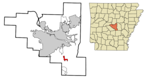
mapsize = 250px
map_caption = Location in Pulaski County and the state ofArkansas
mapsize1 =
map_caption1 =
subdivision_type = Country
subdivision_type1 = State
subdivision_type2 = County
subdivision_name =United States
subdivision_name1 =Arkansas
subdivision_name2 = Pulaski
government_type =
leader_title =
leader_name =
established_date =
area_magnitude =
area_total_km2 = 5.3
area_total_sq_mi = 2
area_land_km2 = 5.3
area_land_sq_mi = 2
area_water_km2 = 0
area_water_sq_mi = 0
elevation_ft = 256
elevation_m = 78
population_as_of = 2000
population_footnotes =
population_total = 1368
population_metro =
population_density_km2 = 258.1
population_density_sq_mi = 684
timezone = Central (CST)
utc_offset = -6
latd = 34 |latm = 36 |lats = 38 |latNS = N
longd = 92 |longm = 13 |longs = 2 |longEW = W
timezone_DST = CDT
utc_offset_DST = -5
postal_code_type =ZIP code
postal_code = 72183
area_code = 501
blank_name = FIPS code
blank_info = 05-76970
blank1_name = GNIS feature ID
blank1_info = 0056563
footnotes =
website =Wrightsville is a city in Pulaski County,
Arkansas ,United States . Its population was 1,368 at the 2000 census. It is part of the Little Rock–North Little Rock–Conway Metropolitan Statistical Area.Geography
Wrightsville is located at coor dms|34|36|38|N|92|13|2|W|city (34.610434, -92.217113)GR|1.
According to the
United States Census Bureau , the city has a total area of 2.1square mile s (5.3km² ), of which, 2.0 square miles (5.3 km²) of it is land and 0.49% is water.Economy
Since 1981, Wrightsville has been home to the Arkansas Department of Corrections Wrightsville Unit, which focuses on educational and rehabilitative services, aiding in workforce preparation, substance abuse recovery, and other aspects of re-entry into society for as many as 850 male and female inmates. A 212-inmate capacity boot camp program is also administered at the site for first-time non-violent inmates, along with a 50-inmate capacity female work release program, operated by the ADC since 1990. The Wrightsville Unit is a major employer in the community, with a staff of 169 employees in various fields.
Wrightsville also serves as the city of license for at least one Little Rock area radio station,
KLAL-FM .Demographics
As of the
census GR|2 of 2000, there were 1,368 people, 262 households, and 193 families residing in the city. Thepopulation density was 667.6 people per square mile (257.7/km²). There were 291 housing units at an average density of 142.0/sq mi (54.8/km²). The racial makeup of the city was 24.12% White, 74.56% Black or African American, 0.07% Native American, 0.29% Asian, 0.29% from other races, and 0.66% from two or more races. 0.29% of the population were Hispanic or Latino of any race.There were 262 households out of which 32.4% had children under the age of 18 living with them, 42.4% were married couples living together, 24.8% had a female householder with no husband present, and 26.3% were non-families. 23.7% of all households were made up of individuals and 8.0% had someone living alone who was 65 years of age or older. The average household size was 2.86 and the average family size was 3.37.
In the city the population was spread out with 16.5% under the age of 18, 13.7% from 18 to 24, 44.0% from 25 to 44, 18.6% from 45 to 64, and 7.1% who were 65 years of age or older. The median age was 34 years. For every 100 females there were 250.8 males. For every 100 females age 18 and over, there were 299.3 males.
The median income for a household in the city was $28,036, and the median income for a family was $32,500. Males had a median income of $26,563 versus $20,000 for females. The
per capita income for the city was $9,518. About 21.5% of families and 22.6% of the population were below thepoverty line , including 27.4% of those under age 18 and 28.0% of those age 65 or over.References
External links
Wikimedia Foundation. 2010.