- Oasby
-
Coordinates: 52°56′34″N 0°30′31″W / 52.942890°N 0.508484°W
Oasby 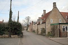
Back Lane, Oasby
 Oasby
Oasby
Oasby shown within LincolnshireOS grid reference TF003394 Parish Heydour District South Kesteven Shire county Lincolnshire Region East Midlands Country England Sovereign state United Kingdom Postcode district NG32 3 Police Lincolnshire Fire Lincolnshire Ambulance East Midlands EU Parliament East Midlands UK Parliament Grantham and Stamford List of places: UK • England • Lincolnshire Oasby is a hamlet in the civil parish of Heydour, South Kesteven, Lincolnshire, England. It lies 7 miles (11 km) north-east of Grantham.
Oasby, Heydour, Aisby, Culverthorpe and Kelby are the five hamlets within Heydour parish.
Oasby Manor House is a grade II* listed building dating from the 17th century with reused 15th century stonework and 19th century alterations. There is a 15th century Oriel window on the first floor.[1]
Manor House Farm is a 17th century single story grade II listed farmhouse.[2]
Oasby
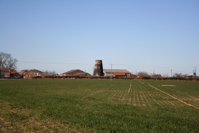
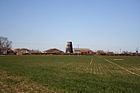 Oasby mill
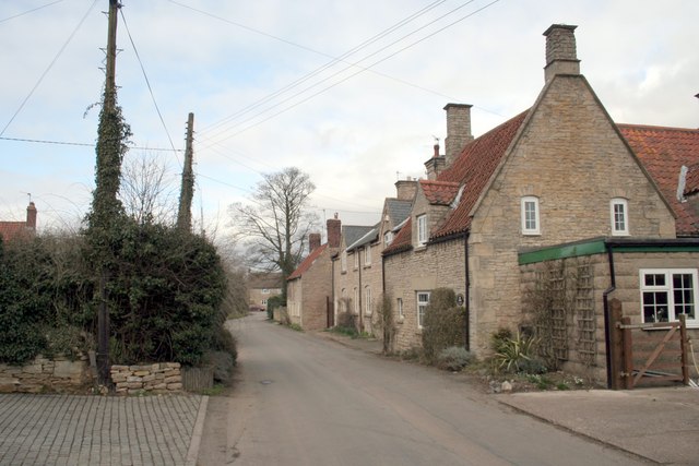
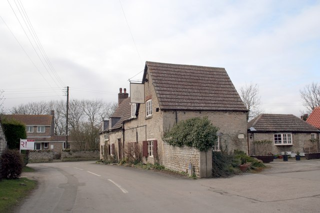
 Houblon Arms
Oasby Mill - tower windmill built about 1810 of black bitumen painted ashlar. It is grade II listed, and all machinery has been removed.[3]
The village pub, the Houblon Arms, is named after Sir John Houblon, the first governor of the Bank of England.[citation needed] It was built around 1700 and is grade II listed.[4]
The parish holds community events, usually in Aisby village hall, with a book club, art club, cricket club, annual art exhibition and January pantomime.[citation needed]
References
- ^ "Oasby Manor House". National Heritage List for England. English Heritage. http://list.english-heritage.org.uk/resultsingle.aspx?uid=1062391. Retrieved 2 August 2011.
- ^ "Oasby Manor Farmhouse". National Heritage List for England. English Heritage. http://list.english-heritage.org.uk/resultsingle.aspx?uid=1062393. Retrieved 2 August 2011.
- ^ "Oasby Mill". National Heritage List for England. English Heritage. http://list.english-heritage.org.uk/resultsingle.aspx?uid=1146543. Retrieved 2 August 2011.
- ^ "Houblon Arms". National Heritage List for England. English Heritage. http://list.english-heritage.org.uk/resultsingle.aspx?uid=1062390. Retrieved 2 August 2011.
Categories:- Lincolnshire geography stubs
- Villages in Lincolnshire
- South Kesteven

Wikimedia Foundation. 2010.