- Dingalan, Aurora
-
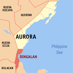
Dingalan — Municipality — Map of Aurora showing the location of Dingalan. Location in the Philippines
 Dingalan
Coordinates: 15°23′N 121°24′E / 15.383°N 121.4°ECoordinates: 15°23′N 121°24′E / 15.383°N 121.4°E Country  Philippines
Region Central Luzon (Region III) Province Aurora District Lone District Founded Barangays 11 Government – Mayor ZENAIDA Q. PADIERNOS Area – Total 304.6 km2 (117.6 sq mi) Population (2007) – Total 21,992 – Density 72.2/km2 (187/sq mi) Time zone PST (UTC+8) ZIP code 3207 Income class 4th class Population Census of Dingalan Census Pop. Rate 1995 19,325 — 2000 20,157 0.91% 2007 21,992 1.21% Dingalan is a 4th class municipality in the province of Aurora, Philippines. According to the latest census, it has a population of 21,992 people in 4,115 households.
Dingalan has several caves, of which the Lamao Caves are the best known. The rough shoreline and very high waves of Dingalan makes it attractive to surfers.
Contents
Geography
Dingalan is situated approximately 183 kilometres northeast of Manila. It is bounded on the north by San Luis (in Aurora province), on the west by Gabaldon and General Tinio (Nueva Ecija) and Doña Remedios Trinidad (Bulacan), on the south by General Nakar (Quezon), and on the east by the Pacific Ocean.
It is a small town with one main cemented road with branching alleys. Further south of the town proper are the barangays of Aplaya,butas na bato,Matawe, Ibona,dikapanikian and Umiray. The premier barangay north of the town is Paltic. All of the barangays are located on the seashore, except for poblacion and two barangay located in the mountains. The whole town is mountainous due to the Sierra Madre Mountains. The Umiray River separates the town from Quezon Province.
Barangays
Dingalan is politically subdivided into 11 barangays.
- Aplaya
- Butas Na Bato
- Cabog (Matawe)
- Caragsacan
- Davildavilan
- Dikapanikian
- Ibona
- Paltic
- Poblacion
- Tanawan
- Umiray (Malamig)
History
Dingalan, formerly just a barrio, was created a municipal district within the municipality of Baler in 1956.[1] It was declared a town in 1962.
From November 30 to December 3, 2004, the town was wiped out by the tropical storms Violeta, Winnie, and Yoyong. The town benefited by relief efforts from foreign traders, some Christian groups, La Salle Greenhills, and the Philippine National Red Cross.
References
External links
- Dingalan
- Philippine Standard Geographic Code
- 1995 Philippine Census Information
- 2000 Philippine Census Information
- 2007 Philippine Census Information
Municipalities - Baler
- Casiguran
- Dilasag
- Dinalungan
- Dingalan
- Dipaculao
- Maria Aurora
- San Luis
Categories:- Municipalities of Aurora (province)

Wikimedia Foundation. 2010.