- Dilasag, Aurora
-
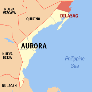
Dilasag — Municipality — Map of Aurora showing the location of Dilasag. Location in the Philippines
 Dilasag
Coordinates: 16°24′N 122°13′E / 16.4°N 122.217°ECoordinates: 16°24′N 122°13′E / 16.4°N 122.217°E Country  Philippines
Region Central Luzon (Region III) Province Aurora District Lone District Founded Barangays 11 Government – Mayor Victorio B. Briones Area – Total 306.25 km2 (118.2 sq mi) Population (2007) – Total 14,833 – Density 48.4/km2 (125.4/sq mi) Time zone PST (UTC+8) ZIP code 3205 Income class 3rd class Website http://www.dilasag-aurora.ph Population Census of Dilasag Census Pop. Rate 1995 12,825 — 2000 14,676 2.94% 2007 14,833 0.15% Dilasag is a 3rd class municipality in the province of Aurora, Philippines. According to the latest census, it has a population of 14,833 people in 3,011 households.
History
During World War II, The Japanese Imperial forces was did not occupied and entering the town municipality of Dilasag, Tayabas (now. Aurora). When the local military built of the general headquarters and camp base of the Commonwealth Army of the Philippines from 1942 to 1946 and the Philippine Constabulary from 1944 to 1946 and stationed in Dilasag.
Barangays
Dilasag is politically subdivided into 11 barangays.
- Diagyan
- Dicabasan
- Dilaguidi
- Dimaseset
- Diniog
- Lawang
- Maligaya (Pob.)
- Manggitahan
- Masagana (Pob.)
- Ura
- Esperanza
External links
- Dilasag
- Philippine Standard Geographic Code
- 1995 Philippine Census Information
- 2000 Philippine Census Information
- 2007 Philippine Census Information
Municipalities Categories:- Municipalities of Aurora (province)

Wikimedia Foundation. 2010.