- Mojave Ranch Estates, Arizona
-
Mojave Ranch Estates, Arizona — CDP — Location in Mohave County and the state of Arizona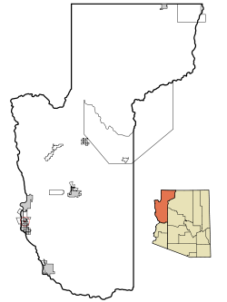
Coordinates: 34°56′59″N 114°35′37″W / 34.94972°N 114.59361°WCoordinates: 34°56′59″N 114°35′37″W / 34.94972°N 114.59361°W Country United States State Arizona County Mohave Area – Total 0.7 sq mi (1.8 km2) – Land 0.7 sq mi (1.9 km2) – Water 0.0 sq mi (0.0 km2) Elevation 473 ft (144 m) Population (2000) – Total 28 – Density 37.7/sq mi (14.6/km2) Time zone MST (UTC-7) FIPS code 04-47495 GNIS feature ID 1853163 Mojave Ranch Estates is a census-designated place (CDP) in Mohave County, Arizona, United States. The population was 28 at the 2000 census.
Geography
Mojave Ranch Estates is located at 34°56′59″N 114°35′37″W / 34.94972°N 114.59361°W (34.949652, -114.593489).[1]
According to the United States Census Bureau, the CDP has a total area of 0.7 square miles (1.8 km2), all of it land.
Demographics
As of the census[2] of 2000, there were 28 people, 6 households, and 6 families residing in the CDP. The population density was 37.7 people per square mile (14.6/km²). There were 6 housing units at an average density of 8.1/sq mi (3.1/km²). The racial makeup of the CDP was 46.43% White, 25.00% Native American, 14.29% from other races, and 14.29% from two or more races. 78.57% of the population were Hispanic or Latino of any race.
There were 6 households out of which 100.0% had children under the age of 18 living with them, 83.3% were married couples living together, and 16.7% had a female householder with no husband present. No households were made up of individuals and none had someone living alone who was 65 years of age or older. The average household size was 4.67 and the average family size was 4.67.
In the CDP the population was spread out with 42.9% under the age of 18, 10.7% from 18 to 24, 25.0% from 25 to 44, and 21.4% from 45 to 64. The median age was 22 years. For every 100 females there were 64.7 males. For every 100 females age 18 and over, there were 100.0 males.
The median income for a household in the CDP was $42,917, and the median income for a family was $42,917. Males had a median income of $11,786 versus $17,188 for females. The per capita income for the CDP was $8,359. None of the population and none of the families were below the poverty line.
References
- ^ "US Gazetteer files: 2010, 2000, and 1990". United States Census Bureau. 2011-02-12. http://www.census.gov/geo/www/gazetteer/gazette.html. Retrieved 2011-04-23.
- ^ "American FactFinder". United States Census Bureau. http://factfinder.census.gov. Retrieved 2008-01-31.
Municipalities and communities of Mohave County, Arizona Cities 
Town CDPs Arizona Village | Desert Hills | Dolan Springs | Fort Mohave | Golden Valley | Kaibab‡ | Mesquite Creek | Mohave Valley | Mojave Ranch Estates | New Kingman-Butler | Peach Springs | Willow Valley
Unincorporated
communitiesBeaver Dam | Chloride | Hackberry | Littlefield | Meadview | Nothing | Oatman | Scenic | Topock | Valentine | Walapai | White Hills | Wikieup | Yucca
Indian reservations Ghost towns Alamo Crossing | Aubrey Landing | Cedar | Cerbat | Mohave City | Santa Claus | Wolf Hole
Footnotes ‡This populated place also has portions in an adjacent county or counties
Categories:- Census-designated places in Mohave County, Arizona


Wikimedia Foundation. 2010.