- Bouse, Arizona
Infobox Settlement
official_name = Bouse, Arizona
settlement_type = CDP
image_caption =
imagesize =
image_caption =
imagesize =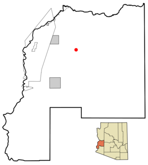
mapsize = 250px
map_caption = Location in La Paz County and the state ofArizona
mapsize1 =
map_caption1 =
subdivision_type = Country
subdivision_type1 = State
subdivision_type2 = County
subdivision_name =United States
subdivision_name1 =Arizona
subdivision_name2 = La Paz
established_title =
established_date =
government_type =
leader_title =
leader_name =
area_magnitude =
area_total_km2 = 26.1
area_total_sq_mi = 10.1
area_land_km2 = 26.1
area_land_sq_mi = 10.1
area_water_km2 = 0.0
area_water_sq_mi = 0.0
elevation_ft = 948
elevation_m = 289
population_as_of = 2000
population_footnotes =
population_total = 615
population_density_km2 = 23.6
population_density_sq_mi = 60.9
timezone = MST (nodaylight saving time )
utc_offset = -7
latd = 33 |latm = 56 |lats = 1 |latNS = N
longd = 114 |longm = 0 |longs = 30 |longEW = W
website =
timezone_DST =
utc_offset_DST =
postal_code_type =ZIP code
postal_code = 85325
area_code = 928
blank_name = FIPS code
blank_info = 04-07310
blank1_name = GNIS feature ID
blank1_info = 0001887
footnotes =Bouse is a
census-designated place (CDP) in La Paz County,Arizona ,United States . The population was 615 at the 2000 census.Geography
Bouse is located at coor dms|33|56|1|N|114|0|30|W|city (33.933657, -114.008268)GR|1.
According to the
United States Census Bureau , the CDP has a total area of 10.1square mile s (26.1km² ), all of it land.Bouse (Rhymes with "House") is the former site of a US Army tank training camp. Although the buildings are gone, a few foundations remain, as do some of the tank tracks from WWII.fact|date=August 2008
Demographics
As of the
census GR|2 of 2000, there were 615 people, 320 households, and 207 families residing in the CDP. Thepopulation density was 60.9 people per square mile (23.5/km²). There were 562 housing units at an average density of 55.7/sq mi (21.5/km²). The racial makeup of the CDP was 95.61% White, 0.33% Black or African American, 1.30% Native American, 0.16% Asian, 0.33% Pacific Islander, 0.81% from other races, and 1.46% from two or more races. Hispanic or Latino of any race were 4.55% of the population.There were 320 households out of which 6.9% had children under the age of 18 living with them, 57.5% were married couples living together, 5.0% had a female householder with no husband present, and 35.3% were non-families. 30.3% of all households were made up of individuals and 22.2% had someone living alone who was 65 years of age or older. The average household size was 1.92 and the average family size was 2.33.
In the CDP the population was spread out with 9.8% under the age of 18, 1.1% from 18 to 24, 8.5% from 25 to 44, 29.3% from 45 to 64, and 51.4% who were 65 years of age or older. The median age was 65 years. For every 100 females there were 97.1 males. For every 100 females age 18 and over, there were 96.1 males.
The median income for a household in the CDP was $19,479, and the median income for a family was $27,935. Males had a median income of $36,250 versus $20,536 for females. The
per capita income for the CDP was $13,623. About 9.9% of families and 21.0% of the population were below thepoverty line , including 47.4% of those under age 18 and 12.3% of those age 65 or over.References
External links
Wikimedia Foundation. 2010.