- Swift Trail Junction, Arizona
Infobox Settlement
official_name = Swift Trail Junction, Arizona
settlement_type = CDP
image_caption =
imagesize =
image_caption =
imagesize =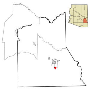
mapsize = 250px
map_caption = Location in Graham County and the state ofArizona
mapsize1 =
map_caption1 =
subdivision_type = Country
subdivision_type1 = State
subdivision_type2 = County
subdivision_name =United States
subdivision_name1 =Arizona
subdivision_name2 = Graham
established_title =
established_date =
government_type =
leader_title =
leader_name =
area_magnitude =
area_total_km2 = 12.3
area_total_sq_mi = 4.7
area_land_km2 = 12.2
area_land_sq_mi = 12.26
area_water_km2 = 0.1
area_water_sq_mi = 0.04
elevation_ft = 3232
elevation_m = 985
population_as_of = 2000
population_footnotes =
population_total = 2195
population_density_km2 = 178.5
population_density_sq_mi = 467.0
timezone = MST (no DST)
utc_offset = -7
latd = 32 |latm = 44 |lats = 5 |latNS = N
longd = 109 |longm = 42 |longs = 54 |longEW = W
website =
timezone_DST =
utc_offset_DST =
postal_code_type =
postal_code =
area_code =
blank_name = FIPS code
blank_info = 04-71650
blank1_name = GNIS feature ID
blank1_info = 0024638
footnotes =Swift Trail Junction is a
census-designated place (CDP) in Graham County,Arizona ,United States . The population was 2,195 at the 2000 census. It is part of the Safford Micropolitan Statistical Area.Geography
Swift Trail Junction is located at coor dms|32|44|5|N|109|42|54|W|city (32.734604, -109.714970)GR|1 at the base of the
Pinaleno Mountains .According to the
United States Census Bureau , the CDP has a total area of 4.7square mile s (12.3km² ), of which, 4.7 square miles (12.2 km²) of it is land and 0.04 square miles (0.1 km²) of it (0.42%) is water.Demographics
As of the
census GR|2 of 2000, there were 2,195 people, 499 households, and 349 families residing in the CDP. Thepopulation density was 465.2 people per square mile (179.6/km²). There were 561 housing units at an average density of 118.9/sq mi (45.9/km²). The racial makeup of the CDP was 77.68% White, 5.79% Black or African American, 6.06% Native American, 2.19% Asian, 0.05% Pacific Islander, 7.24% from other races, and 1.00% from two or more races. 28.43% of the population were Hispanic or Latino of any race.There were 499 households out of which 33.9% had children under the age of 18 living with them, 56.9% were married couples living together, 8.8% had a female householder with no husband present, and 29.9% were non-families. 24.6% of all households were made up of individuals and 9.4% had someone living alone who was 65 years of age or older. The average household size was 2.56 and the average family size was 3.07.
In the CDP the population was spread out with 16.1% under the age of 18, 10.2% from 18 to 24, 43.6% from 25 to 44, 20.7% from 45 to 64, and 9.3% who were 65 years of age or older. The median age was 35 years. For every 100 females there were 236.1 males. For every 100 females age 18 and over, there were 285.4 males.
The median income for a household in the CDP was $28,393, and the median income for a family was $29,762. Males had a median income of $14,901 versus $18,750 for females. The
per capita income for the CDP was $11,731. About 10.4% of families and 13.8% of the population were below thepoverty line , including 7.4% of those under age 18 and 22.5% of those age 65 or over.References
External links
Wikimedia Foundation. 2010.