- Denning Township, Franklin County, Illinois
-
Denning Township — Township — Location in Franklin County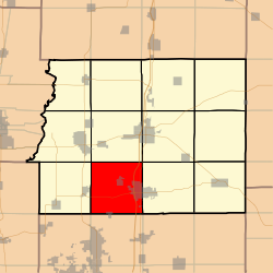 Franklin County's location in Illinois
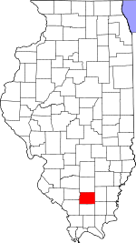
Coordinates: 37°54′29″N 88°59′03″W / 37.90806°N 88.98417°WCoordinates: 37°54′29″N 88°59′03″W / 37.90806°N 88.98417°W Country United States State Illinois County Franklin Established November 4, 1884 Area - Total 36.89 sq mi (95.54 km2) - Land 36.37 sq mi (94.2 km2) - Water 0.52 sq mi (1.34 km2) 1.4% Elevation 387 ft (118 m) Population (2000) - Total 4,910 - Density 135/sq mi (52.1/km2) Time zone CST (UTC-6) - Summer (DST) CDT (UTC-5) ZIP codes 62812, 62865, 62874, 62896 GNIS feature ID 0428888 Denning Township is one of twelve townships in Franklin County, Illinois, USA. As of the 2000 census, its population was 4,910[1].
Contents
Geography
According to the United States Census Bureau, Denning Township covers an area of 36.89 square miles (95.5 km2); of this, 0.52 square miles (1.3 km2) or 1.4 percent is water.
Cities, towns, villages
- Freeman Spur (north half)
- Orient
- West Frankfort (west half)
Unincorporated towns
- Cambon
- Lake Creek
- Pershing
- Plumfield
(This list is based on USGS data and may include former settlements.)
Cemeteries
The township contains these four cemeteries: Denning, Follis, Hanes and Rose.
Major highways
Lakes
- Beaver Lake
- Cambon Lake
School districts
- Frankfort Community Unit School District 168
- Herrin Community Unit School District 4
- Zeigler-Royalton Community Unit School District 188
Political districts
- Illinois' 12th congressional district
- State House District 117
- State Senate District 59
References
- "Denning Township, Franklin County, Illinois". Geographic Names Information System, U.S. Geological Survey. http://geonames.usgs.gov/pls/gnispublic/f?p=gnispq:3:::NO::P3_FID:0428888. Retrieved 2010-01-16.
- United States Census Bureau 2007 TIGER/Line Shapefiles
- United States National Atlas
External links

Tyrone Township Browning Township Benton Township Six Mile Township 
Frankfort Township  Denning Township

Municipalities and communities of Franklin County, Illinois County seat: Benton Cities Benton | Christopher | Orient | Sesser | West Frankfort | Zeigler

Villages Buckner | Ewing | Freeman Spur‡ | Hanaford | Macedonia‡ | North City | Royalton | Thompsonville | Valier | West City
Townships Unincorporated
communitiesAkin | Akin Junction | Benton Park | Bessie | Boothby | Cambon | Cleburne | Deering City | Diana | Ferber | Frisco | Groat | Hickory Corners | Kegley | Lake Creek | Meyer | Mitchell | Mulkeytown | New Bush | Parrish | Pershing | Plumfield | Rend City | Rust | Steel City | Urbain | Valier Patch | West End | Whittington
Categories:- Townships in Franklin County, Illinois


Wikimedia Foundation. 2010.