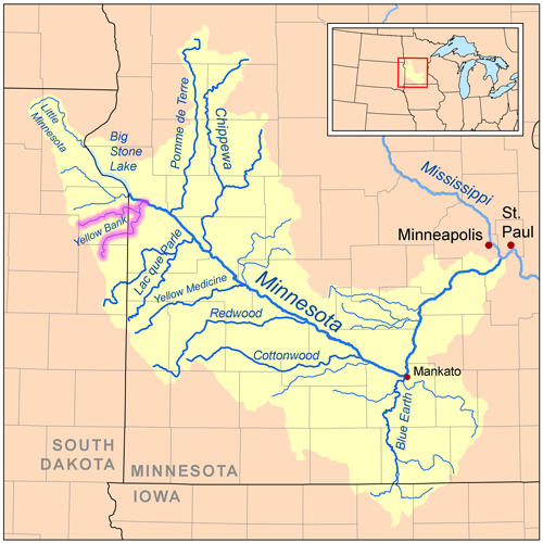
- Yellow Bank River
-
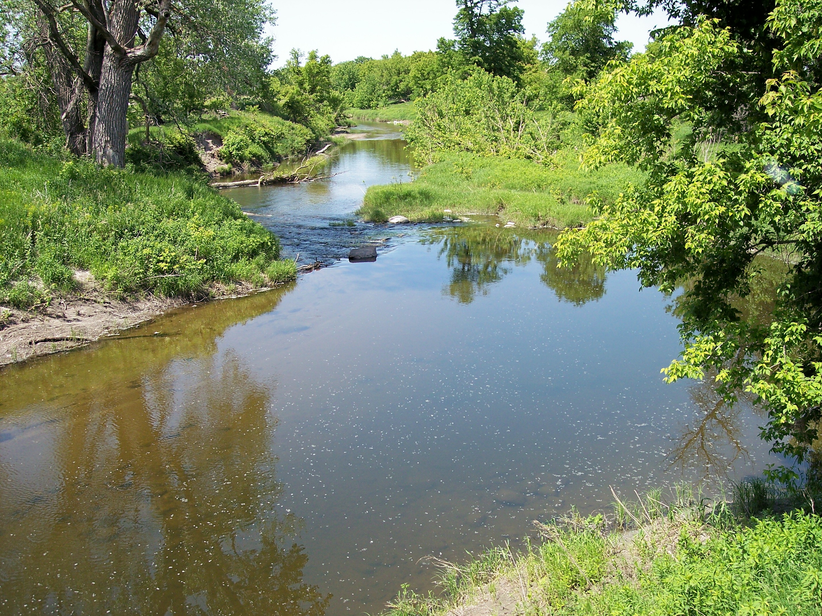
Yellow Bank River River 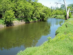 The Yellow Bank River in the Big Stone National Wildlife Refuge in 2007
Country United States States South Dakota, Minnesota Source North Fork Yellow Bank River - location Round Lake, Coteau des Prairies, Codington County, South Dakota - elevation 1,838 ft (560 m) [1] - coordinates 45°06′57″N 96°55′00″W / 45.11583°N 96.9166667°W [2] Secondary source South Fork Yellow Bank River - location Coteau des Prairies, Deuel County, South Dakota - elevation 1,849 ft (564 m) [1] - coordinates 44°58′17″N 96°48′09″W / 44.97139°N 96.8025°W [3] Source confluence - location Yellow Bank Township, Lac qui Parle County, Minnesota - elevation 991 ft (302 m) [1] - coordinates 45°10′47″N 96°21′29″W / 45.17972°N 96.35806°W [4] Mouth Minnesota River - location Agassiz Township, Lac qui Parle County, Minnesota - elevation 938 ft (286 m) [1] - coordinates 45°14′12″N 96°17′11″W / 45.23667°N 96.28639°W [4] Length 8.69 mi (14 km) [5] Basin 460 sq mi (1,191 km2) [6] Discharge for Agassiz Township - average 69.3 cu ft/s (2 m3/s) [6] - max 6,940 cu ft/s (197 m3/s) - min 0 cu ft/s (0 m3/s) 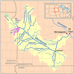
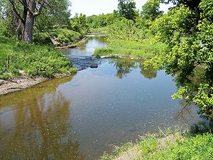 The Yellow Bank River in the Big Stone National Wildlife Refuge in 2007
The Yellow Bank River is a tributary of the Minnesota River, approximately nine miles (14 km) long, in western Minnesota in the United States. It is formed by the confluence of two longer streams, the North Fork Yellow Bank River and the South Fork Yellow Bank River, which also flow in northeastern South Dakota. Via the Minnesota River, the Yellow Bank River is part of the watershed of the Mississippi River, draining an area of approximately 460 square miles (1,190 km²) in an agricultural region.
The river was named for yellowish glacial drift in bluffs along the river. Its name was translated from the Sioux language as "Spirit Mountain Creek" by William Keating in his account of Stephen Harriman Long's expedition to the region in 1823. It was labelled as "Yellow Earth River" on an 1860 map of Minnesota.[7]
Contents
Geography
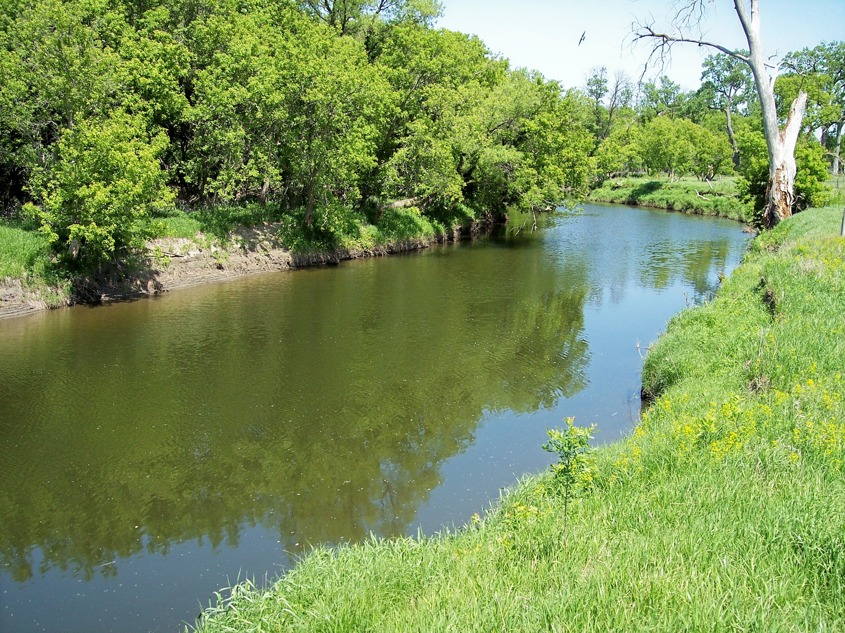
The river's north and south forks each rise in South Dakota on the Coteau des Prairies, a morainic plateau dividing the Mississippi and Missouri River watersheds, and flow across till plains[8] into Minnesota. The north fork issues from Round Lake near South Shore in northeastern Codington County, South Dakota, and flows eastwardly for approximately fifty miles (80 km) through central Grant County into northwestern Lac qui Parle County, Minnesota. The south fork rises in northwestern Deuel County, South Dakota, approximately six miles (10 km) southwest of Strandburg, and flows generally northeastwardly for approximately 55 miles (90 km) through southern Grant County and western Lac qui Parle County, passing near the community of Nassau, Minnesota. From the confluence of the forks in Yellow Bank Township, Minnesota, the Yellow Bank River flows northwardly for its short course, passing through the Big Stone National Wildlife Refuge, and entering the Minnesota River in Agassiz Township, approximately three miles (5 km) southeast of Odessa.[9] In the Big Stone refuge, the river flows among woodlands of American elm, ash, box elder, and silver maple, and may be fished.[10]
Flow rate
At the United States Geological Survey's stream gauge in Agassiz Township south of Odessa, 4.5 miles (7.2 km) upstream from the river's mouth, the annual mean flow of the river between 1940 and 2005 was 69.3 cubic feet per second (2 m³/s). The highest recorded flow during the period was 6,940 ft³/s (197 m³/s) on April 9, 1969. Readings of zero were recorded on numerous days during several years.[6]
See also
- List of rivers in Minnesota
- List of rivers in South Dakota
References
Notes
- ^ a b c d Google Earth.
- ^ Geographic Names Information System, North Fork Yellow Bank River.
- ^ Geographic Names Information System, South Fork Yellow Bank River.
- ^ a b Geographic Names Information System, Yellow Bank River.
- ^ National Assessment Database, Minnesota
- ^ a b c Mitton.
- ^ Upham.
- ^ Watersheds of the Minnesota River Basin.
- ^ Minnesota Atlas & Gazetteer, p. 36. South Dakota Atlas & Gazetteer, pp. 34-35.
- ^ Big Stone National Wildlife Refuge.
Sources
Books
- Minnesota Atlas & Gazetteer. Yarmouth, Me.: DeLorme. 1994. ISBN 0-89933-222-6.
- South Dakota Atlas & Gazetteer. Yarmouth, Me.: DeLorme. 2001. ISBN 0-89933-330-3.
Websites
- "Big Stone National Wildlife Refuge.". United States Fish and Wildlife Service. pp. Brochure. http://www.fws.gov/midwest/BigStone/. Retrieved 2007-06-16.
- "Geographic Names Information System entry for North Fork Yellow Bank River (Feature ID #648643)". Geographic Names Information System. http://geonames.usgs.gov/pls/gnispublic/f?p=gnispq:3:::NO::P3_FID:648643. Retrieved 2007-06-16.
- "Geographic Names Information System entry for South Fork Yellow Bank River (Feature ID #652306)". Geographic Names Information System. http://geonames.usgs.gov/pls/gnispublic/f?p=gnispq:3:::NO::P3_FID:652306. Retrieved 2007-06-16.
- "Geographic Names Information System entry for Yellow Bank River (Feature ID #654414)". Geographic Names Information System. http://geonames.usgs.gov/pls/gnispublic/f?p=gnispq:3:::NO::P3_FID:654414. Retrieved 2007-06-16.
- Mitton, G. B.; K. G. Guttormson, G. W. Stratton, E. S. Wakeman. "Water Resources Data in Minnesota, Water Year 2005 Annual Report.". United States Geological Survey. pp. Yellow Bank River near Odessa, MN. http://pubs.usgs.gov/wdr/2005/wdr-mn-05-1/. Retrieved 2007-06-16.
- "National Assessment Database: Assessment Data for the State of Minnesota Year 2004.". United States Environmental Protection Agency. pp. Upper Minnesota Watershed. http://iaspub.epa.gov/waters/w305b_report_control.get_report?p_state=MN. Retrieved 2007-06-16.[dead link]
- "National Assessment Database: Assessment Data for the State of South Dakota Year 2004.". United States Environmental Protection Agency. pp. Upper Minnesota Watershed. http://iaspub.epa.gov/waters/w305b_report_control.get_report?p_state=SD. Retrieved 2007-06-16.[dead link]
- Upham, Warren. "Minnesota Place Names: A Geographical Encyclopedia.". Minnesota Historical Society. pp. Lac qui Parle County: Yellow Bank Township. http://mnplaces.mnhs.org/upham/index.cfm. Retrieved 2007-06-19.
- "Watersheds of the Minnesota River Basin.". Minnesota Pollution Control Agency. 2005-12-01. pp. Minnesota River Basin: Upper Minnesota River Watershed. http://www.pca.state.mn.us/water/basins/mnriver/watersheds.html. Retrieved 2007-06-16.
Software
- Google Earth elevations for Geographic Names Information System coordinates. Retrieved on 2007-06-15.
Categories:- Rivers of Minnesota
- Rivers of South Dakota
- Tributaries of the Minnesota River
- Geography of Grant County, South Dakota
- Geography of Lac qui Parle County, Minnesota
- Geography of Codington County, South Dakota
Wikimedia Foundation. 2010.