- Mount Pluto, California
-
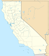
Mount Pluto Location in Placer County, California Elevation 8,617 ft (2,626 m) NGVD 29[1] Prominence 1,457 ft (444 m) [1] Location Location Placer County, California Range Sierra Nevada Coordinates 39°14′30″N 120°08′23″W / 39.2415733°N 120.1396385°WCoordinates: 39°14′30″N 120°08′23″W / 39.2415733°N 120.1396385°W[2] Topo map USGS Tahoe City Geology Last eruption 2 million years ago Mount Pluto is an extinct volcano in the Granite Chief Range near Lake Tahoe, California. The volcano erupted approximately 2 million years ago producing lava and mudflows that dammed Lake Tahoe.[3] The Northstar at Tahoe ski resort covers part of the 8,617 ft (2,626 m) high peak.
References
- ^ a b "Mount Pluto, California". Peakbagger.com. http://www.peakbagger.com/peak.aspx?pid=2560.
- ^ "Mount Pluto". Geographic Names Information System, U.S. Geological Survey. http://geonames.usgs.gov/pls/gnispublic/f?p=gnispq:3:::NO::P3_FID:230831.
- ^ "Frequently Asked Questions about Lake Tahoe and the Basin". Lake Tahoe Basin Management Unit, U.S. Forest Service. http://www.fs.usda.gov/wps/portal/fsinternet/!ut/p/c5/04_SB8K8xLLM9MSSzPy8xBz9CP0os3gjAwhwtDDw9_AI8_MONYSKAOUjMeXDfAxg8vh1h4Psw68fJG-AAzga6Pt55Oem6hfkRhhkmTgqAgA4l8Ee/dl3/d3/L2dJQSEvUUt3QS9ZQnZ3LzZfMjAwMDAwMDBBODBPSEhWTjBNMDAwMDAwMDA!/?ss=110519&navtype=BROWSEBYSUBJECT&cid=FSE_003834&navid=170150000000000&pnavid=170000000000000&ttype=main&pname=Lake%20Tahoe%20Basin%20Mgt%20Unit%20-%20About%20the%20Area. Retrieved 20 June 2007.
Categories:- Volcanoes of California
- Extinct volcanoes
- Landforms of Placer County, California
- Pliocene volcanism
- Sacramento Valley geography stubs
Wikimedia Foundation. 2010.

