- Manokotak, Alaska
-
Manokotak
Manuquutaq— City — Location in Alaska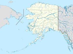
 Manokotak
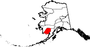
Coordinates: 58°58′52″N 159°3′21″W / 58.98111°N 159.05583°W Country United States State Alaska Census Area Dillingham Area - Total 37.3 sq mi (96.5 km2) - Land 36.4 sq mi (94.2 km2) - Water 0.9 sq mi (2.3 km2) Elevation 16 ft (5 m) Population (2007)[1] - Total 405 - Density 11.0/sq mi (4.2/km2) Time zone Alaska (AKST) (UTC-9) - Summer (DST) AKDT (UTC-8) Area code 907 FIPS code 02-46890 Manokotak (Manuquutaq in Central Alaskan Yup'ik) is a city in Dillingham Census Area, Alaska, United States. At the 2000 census the population was 399.
Geography
Manokotak is located at 58°58′52″N 159°3′21″W / 58.98111°N 159.05583°W (58.981087, -159.055808)[2].
According to the United States Census Bureau, the city has a total area of 37.3 square miles (97 km2), of which, 36.4 square miles (94 km2) of it is land and 0.9 square miles (2.3 km2) of it (2.42%) is water.
Demographics
As of the census[3] of 2000, there were 399 people, 93 households, and 77 families residing in the city. The population density was 11.0 people per square mile (4.2/km²). There were 106 housing units at an average density of 2.9 per square mile (1.1/km²). The racial makeup of the city was 4.76% White, 0.25% Black or African American, 94.74% Native American, and 0.25% from two or more races.
There were 93 households out of which 55.9% had children under the age of 18 living with them, 67.7% were married couples living together, 11.8% had a female householder with no husband present, and 17.2% were non-families. 15.1% of all households were made up of individuals and none had someone living alone who was 65 years of age or older. The average household size was 4.29 and the average family size was 4.92.
In the village the age distribution of the population shows 44.4% under the age of 18, 10.8% from 18 to 24, 24.8% from 25 to 44, 15.0% from 45 to 64, and 5.0% who were 65 years of age or older. The median age was 22 years. For every 100 females there were 116.8 males. For every 100 females age 18 and over, there were 133.7 males.
The median income for a household in the village was $26,875, and the median income for a family was $30,357. Males had a median income of $13,125 versus $0 for females. The per capita income for the city was $9,294. About 32.5% of families and 35.3% of the population were below the poverty line, including 44.0% of those under age 18 and none of those age 65 or over.
References
- ^ "Annual Estimates of the Population for Incorporated Places in Alaska". United States Census Bureau. 2008-07-10. http://www.census.gov/popest/cities/tables/SUB-EST2007-04-02.csv. Retrieved 2008-07-14.
- ^ "US Gazetteer files: 2010, 2000, and 1990". United States Census Bureau. 2011-02-12. http://www.census.gov/geo/www/gazetteer/gazette.html. Retrieved 2011-04-23.
- ^ "American FactFinder". United States Census Bureau. http://factfinder.census.gov. Retrieved 2008-01-31.
Coordinates: 58°58′52″N 159°03′21″W / 58.981087°N 159.055808°W
Municipalities and communities of Dillingham Census Area, Alaska Cities Aleknagik | Clark's Point | Dillingham | Ekwok | Manokotak | New Stuyahok | Togiak
CDPs Unincorporated
communitiesCategories:- Cities in Alaska
- Populated places in Dillingham Census Area, Alaska
- Populated places in Alaska with Native American majority populations


Wikimedia Foundation. 2010.