- Atka, Alaska
Infobox Settlement
official_name = Atka, Alaska
settlement_type =City
nickname =
motto =
imagesize =
image_caption =
image_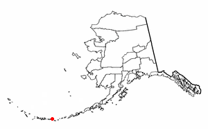
map_caption = Location of Atka, Alaska
mapsize = 250px
mapsize1 =
map_caption1 =subdivision_type = Country
subdivision_name =United States
subdivision_type1 = State
subdivision_name1 =Alaska
subdivision_type2 = Census Area
subdivision_name2 = Aleutians West
government_footnotes =
government_type =
leader_title =
leader_name =
leader_title1 =
leader_name1 =
established_title =
established_date =area_magnitude =
area_footnotes =
area_total_km2 = 93.7
area_land_km2 = 22.6
area_water_km2 = 71
area_total_sq_mi = 36.2
area_land_sq_mi = 8.7
area_water_sq_mi = 27.4population_as_of = 2007
population_footnotes =cite web|url=http://www.census.gov/popest/cities/tables/SUB-EST2007-04-02.csv|title=Annual Estimates of the Population for Incorporated Places in Alaska|publisher=United States Census Bureau |date=2008-07-10|accessdate=2008-07-14]
population_total = 75timezone = Hawaii-Aleutian (HST)
utc_offset = -10
timezone_DST = HDT
utc_offset_DST = -9
elevation_footnotes =
elevation_m = 18
elevation_ft = 59
latd = 52 |latm = 11 |lats = 57 |latNS = N
longd = 174 |longm = 12 |longs = 48 |longEW = Wpostal_code_type =
postal_code =
area_code = 907
GNIS_id = 1418170
blank_name = FIPS code
blank_info = 02-04210
blank1_name =
blank1_info =
website =
footnotes =Atka is a city located on the east side of
Atka Island , in Aleutians West Census Area,Alaska ,United States . The population was 92 at the 2000 census.The population of Atka is nearly entirely
Aleut (Unangan). The major industry is fishing.Geography
Atka is located at coor dms|52|11|57|N|174|12|48|W|city (52.199271, -174.213398)GR|1.
According to the
U.S. Census Bureau , the city has a total area of 36.2square mile s (93.7km² ), of which, 8.7 square miles (22.6 km²) of it is land and 27.4 square miles (71.0 km²) of it (75.81%) is water.Demographics
As of the
census GR|2 of 2000, there were 92 people, 32 households, and 20 families residing in the city. Thepopulation density was 10.5 people per square mile (4.1/km²). There were 41 housing units at an average density of 4.7/sq mi (1.8/km²). The racial makeup of the city was 80.43% Native American, 6.52% White, 1.09% Asian, 1.09% Pacific Islander, and 10.87% from two or more races. 1.09% of the population were Hispanic or Latino of any race.There were 32 households out of which 40.6% had children under the age of 18 living with them, 37.5% were married couples living together, 9.4% had a female householder with no husband present, and 34.4% were non-families. 28.1% of all households were made up of individuals and 9.4% had someone living alone who was 65 years of age or older. The average household size was 2.69 and the average family size was 3.33.
In the city the population was spread out with 30.4% under the age of 18, 7.6% from 18 to 24, 29.3% from 25 to 44, 23.9% from 45 to 64, and 8.7% who were 65 years of age or older. The median age was 36 years. For every 100 females there were 100.0 males. For every 100 females age 18 and over, there were 106.5 males.
The median income for a household in the city was $30,938, and the median income for a family was $34,375. Males had a median income of $28,750 versus $33,438 for females. The
per capita income for the city was $17,080. There were no families and 7.5% of the population living below thepoverty line , including no under eighteens and 26.7% of those over 64.Education
Atka is served by the
Aleutian Region Schools .The Yakov E. Netsvetov School serves grades K-12.
References
External links
Wikimedia Foundation. 2010.