- False Pass, Alaska
Infobox Settlement
official_name = False Pass, Alaska
settlement_type =City
nickname =
motto =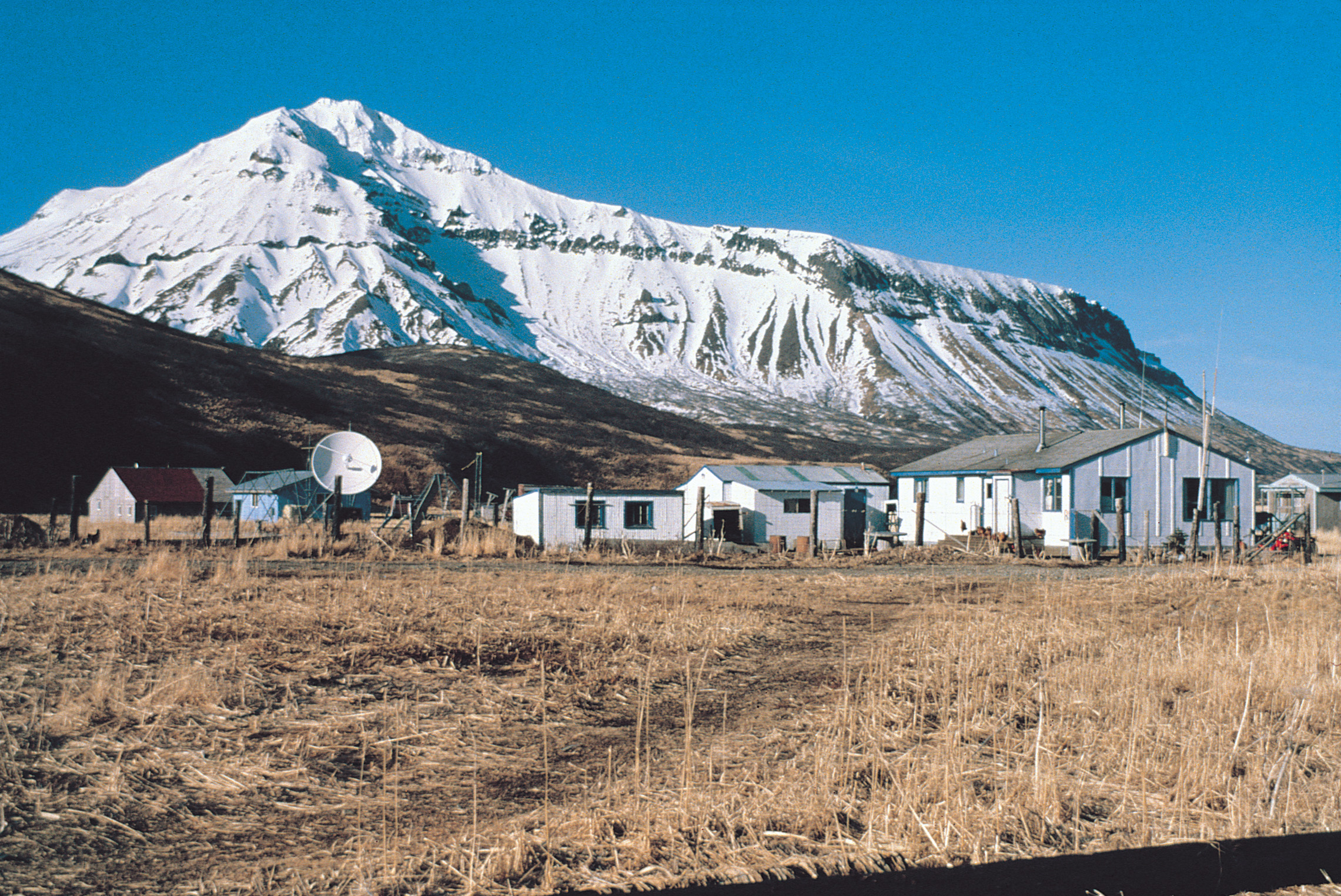
image_caption = False Pass looking north
imagesize = 250px
image_
map_caption = Location of False Pass, Alaska
mapsize = 250px
mapsize1 =
map_caption1 =subdivision_type = Country
subdivision_name =United States
subdivision_type1 = State
subdivision_name1 =Alaska
subdivision_type2 = Borough
subdivision_name2 = Aleutians East
government_footnotes =
government_type =
leader_title =
leader_name =
leader_title1 =
leader_name1 =
established_title =
established_date =area_magnitude =
area_footnotes =
area_total_km2 = 176.8
area_land_km2 = 69.6
area_water_km2 = 107.2
area_total_sq_mi = 68.3
area_land_sq_mi = 26.9
area_water_sq_mi = 41.4population_as_of = 2007
population_footnotes =cite web|url=http://www.census.gov/popest/cities/tables/SUB-EST2007-04-02.csv|title=Annual Estimates of the Population for Incorporated Places in Alaska|publisher=United States Census Bureau |date=2008-07-10|accessdate=2008-07-14]
population_total = 55timezone = Alaska (AKST)
utc_offset = -9
timezone_DST = AKDT
utc_offset_DST = -8
elevation_footnotes =
elevation_m = 9
elevation_ft = 30
latd = 54 |latm = 49 |lats = 40 |latNS = N
longd = 163 |longm = 23 |longs = 57 |longEW = Wpostal_code_type =
postal_code =
area_code = 907
GNIS_id = 1418574
blank_name = FIPS code
blank_info = 02-24660
blank1_name =
blank1_info =
website =
footnotes =False Pass (Isanax̂ [Bergsland, K "Aleut Dictionary" Fairbanks: Alaska Native Language Center, 1994] in Aleut) is a city in Aleutians East Borough,
Alaska ,United States . The population was 64 at the 2000 census.Geography
False Pass is located at coor dms|54|49|40|N|163|23|57|W|city (54.827886, -163.399090)GR|1. It is near the eastern end of
Unimak Island , in theAleutian Islands chain. Part of the city (26.093 km², or 10.075 sq mi) is actually on the westernmost tip of the mainlandAlaska Peninsula , across theIsanotski Strait (about 600 meters at the closest point), although that section is unpopulated.According to the
U.S. Census Bureau , the city has a total area of 68.3square mile s (176.8km² ), of which, 26.9 square miles (69.6 km²) of it is land and 41.4 square miles (107.2 km²) of it (60.63%) is water.Demographics
As of the
census GR|2 of 2000, there were 64 people, 22 households, and 13 families residing in the city. Thepopulation density was 2.4 people per square mile (0.9/km²). There were 40 housing units at an average density of 1.5/sq mi (0.6/km²). The racial makeup of the city was 26.56% White, 62.50% Native American, 1.56% from other races, and 9.38% from two or more races. 1.56% of the population were Hispanic or Latino of any race.There were 22 households out of which 31.8% had children under the age of 18 living with them, 22.7% were married couples living together, 18.2% had a female householder with no husband present, and 36.4% were non-families. 31.8% of all households were made up of individuals and 9.1% had someone living alone who was 65 years of age or older. The average household size was 2.91 and the average family size was 3.79.
In the city the population was spread out with 35.9% under the age of 18, 9.4% from 18 to 24, 18.8% from 25 to 44, 31.3% from 45 to 64, and 4.7% who were 65 years of age or older. The median age was 32 years. For every 100 females there were 100.0 males. For every 100 females age 18 and over, there were 115.8 males.
The median income for a household in the city was $49,375, and the median income for a family was $70,625. Males had a median income of $23,750 versus $37,083 for females. The
per capita income for the city was $21,465. There were 11.1% of families and 8.0% of the population living below thepoverty line , including no under eighteens and 50.0% of those over 64.References
External links
Wikimedia Foundation. 2010.