- Arley, Alabama
Infobox Settlement
official_name = Arley, Alabama
settlement_type =Town
imagesize =
image_caption =
image_
imagesize =
image_caption =
image_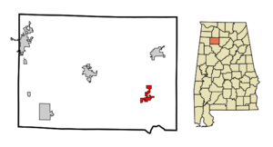
mapsize = 250px
map_caption = Location in Winston County and the state ofAlabama
mapsize1 =
map_caption1 =
subdivision_type = Country
subdivision_type1 = State
subdivision_type2 = County
subdivision_name =United States
subdivision_name1 =Alabama
subdivision_name2 = Winston
government_type =
leader_title =
leader_name =
established_date =
area_magnitude =
area_total_km2 = 7.2
area_total_sq_mi = 2.8
area_land_km2 = 7.2
area_land_sq_mi = 2.8
area_water_km2 = 0
area_water_sq_mi = 0
elevation_ft = 778
elevation_m = 237
population_as_of =2007
population_footnotes = cite web|url=http://www.census.gov/popest/cities/tables/SUB-EST2007-04-01.csv|title=Annual Estimates of the Population for Incorporated Places in Alabama|publisher=United States Census Bureau |date=2008-07-10|accessdate=2008-07-14]
population_total =320
population_metro =
population_density_km2 = 40.3
population_density_sq_mi = 103.6
timezone = Central (CST)
utc_offset = -6
latd = 34 |latm = 4 |lats = 53 |latNS = N
longd = 87 |longm = 12 |longs = 38 |longEW = W
timezone_DST = CDT
utc_offset_DST = -5
postal_code_type =ZIP code
postal_code = 35540-35541
area_code = 205, 256
blank_name = FIPS code
blank_info = 01-02500
blank1_name = GNIS feature ID
blank1_info = 0159081
footnotes =
website =Arley is a town in Winston County,
Alabama ,United States . At the 2000 census the population was 290. According to the 2005U.S. Census estimates, the town had a population of 321. [http://www.census.gov/popest/cities/files/SUB-EST2005-all.csv]Geography
Arley is located at coor dms|34|4|53|N|87|12|39|W|city (34.081499, -87.210768)GR|1.
According to the
U.S. Census Bureau , the town has a total area of 2.8square mile s (7.3km² ), all of it land.Demographics
As of the
census GR|2 of 2000, there were 290 people, 123 households, and 89 families residing in the town. Thepopulation density was 103.6 people per square mile (40.0/km²). There were 139 housing units at an average density of 49.7/sq mi (19.2/km²). The racial makeup of the town was 99.31% White, and 0.69% from two or more races. 1.38% of the population were Hispanic or Latino of any race.There were 123 households out of which 22.0% had children under the age of 18 living with them, 60.2% were married couples living together, 9.8% had a female householder with no husband present, and 27.6% were non-families. 26.0% of all households were made up of individuals and 13.8% had someone living alone who was 65 years of age or older. The average household size was 2.36 and the average family size was 2.82.
In the town the population was spread out with 17.9% under the age of 18, 9.7% from 18 to 24, 26.6% from 25 to 44, 27.2% from 45 to 64, and 18.6% who were 65 years of age or older. The median age was 41 years. For every 100 females there were 100.0 males. For every 100 females age 18 and over, there were 91.9 males.
The median income for a household in the town was $26,500, and the median income for a family was $31,000. Males had a median income of $25,750 versus $16,667 for females. The
per capita income for the town was $12,822. About 13.3% of families and 15.4% of the population were below thepoverty line , including 25.0% of those under age 18 and 22.6% of those age 65 or over.Education
Meek High School, home of the
Tiger s, is a member of theWinston County School System . In recent years the Meek High School "Band of Champions" has performed very well in competition and has produced outstanding individuals.References
External links
Wikimedia Foundation. 2010.