- Prichard, Alabama
Infobox Settlement
official_name = Prichard, Alabama
settlement_type =City
nickname = The City Of Champions", "The Crossroads of Mobile County
utc_offset_DST = -5
postal_code_type =ZIP code s
postal_code = 36610, 36617
area_code = 251
blank_name = FIPS code
blank_info = 01-62496
blank1_name = GNIS feature ID
blank1_info = 0125275
footnotes =
website = http://www.thecityofprichard.org
imagesize =
image_caption =
image_
mapsize = 250px
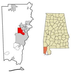
map_caption = Location in the State ofAlabama and theUnited States
mapsize1 =
map_caption1 =
subdivision_type = Country
subdivision_type1 = State
subdivision_type2 = County
subdivision_name =United States
subdivision_name1 =Alabama
subdivision_name2 = Mobile
established_title = Founded
established_date = 1925
government_type =
leader_title =Mayor
leader_name =Ron Davis (D)
area_magnitude = 0 E0
area_total_km2 = 66.0
area_land_km2 = 65.8
area_water_km2 = 0.2
area_total_sq_mi = 25.5
area_land_sq_mi = 25.4
area_water_sq_mi = 0.1
elevation_m = 9
elevation_ft = 30
latd = 30 |latm = 44 |lats = 53 |latNS = N
longd = 88 |longm = 6 |longs = 1 |longEW = W
population_as_of = 2005
population_footnotes = cite web | date =June 21 2006 | url = http://www.census.gov/popest/cities/tables/SUB-EST2006-04-01.csv | title = Annual Estimates of the Population for All Incorporated Places in Alabama | format = CSV | work = 2005 Population Estimates | publisher = U.S. Census Bureau, Population Division | accessmonthday = November 9 | accessyear = 2006]
population_total = 27963
population_density_km2 = 425.0
timezone = CST
utc_offset = -6
timezone_DST = CDTPrichard is a city in Mobile County,
Alabama , in theUnited States .Prichard borders the northside of Mobile, as well as the Mobile suburbs of
Chickasaw, Alabama ,Saraland, Alabama , and the unincorporated sections ofEight Mile, Alabama . As of 2005 Census Bureau estimates, the population of the city was 27,963. It is a part of the Mobilemetropolitan statistical area .History
Prichard began as a settlement in the 1830s bordering Telegraph Road (known now as
U.S. Highway 43 ) It remained largely unsettled until the Clotilde landed inMobile Bay prior to the Civil War.Africatown evolved into a greater part of the Plateau/Magazine area which developed along Telegraph Road, and eventually, Plateau and Magazine had their territory split between Mobile and Prichard.After 1900, Prichard began a slow and steady development. In 1925, Prichard was incorporated as a city during
World War II Prichard became a company town as many Mobile shipbuilding companies built homes for their workers in Prichard. During the 1950s and 60's, Prichard annexed historic Whistler as well as parts ofEight Mile, Alabama andKushla . The 40's and 50's saw phenomenal growth in the Mobile area, and Mobile, Prichard and Chickasaw all recorded their highest city proper populations in 1960. Following theCivil Rights Movement however, Prichard's rigid system of segregation collapsed, and many blacks who had previously lived in the Bullshead/Neely/Trinity Gardens area of Prichard began moving into East Prichard (downtown Prichard) causing a dramatic white flight to occur.In 1960, Prichard recorded a population of 47,371. In 1970, the population had decreased to 41,000 and by 1990 it had decreased to approximately 34,000.In 1970,
Vigor High School on Wilson Avenue, which had been Prichard's white high school during segregation was 70% white, by 1980, it was 80% black, even considering the fact that most of Prichard's remaining white areas were in its district. In 1994, construction of I-165 was completed, and it has produced some economic benefits in East Prichard. The 1980s downtown vacancy rate was near 80%, as of 2000, it was closer to 30%. In 2004, the Prichard Housing Authority began demolition of the Bessemer Avenue Housing Project in Bullshead.In December 2006, the city of Prichard was selected as the site of the future Alabama Motorsports Park, a Dale Earnhardt Jr. Speedway and theme park. This complex of racetracks and entertainment venues will be constructed on nearly convert|3000|acre|km2 of land near the intersection of Industrial Parkway (Alabama State Route 158) and US Highway 45 in the northern section of Prichard. [cite news|title=Racetrack site: Questions surround environmental survey, but developers say they are minimizing damage |source=Press Register (Mobile) |date= 2007-06-13 |accessdate= 2007-07-28 |last=Finch |first=Bill ]
Recent Political History
In 1972, while still a majority white city, Prichard elected its first black Mayor, Algernon Johnson (A.J) Cooper, who would serve 2 terms as Prichard's mayor, and would eventually serve in the administration of President
Bill Clinton . In 1968, Cooper had founded the Black American Law Students Association at New York University. Mayor Cooper was popular with both blacks and whites, however, he engaged in many battles with the Prichard City Council during his tenure.In the 80's and 90's problems with crime, drugs and middle class flight were elevated when the areas major financial and employment base left with the closing of Scott and International Paper companies and Brookley Field Air Base. This devastated the area and the city struggled to recover. In 1999, the city was forced to declare bankruptcy. Fact|date=July 2007
In November 2004, Mobile County voters narrowly (500 votes out of 100000 cast on the issue) defeated a local amendment which would have allowed Prichard to set up a special trade zone, the measure passed by a 2/3s vote in Prichard, and also passed by smaller margins in Mobile and Chickasaw, but was defeated by the rest of Mobile County.
City Government
The current
mayor of Prichard is Ron Davis. Davis was elected mayor in the 2004municipal elections, defeatingincumbent mayor Charles Harden.The city is served by a five-member
city council , which is composed of five districts of equal size. The city council is responsible for establishing the policies of the city of Prichard. The current council president is Troy Ephriam. The Prichard City Council meets every Thursday at 4:30 pm in the Council Chambers at Prichard City Hall.Geography
Prichard is located at coor dms|30|44|53|N|88|6|1|W|city (30.748038, -88.100384)GR|1.
According to the
U.S. Census Bureau , the city has a total area of 25.5 square miles (66.0 km²), of which, 25.4 square miles (65.8 km²) of it is land and 0.1 square miles (0.2 km²) of it (0.31%) is water.Demographics
USCensusPop
1930=4580
1940=6084
1950=19014
1960=47371
1970=41578
1980=39541
1990=34311
2000=28633
estyear=2007
estimate=27791As of thecensus GR|2 of 2000, there were 28,633 people, 9,841 households, and 7,272 families residing in the city. Thepopulation density was 1,127.6 people per square mile (435.4/km²). There were 11,336 housing units at an average density of 446.4/sq mi (172.4/km²). The racial makeup of the city was 84.53% Black or African American, 14.18% White, 0.30% Native American, 0.12% Asian, 0.02% Pacific Islander, 0.07% from other races, and 0.79% from two or more races. 0.57% of the population were Hispanic or Latino of any race.There were 9,841 households out of which 36.3% had children under the age of 18 living with them, 32.8% were married couples living together, 36.0% had a female householder with no husband present, and 26.1% were non-families. 23.4% of all households were made up of individuals and 9.0% had someone living alone who was 65 years of age or older. The average household size was 2.84 and the average family size was 3.35.
In the city the population was spread out with 31.4% under the age of 18, 11.4% from 18 to 24, 24.6% from 25 to 44, 21.0% from 45 to 64, and 11.5% who were 65 years of age or older. The median age was 32 years. For every 100 females there were 84.1 males. For every 100 females age 18 and over, there were 76.8 males.
The median income for a household in the city was $19,544, and the median income for a family was $23,519. Males had a median income of $26,543 versus $17,040 for females. The
per capita income for the city was $10,626. About 31.8% of families and 35.5% of the population were below thepoverty line , including 47.8% of those under age 18 and 25.8% of those age 65 or over.Education
The
Mobile County Public School System serves Prichard. High schools include Blount and Vigor. TheUniversity of Mobile is also located within the city.References
* [http://www.census.gov/population/www/estimates/metro_general/2006/List3.xls information on metropolitan statistical areas and Mobile MSA]External links
* [http://www.thecityofprichard.org/ City Of Prichard Online]
* [http://www.prichardpubliclibrary.org/ Prichard Public Library]
* [http://www.alabamamotorsportspark.com/ Alabama Motorsports Park]

Wikimedia Foundation. 2010.