- Rogersville, Alabama
Infobox Settlement
official_name = Rogersville, Alabama
settlement_type =Town
imagesize =
image_caption =
image_
imagesize =
image_caption =
image_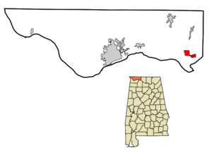
mapsize = 250px
map_caption = Location in Lauderdale County and the state ofAlabama
mapsize1 =
map_caption1 =
subdivision_type = Country
subdivision_type1 = State
subdivision_type2 = County
subdivision_name =United States
subdivision_name1 =Alabama
subdivision_name2 = Lauderdale
government_type =
leader_title =
leader_name =
established_date =
area_magnitude =
area_total_km2 = 8
area_total_sq_mi = 3.1
area_land_km2 = 8
area_land_sq_mi = 3.1
area_water_km2 = 0
area_water_sq_mi = 0
elevation_ft = 640
elevation_m = 195
population_as_of = 2000
population_footnotes =
population_total = 1199
population_metro =
population_density_km2 = 149.9
population_density_sq_mi = 386.8
timezone = Central (CST)
utc_offset = -6
latd = 34 |latm = 49 |lats = 24 |latNS = N
longd = 87 |longm = 17 |longs = 8 |longEW = W
timezone_DST = CDT
utc_offset_DST = -5
postal_code_type =ZIP code
postal_code = 35652
area_code = 256
blank_name = FIPS code
blank_info = 01-66216
blank1_name = GNIS feature ID
blank1_info = 0153210
footnotes =
website =Rogersville is a town in Lauderdale County,
Alabama ,United States . It is part of the Florence - Muscle ShoalsMetropolitan Statistical Area known as "The Shoals ". As of the 2000 census, the population of the town is 1,199.Geography
Rogersville is located at coor dms|34|49|24|N|87|17|8|W|city (34.823444, -87.285693)GR|1.
According to the
U.S. Census Bureau , the town has a total area of 3.1square mile s (8.0km² ), all of it land.Demographics
As of the
census GR|2 of 2000, there were 1,199 people, 536 households, and 361 families residing in the town. Thepopulation density was 389.6 people per square mile (150.3/km²). There were 604 housing units at an average density of 196.3/sq mi (75.7/km²). The racial makeup of the town was 93.08% White, 5.67% Black or African American, 0.17% Native American, 0.42% Asian, 0.08% from other races, and 0.58% from two or more races. 0.42% of the population were Hispanic or Latino of any race.There were 536 households out of which 26.1% had children under the age of 18 living with them, 51.1% were married couples living together, 12.9% had a female householder with no husband present, and 32.5% were non-families. 31.2% of all households were made up of individuals and 19.0% had someone living alone who was 65 years of age or older. The average household size was 2.24 and the average family size was 2.79.
In the town the population was spread out with 22.2% under the age of 18, 7.3% from 18 to 24, 24.7% from 25 to 44, 24.4% from 45 to 64, and 21.4% who were 65 years of age or older. The median age was 42 years. For every 100 females there were 83.6 males. For every 100 females age 18 and over, there were 79.8 males.
The median income for a household in the town was $29,779, and the median income for a family was $37,639. Males had a median income of $30,852 versus $18,571 for females. The
per capita income for the town was $16,435. About 10.2% of families and 14.3% of the population were below thepoverty line , including 19.2% of those under age 18 and 15.7% of those age 65 or over.References
External links
* [http://immersiveimagingsolutions.com/rogersville.html Virtual Tour of Rogersville]
* [http://www.rogersvillelibrary.org/ Rogersville Public Library]
* [http://www.joewheelerstatepark.com/ Joe Wheeler State Park, Rogersville, AL]
Wikimedia Foundation. 2010.