- Navarrete, La Rioja
-
Navarrete 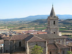
SealLocation within La Rioja.
Coordinates: 42°26′N 2°33′W / 42.433°N 2.55°W Country Spain Autonomous community La Rioja Comarca Rioja Media Government - Mayor Miguel Santo Domingo Victoriano (PSOE) Area - Total 28.49 km2 (11 sq mi) Elevation 512 m (1,680 ft) Population (2006) - Total 2,660 - Density 93.37/km2 (241.8/sq mi) Time zone CET (UTC+1) - Summer (DST) CET (UTC+2) Website http://www.ayuntamientonavarrete.org 11 km to Logroño Navarrete is a municipality of the autonomous community of La Rioja, Spain, with a population of 2,660 (as of January 2006) and an area of 28.49 km2. Named a conjunto histórico of Spain, Navarrete is located between Logroño and Nájera on the Way of St. James, a medieval pilgrim route.
Contents
Economy
Rioja wine is very important to Navarrete's economy. There are still some old potteries in the upper part of the town, although the industry has relocated to the lower part of town, next to the communication routes.
Geography
The historic centre of the town is built on a hill called Tedeón (512 m), from which the town has since expanded. The municipality borders Fuenmayor to the north, Logroño and Lardero to the east, Entrena, Medrano, Hornos de Moncalvillo, and Sotés to the south, and Huércanos and Cenicero to the west.
History
The origin of the name Navarrete is uncertain. Navarrete was founded by the King of Castile as part of a plan to defend his borders and the name appears to have some relation to the neighbouring Kingdom of Navarre. One theory notes that the word "Nafarrate" in Basque means "Door of Navarre"; the later castellanization of the name would give rise to the present spelling.
Alfonso VIII of Castile proposed to the inhabitants of the old villages of the zone that they relocate in a defensive place. These villages were known by the name of Corcuetos and their names were: San Llorente, San Antolín, San Pedro and Nuestra Señora del Prado. Their population settled around a castle raised on Tedeón hill, thus founding the new villa of Navarrete. The castle was fortified and protected with a small wall, that enclosed the settlement and it defended it from the possible attacks that threatened from the north.
In 1192 important fueros were granted to the inhabitants of the new settlement. These fueros, or charter, gave rise to the use in common of river waters and the collective exploitation of grass lands and woods to the east of the town. The charter also allowed for the establishment of local markets and fairs. Thanks to these privileges, the villa reached a great importance.
In 1367 a battle took place in the locality which is sometimes called the Battle of Navarrete, but is better known as the Battle of Nájera.
Places of interest
The historic centre is protected as a Conjunto histórico.
Buildings and monuments
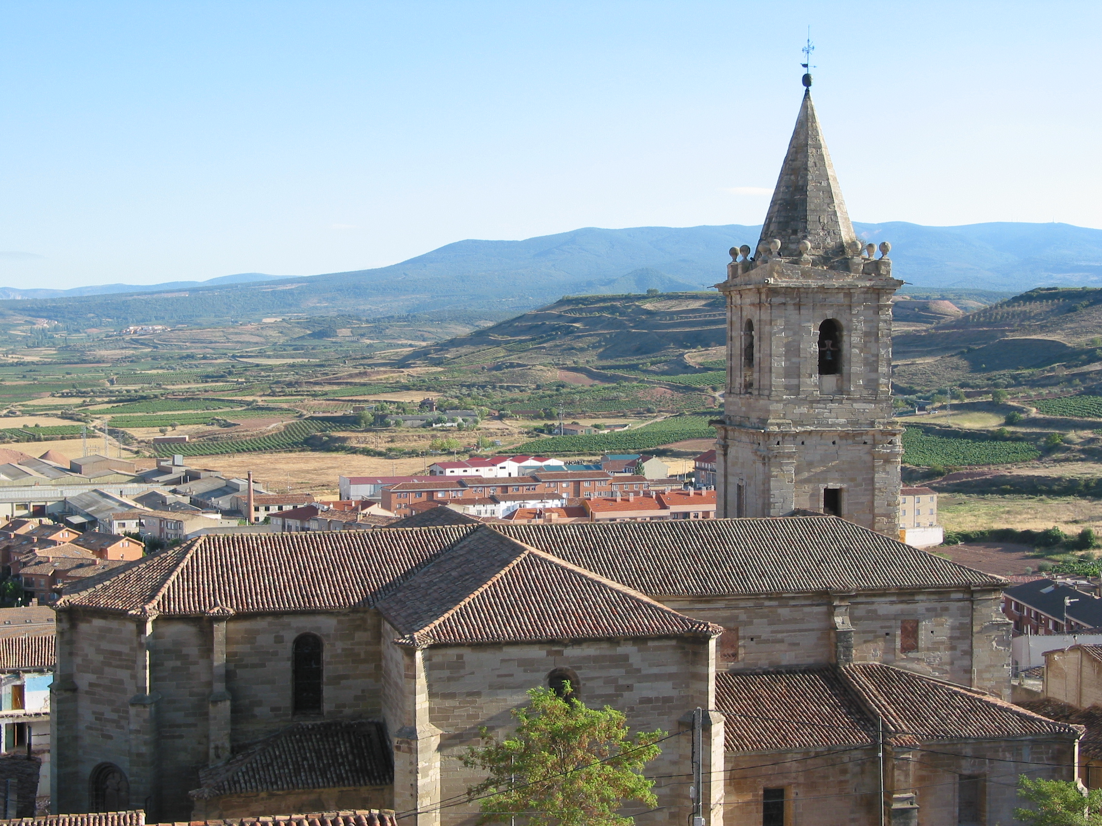
- Parish church of the Assumption (Asunción de María). Construction began in 1553 and finished in 17th century. It consists of three naves and a baroque altarpiece.
- Hermitage of Santa Maria del Buen Suceso. Located to the south of the municipality, in the direction of Entrena. The facade reliefs make references to the travellers of the Way of St. James.
- The Castle. This is the name given to the highest peak of the Cerro Tedeón on account of there once being a castle there. No trace of the castle now exists. There is a viewing point from which can be seen several towns and mountains.
Demography
Demographic evolution of Navarrete, during 20th century.

See also
External links
References
Coordinates: 42°26′N 2°33′W / 42.433°N 2.55°W
Municipalities in La Rioja Ábalos · Agoncillo · Aguilar del Río Alhama · Ajamil · Albelda de Iregua · Alberite · Alcanadre · Aldeanueva de Ebro · Alesanco · Alesón · Alfaro · Almarza de Cameros · Anguciana · Anguiano · Arenzana de Abajo · Arenzana de Arriba · Arnedillo · Arnedo · Arrúbal · Ausejo · Autol · Azofra · Badarán · Bañares · Baños de Rioja · Baños de Río Tobía · Berceo · Bergasa · Bergasillas Bajera · Bezares · Bobadilla · Brieva de Cameros · Briones · Briñas · Cabezón de Cameros · Calahorra · Camprovín · Canales de la Sierra · Canillas de Río Tuerto · Casalarreina · Castañares de Rioja · Castroviejo · Cañas · Cellorigo · Cenicero · Cervera del Río Alhama · Cidamón · Cihuri · Cirueña · Clavijo · Cordovín · Corera · Cornago · Corporales · Cuzcurrita de Río Tirón · Cárdenas · Daroca de Rioja · El Rasillo de Cameros · El Redal · El Villar de Arnedo · Enciso · Entrena · Estollo · Ezcaray · Foncea · Fonzaleche · Fuenmayor · Galbárruli · Galilea · Gallinero de Cameros · Gimileo · Grañón · Grávalos · Haro · Herce · Herramélluri · Hervías · Hormilla · Hormilleja · Hornillos de Cameros · Hornos de Moncalvillo · Huércanos · Igea · Jalón de Cameros · Laguna de Cameros · Lagunilla del Jubera · Lardero · Ledesma de la Cogolla · Leiva · Leza de Río Leza · Logroño · Lumbreras · Manjarrés · Mansilla de la Sierra · Manzanares de Rioja · Matute · Medrano · Munilla · Murillo de Río Leza · Muro de Aguas · Muro en Cameros · Nalda · Navajún · Navarrete · Nestares · Nieva de Cameros · Nájera · Ochánduri · Ocón · Ojacastro · Ollauri · Ortigosa de Cameros · Pazuengos · Pedroso · Pinillos · Pradejón · Pradillo · Préjano · Quel · Rabanera · Ribafrecha · Rincón de Soto · Robres del Castillo · Rodezno · Sajazarra · San Asensio · San Millán de Yécora · San Millán de la Cogolla · San Román de Cameros · San Torcuato · San Vicente de la Sonsierra · Santa Coloma · Santa Engracia del Jubera · Santa Eulalia Bajera · Santo Domingo de la Calzada · Santurde de Rioja · Santurdejo · Sojuela · Sorzano · Soto en Cameros · Sotés · Terroba · Tirgo · Tobía · Tormantos · Torre en Cameros · Torrecilla en Cameros · Torrecilla sobre Alesanco · Torremontalbo · Treviana · Tricio · Tudelilla · Uruñuela · Valdemadera · Valgañón · Ventosa · Ventrosa · Viguera · Villalba de Rioja · Villalobar de Rioja · Villamediana de Iregua · Villanueva de Cameros · Villar de Torre · Villarejo · Villarroya · Villarta-Quintana · Villavelayo · Villaverde de Rioja · Villoslada de Cameros · Viniegra de Abajo · Viniegra de Arriba · Zarratón · Zarzosa · Zorraquín Categories:
- Municipalities in La Rioja
- Way of St. James

Wikimedia Foundation. 2010.