- Lineville, Alabama
Infobox Settlement
official_name = Lineville, Alabama
settlement_type =City
imagesize =
image_caption =
image_
imagesize =
image_caption =
image_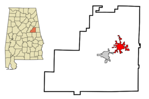
mapsize = 250px
map_caption = Location in Clay County and the state ofAlabama
mapsize1 =
map_caption1 =
subdivision_type = Country
subdivision_type1 = State
subdivision_type2 = County
subdivision_name =United States
subdivision_name1 =Alabama
subdivision_name2 = Clay
government_type =
leader_title =
leader_name =
established_date =
area_magnitude =
area_total_km2 = 23.3
area_total_sq_mi = 9
area_land_km2 = 23.2
area_land_sq_mi = 9
area_water_km2 = 0.1
area_water_sq_mi = 0
elevation_ft = 1056
elevation_m = 322
population_as_of = 2000
population_footnotes =
population_total = 2401
population_metro =
population_density_km2 = 103
population_density_sq_mi = 266.8
timezone = Central (CST)
utc_offset = -6
latd = 33 |latm = 18 |lats = 45 |latNS = N
longd = 85 |longm = 45 |longs = 9 |longEW = W
timezone_DST = CDT
utc_offset_DST = -5
postal_code_type =ZIP code
postal_code = 36266
area_code = 256
blank_name = FIPS code
blank_info = 01-43264
blank1_name = GNIS feature ID
blank1_info = 0159953
footnotes =
website =Lineville is a city in Clay County,
Alabama ,United States . At the 2000 census the population was 2,401.Geography
Lineville is located at 33°18'45.122" North, 85°45'9.274" West (33.312534, -85.752576)GR|1.
According to the
U.S. Census Bureau , the city has a total area of 9.0square mile s (23.3km² ), of which, 9.0 square miles (23.2 km²) of it is land and 0.1 square miles (0.1 km²) of it (0.55%) is water.Lineville was named for its location on what was then the
border betweenTalladega andRandolph counties.Alabama's highest point,
Mount Cheaha , is located several miles north of Lineville on Alabama Highway 49.Demographics
As of the
census GR|2 of 2000, there were 2,401 people, 1,004 households, and 665 families residing in the city. Thepopulation density was 267.7 people per square mile (103.3/km²). There were 1,095 housing units at an average density of 122.1/sq mi (47.1/km²). The racial makeup of the city was 60.22% White, 37.78% Black or African American, 0.12% Native American, 0.17% Asian, 0.04% Pacific Islander, 0.87% from other races, and 0.79% from two or more races. 2.62% of the population were Hispanic or Latino of any race.There were 1,004 households out of which 28.8% had children under the age of 18 living with them, 46.5% were married couples living together, 15.8% had a female householder with no husband present, and 33.7% were non-families. 31.2% of all households were made up of individuals and 15.7% had someone living alone who was 65 years of age or older. The average household size was 2.38 and the average family size was 2.97.
In the city the population was spread out with 25.5% under the age of 18, 8.9% from 18 to 24, 24.8% from 25 to 44, 22.1% from 45 to 64, and 18.6% who were 65 years of age or older. The median age was 38 years. For every 100 females there were 87.0 males. For every 100 females age 18 and over, there were 80.8 males.
The median income for a household in the city was $23,468, and the median income for a family was $31,326. Males had a median income of $24,620 versus $18,024 for females. The
per capita income for the city was $13,568. About 18.7% of families and 26.6% of the population were below thepoverty line , including 41.4% of those under age 18 and 20.0% of those age 65 or over.Notable natives
* NASA Astronaut
Joe F. Edwards, Jr. grew up in Lineville before attending the Navy Academy.
*Byron Lavoy Cockrell (1935-2007) was a rocket scientist and engineer.References
External links
* [http://www.legislature.state.al.us/searchableinstruments/1999rs/Resolutions/SJR9.htm DR. GEORGE C. SMITH, SR., HEALTH DEPT BLDG, Clay County, Alabama]
* [http://www.jsc.nasa.gov/Bios/htmlbios/edwards.html/Astronaut Joe Edwards NASA bio]
Wikimedia Foundation. 2010.