- Ngang Pass
-
Ngang Pass Đèo Ngang 
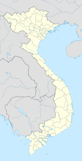
Elevation 250 metres (820 ft) Location Location of the Ngang Pass in Vietnam Location  Vietnam
Range Hoanh So Coordinates 17°57′N 106°28′E / 17.95°N 106.467°ECoordinates: 17°57′N 106°28′E / 17.95°N 106.467°E The Ngang Pass (Vietnamese: Đèo Ngang) is a mountain pass on the border of the two provinces of Quang Binh and Ha Tinh, on the North Central Coast of Vietnam. It is situated on the National Road 1A, traversing the Hoanh Son, a side-spur of the larger Annamite Range. The pass is 2,560 m long with the peak at 250 m (750 ft).
From the summit, the views encompass the sandy beaches below, the forested slopes and the cultivated fields farther afield. At the peak is Hoanh Son Quan (lit. Transverse Mountain Gate), a was gateway built during the Nguyễn Dynasty to control traffic on the mountain. The pass was once known to be a major hindrance to land transportation with its winding and steep grade. A modern tunnel has since bypassed the climb, shortening the driving time through the pass as well as making it safer for drivers. The serpentine road ascending the pass is now restricted to sightseers only. The Ngang Pass is well known in Vietnamese literature through a famous poem by Bà Huyện Thanh Quan.
See also

This article about transport in Vietnam is a stub. You can help Wikipedia by expanding it.

