Omaha Public Power District
- Omaha Public Power District
-
Omaha Public Power District, or OPPD, is a public electric utility in the State of Nebraska. It is one of the largest publicly owned electric utilities in the United States, serving more than 340,000 customers in 13 southeast Nebraska counties. OPPD was formed in 1946 as a political subdivision of the State of Nebraska. A publicly elected eight-member Board of Directors sets rates and policies.[1]
OPPD is headquartered in Omaha.
Generating facilities
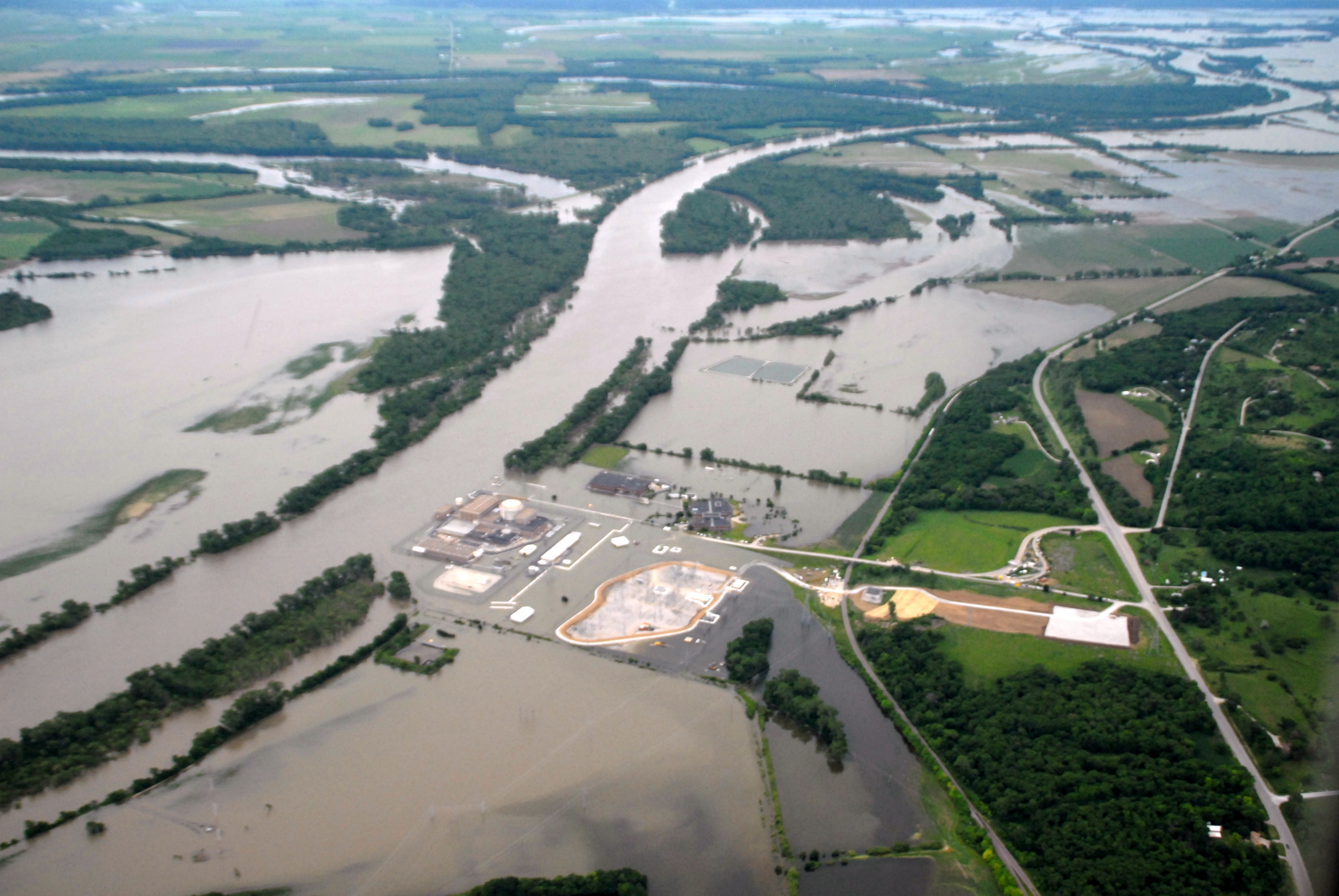
OPPD operates the Fort Calhoun Nuclear Generating Station near Fort Calhoun. It also operates other generating stations in North Omaha, Nebraska City, Valley, Elk City and in Cass County; coal, natural gas, oil, wind turbines, and landfill gas are used to generate electricity at their power plants.
Awards
In 2009 OPPD was awarded its 9th J.D. Power and Associates award. OPPD was named "Highest in Customer Satisfaction among Midsize Utilities in the Midwest" in the J.D. Power and Associates 2009 Electric Utility Residential Customer Satisfaction Study. [2]
References
External links
Categories:
- Government agencies established in 1946
- Government of Omaha, Nebraska
- Nuclear power companies of the United States
- Power districts in Nebraska
- Infrastructure in Omaha, Nebraska
- Public utilities of the United States
- Omaha, Nebraska stubs
Wikimedia Foundation.
2010.
Look at other dictionaries:
Omaha, Nebraska — Omaha redirects here. For other uses, see Omaha (disambiguation). Omaha City An aerial view of Downtown Omaha from the ea … Wikipedia
Government of Omaha — Omaha s City Offices Building in Downtown Omaha. The government of the City of Omaha, Nebraska consists of the Mayor of Omaha, the Omaha City Council and various departments of the City of Omaha, which in located in Douglas County, Nebraska. The… … Wikipedia
Downtown Omaha — View of Downtown Omaha looking west from the Gene Leahy Mall … Wikipedia
East Omaha, Nebraska — East Omaha is a geographically designated community located in Omaha, Nebraska. Located three miles (5 km) from downtown Omaha, East Omaha is the site of Eppley Airfield, Omaha’s main airport, and Carter Lake. This area was Omaha s first… … Wikipedia
Military Road (Omaha) — Military Road Segment U.S. National Register of Historic Places … Wikipedia
Lincoln Highway (Omaha) — Infobox nrhp name = Lincoln Highway (Omaha) caption = Official Lincoln Highway marker. location= Omaha, NE area = built = 1913 architecture= added = 2003 governing body = City of Omaha refnum=03000104 [… … Wikipedia
Omaha Race Riot of 1919 — Part of a series on African Americans in Omaha Historic places Notable people Neighborhood Museum Music Racial tension Tim … Wikipedia
Racial tension in Omaha, Nebraska — mostly occurred because of the city s volatile mixture of high numbers of new immigrants from southern and eastern Europe and African American migrants from the Deep South. While racial discrimination existed at several levels, the violent… … Wikipedia
Cooper Nuclear Power Plant — Cooper Nuclear Station (CNS) is a boiling water reactor (BWR) type nuclear power plant located on a 1,251 acre (5.1 km sup2;) site near Brownville, Nebraska. It is the largest single unit electrical generator in Nebraska. CNS was first put into… … Wikipedia
Omaha Zoo Railroad — The Omaha Zoo Railroad, or the OZRR, is the name of a heritage railroad at the Henry Doorly Zoo in Omaha, Nebraska. The railroad offers a narrow gauge excursion train for zoo visitors hauled by a steam locomotive. The train loads passengers at… … Wikipedia
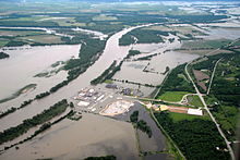 Fort Calhoun on June 16, 2011 during the 2011 Missouri River Floods