Lamar Boulevard Bridge

Lamar Boulevard Bridge

Infobox_nrhp | name = Lamar Boulevard Bridge


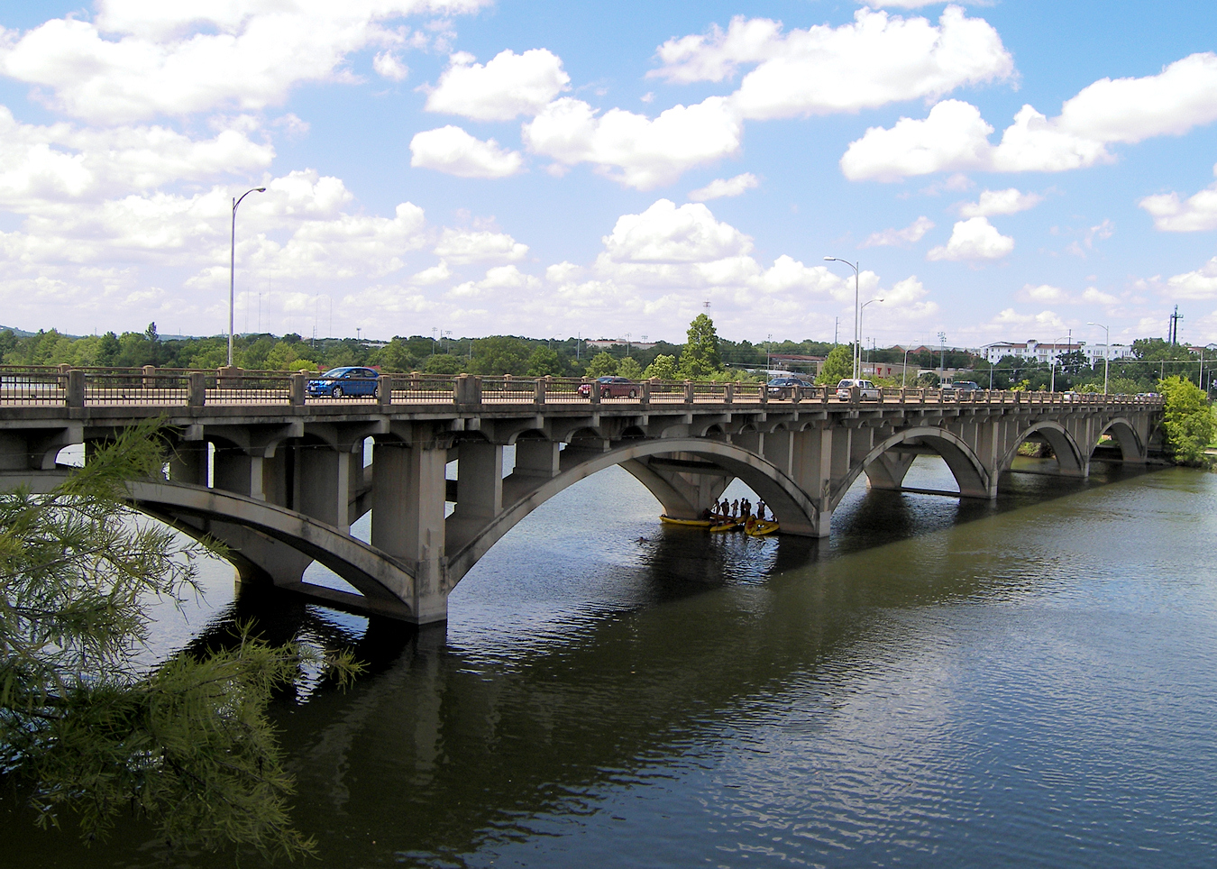
caption = The Lamar Boulevard Bridge in 2007
location = Austin, Texas, USA
nearest_city =
lat_degrees = 30
lat_minutes = 15
lat_seconds = 56
lat_direction = N
long_degrees = 97
long_minutes = 45
long_seconds = 23
long_direction = W
built = 1942
architect=Cage Brothers and L. A. Turner
added = July 7, 1994
refnum=94000678
governing_body =
The Lamar Boulevard Bridge is a historic bridge over Lady Bird Lake in downtown Austin, Texas. The bridge features six open spandrel concrete arches and carries thousands of vehicles daily across the river. [ [http://www.historicbridgefoundation.com/ipages/texas/hillcountry/travis/lamar.html Historic Bridge Foundation - Lamar Boulevard Bridge] ] Completed in 1942, the Lamar Boulevard Bridge was the second permanent bridge to cross the Colorado River after the Congress Avenue Bridge.

In the late 20th century, the bridge was notorious for road accidents involving bicycles and pedestrians. The problem was remedied in 2001, when the James D. Pfluger pedestrian bridge opened 200 feet to the east of the Lamar bridge. [ [http://tspweb02.tsp.utexas.edu/webarchive/06-18-01/2001061801_s01_Pedestrian.html The Daily Texan - Pedestrian bridge opens in central Austin] ]

The bridge was added to the National Register of Historic Places in 1994.

External links


Wikimedia Foundation. 2010.

Игры ⚽ Нужно решить контрольную?

Look at other dictionaries:

  • National Register of Historic Places listings in Travis County, Texas — Location of Travis County in Texas This is a list of the National Register of Historic Places listings in Travis County, Texas. This is intended to be a complete list of the properties and districts on the National Register of Historic Places in… …   Wikipedia

  • Texas State Highway Loop 343 — Infobox TX State Highway type=Loop route=343 shields= length mi=5.186 length ref=TxDOT|SL|343] length km=8.3 formed=1961 dir1=South dir2=East from=jct|state=TX|US|290|SH|71 to=jct|state=TX|I|35 previous type=Spur previous route=342 next type=Loop …   Wikipedia

  • Liste der Einträge im National Register of Historic Places im Travis County — Die Liste der Registered Historic Places im Travis County führt alle Bauwerke und historischen Stätten im texanischen Travis County auf, die in das National Register of Historic Places aufgenommen wurden. Aktuelle Einträge Lfd. Nr. Name Bild… …   Deutsch Wikipedia

  • Mount Righteous — Origin Grapevine, Texas, United States Genres Folk Punk Labels Righteous Records Website http:// …   Wikipedia

  • Interstate 30 — I 30 redirects here. For other uses, see I 30 (disambiguation). Interstate 30 Route information …   Wikipedia

  • Chinatowns in North America — This article surveys individual Chinatowns in North America. * For the purposes of this article North America is defined as Canada and the United States. * For information on Chinatowns in Mexico and Central America, please refer to Chinatowns in …   Wikipedia

  • U.S. Route 290 — U.S. Highway 290 Route information Maintai …   Wikipedia

  • Texas State Highway Loop 275 — Infobox TX State Highway type=Loop route=275 shields= length mi=9.454 length ref=cite web|publisher=Texas Department of Transportation|url=http://www.dot.state.tx.us/tpp/hwy/sl/sl0275.htm|title=Highway Designation File State Highway Loop No.… …   Wikipedia

  • List of Chinatowns — This is a list of Chinatowns (urban regions containing a large population of Chinese people within a non Chinese society) in select countries. It includes the parent city with metropolitan older Chinatown and newer satellite Chinatowns in the… …   Wikipedia

  • Old West Austin Historic District — and Boundary Increase U.S. National Register of Historic Places U.S. Historic district …   Wikipedia

Share the article and excerpts

Direct link
Do a right-click on the link above
and select “Copy Link”