- Munger, Minnesota
-
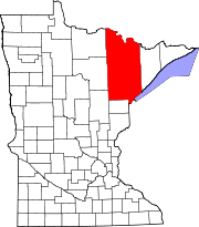
Munger is an unincorporated community in Solway Township, Saint Louis County, Minnesota, United States.
The community is located 11 miles west of the city of Duluth at the junction of U.S. Highway 2 and County Road 223 (Munger Shaw Road). Munger is also located 7 miles west of the city of Proctor.
It is labeled Solway Township 5017, and it encompasses the following area: the area north of Maple Grove Road but between Van Gassler Road and Munger Shaw Road yet south of Arrowhead Road, the area east of Canosia Road but between State Highway 194 and below Arrowhead Road yet west of the state-drawn line separating Solway Township 5017 (Munger) from Solway Township 5018.[1]
Contents
Notes
Most of Munger lies in Saint Louis County, however the mailing address for most of Munger is Cloquet, MN, which is in adjacent Carlton County at latitude 46.801 and longitude -92.344.[2]
Local business establishments include an Armor automated gas station and the Munger Bar and Grill.
Munger also includes a handful of churches, including Hope Lutheran Church (LCMS).
Nearby attractions
- The Willard Munger Trail
- Spirit Mountain Ski Resort
- Miller Hill Mall
- Various Duluth, MN area attractions.
Nearby cities and towns
Notes
- ^ http://factfinder.census.gov/servlet/ReferenceMapFramesetServlet?_bm=y&-tree_id=420&-_MapEvent=Pan&-errMsg=&-redoLog=false&-_zoomLevel=&-rm_config=%7Cb=50%7Cl=en%7Ct=420%7Czf=0.0%7Cms=ref_stat_00dec%7Cdw=0.05896846798952603%7Cdh=0.030257641331375398%7Cdt=gov.census.aff.domain.map.EnglishMapExtent%7Cif=gif%7Ccx=-92.35098789192065%7Ccy=46.84107088768832%7Czl=3%7Cpz=3%7Cbo=318:317:316:314:313:323:319%7Cbl=362:393:358:357:356:355:354%7Cft=350:349:335:389:388:332:331%7Cfl=403:381:204:380:369:379:368%7Cg=10000US271370111005017&-PANEL_ID=rm_result&-_pageY=&-_lang=en&-geo_id=10000US271370111005017&-_pageX=&-_mapY=&-_mapX=&-_latitude=&-_pan=S&-_longitude=&-_changeMap=ZoomIn#?436,178
- ^ http://minnesota.hometownlocator.com/mn/st.-louis/munger.cfm
References
Official State of Minnesota Highway Map - 2007/2008 edition
Coordinates: 46°48′03″N 92°20′38″W / 46.80083°N 92.34389°W
Categories:- Unincorporated communities in Minnesota
- Populated places in St. Louis County, Minnesota
- St. Louis County, Minnesota geography stubs
Wikimedia Foundation. 2010.

