- Ingraham Glacier
Infobox_Glacier | glacier_name = Ingraham Glacier
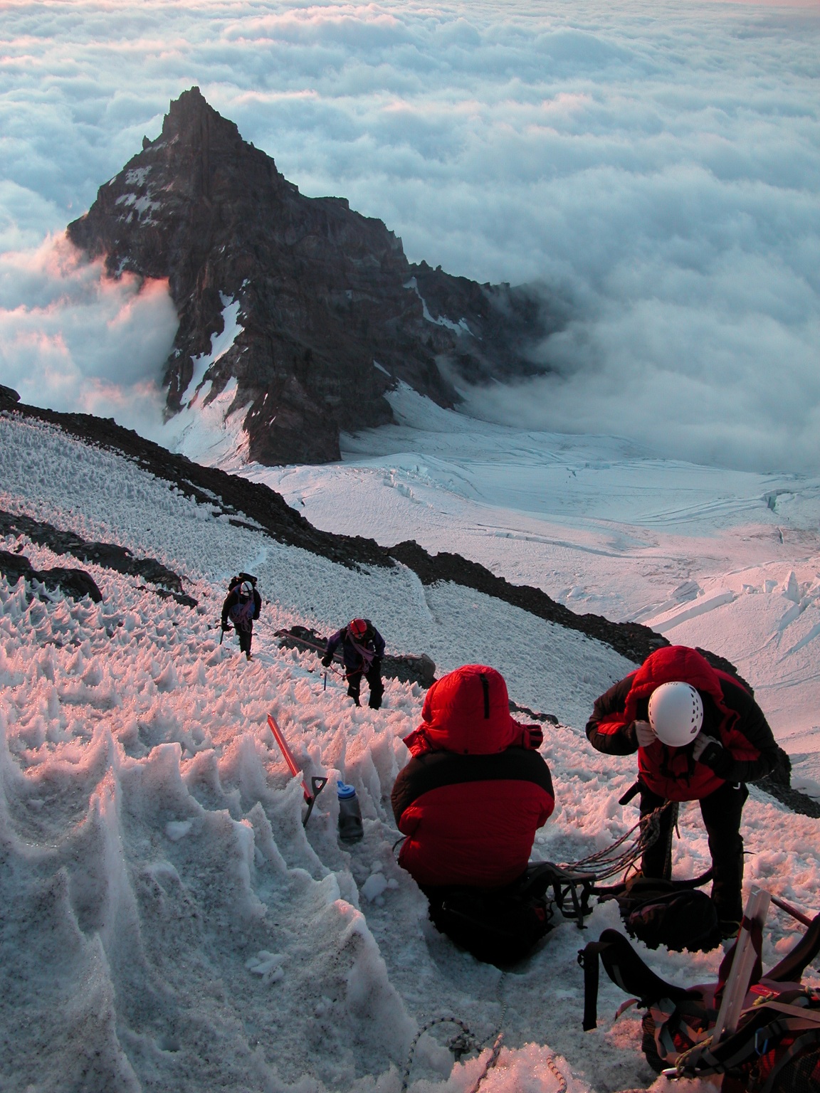
caption = Climbing Ingraham Glacier,Little Tahoma below
type = Mountain glacier
location =Mount Rainier ,Washington , U.S.
coordinates = coord|46|50|18|N|121|42|43|W|display=title,inline|type:glacier
length =
thickness =
area = Convert|1.5|sqmi|km2|1, 1983Cite web|title= DESCRIPTION: Mount Rainier Glaciers and Glaciations - Mount Rainier Glacier Hazards and Glacial Outburst Floods|url=http://vulcan.wr.usgs.gov/Volcanoes/Rainier/Glaciers/description_rainier_glaciers.html|publisher=USGS|accessdate= 2007-11-19]
terminus =Cowlitz Glacier
status = RetreatingThe Ingraham Glacier is a largeglacier on the eastern flank ofMount Rainier ,Washington . It covers an area of 1.5 mi² (3.9 km²) and contains 7 billion ft³ (198 million m³) if ice. The glacier start out at the Disappointment Cleaver at over Convert|12200|ft|m|-2 and flow eastward along with the largeEmmons Glacier . As the glaciers head down to about Convert|10000|ft|m|-2, the wedge fromLittle Tahoma Peak splits up the Emmons and the Ingraham Glacier. While the Emmons glacier heads northeast, this glacier turns and heads southeast and joins the adjacentCowlitz Glacier as a single valley glacier ending at around Convert|5500|ft|m|-2|abbr=on|abbr=on|abbr=on elevation.Cite web|title=USGS Mount Rainier East (WA) Topo Map
work=USGS Quad maps|url=http://www.topoquest.com/map.php?lat=46.83903&lon=-121.71071&datum=nad27&zoom=8|publisher=TopoQuest.com|accessdate=2008-05-15] Meltwater from the glacier drains into theCowlitz River .History
About 35,000 years ago, the Ingraham and Cowlitz glaciers were joined together. The resulting ice stream flowed 65 miles (105 km) down from Mount Rainer to near present-day Mossyrock. More recently, the Cowlitz - Ingraham glacier advanced as recently as the mid-1980s. Currently, the glacier is retreating.
The worst mountaineering accident in American history occurred in 1981, when eleven people lost their lives in an ice fall on the Ingraham Glacier. None of the bodies were recovered.citation | last = Hatcher | first = Candy | title = Ghosts of Rainier: Icefall in 1981 entombed 11 climbers | newspaper=
The Seattle Post-Intelligencer | year=2000 |date = March 30, 2000 | url=http://seattlepi.nwsource.com/ghostsofrainier/fall302.shtml]ee also
*
List of glaciers References
Wikimedia Foundation. 2010.