Mattmarksee

Mattmarksee
Mattmarksee
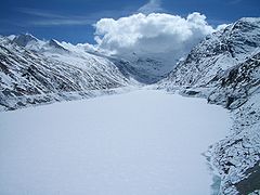
Location Saas Valley, Valais
Coordinates 46°2′17″N 7°57′36″E / 46.03806°N 7.96°E / 46.03806; 7.96Coordinates: 46°2′17″N 7°57′36″E / 46.03806°N 7.96°E / 46.03806; 7.96
Lake type reservoir
Catchment area 37.10 km²
Basin countries Switzerland
Max. length 3.2 km
Surface area 1.76 km²
Max. depth 93 m
Water volume 10.5 mio m³
Surface elevation 2197 m

Mattmarksee is a reservoir in the Saas Valley of the Canton of Valais, Switzerland. The Mattmark dam was built from 1960-1965. The lake's surface area is 1.76 km².
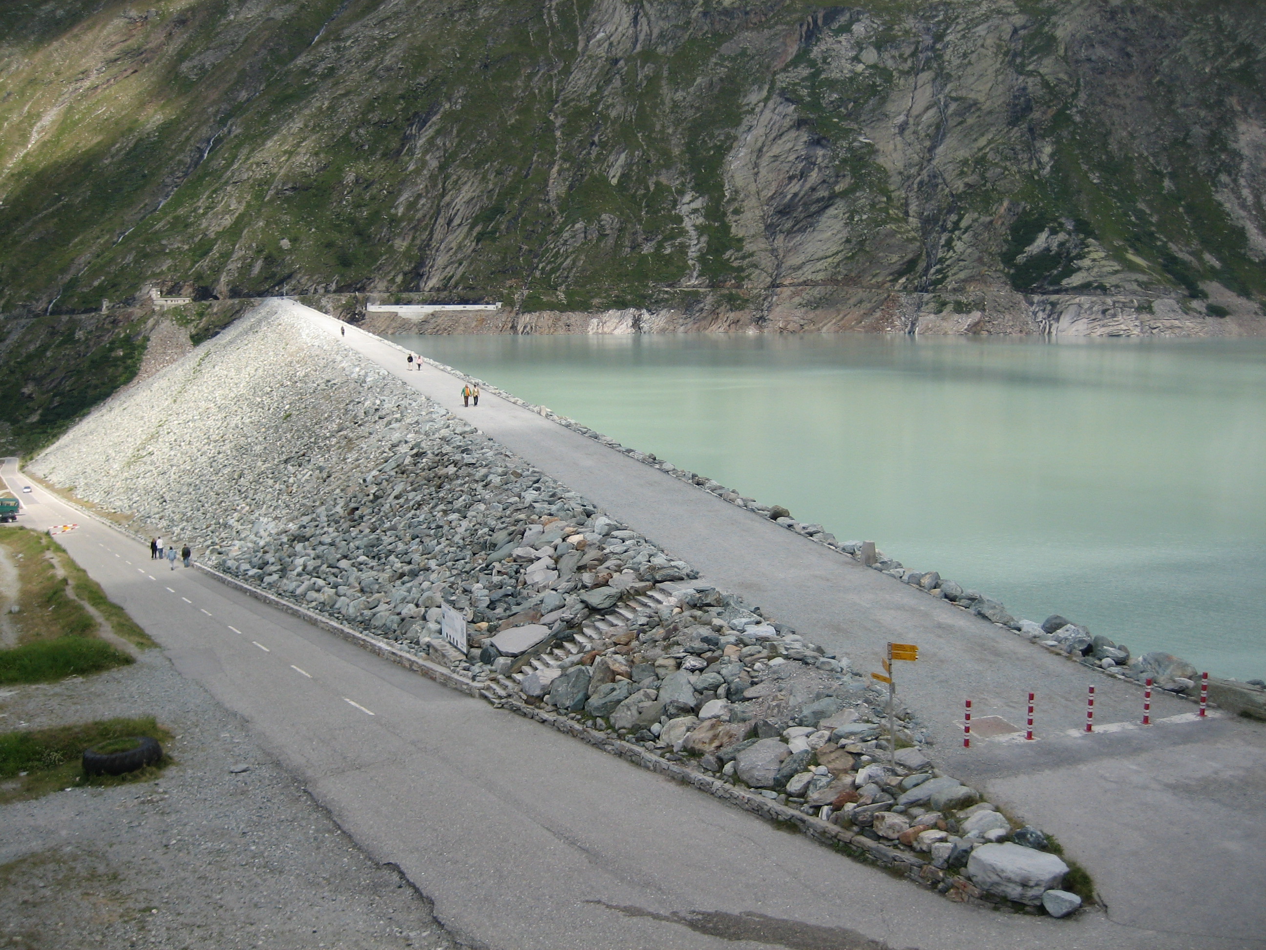
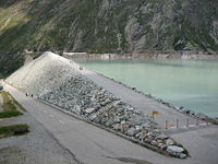
Mattmark dam


External links


Wikimedia Foundation. 2010.

Игры ⚽ Поможем написать реферат

Look at other dictionaries:

  • Mattmarksee — Geographische Lage Kanton Wallis, Schweiz Zuflüsse Stafelbach, diverse Bergbäche, Schmelzwasser des Schwarzberggletschers …   Deutsch Wikipedia

  • Mattmarksee — Mattmarksee, so v.w. Saasersee, s.u. Saas 1) …   Pierer's Universal-Lexikon

  • Mattmark — Mattmarksee Daten Lage: Kanton Wallis Fläche 1.76 km² …   Deutsch Wikipedia

  • Staudamm Mattmark — Mattmarksee Daten Lage: Kanton Wallis Fläche 1.76 km² …   Deutsch Wikipedia

  • CH-VS — Kanton Wallis Basisdaten Hauptort: Sitten/Sion Fläche: 5 224 km² (Rang 3) Einwohner: 298 580 (2007) (Rang 9) …   Deutsch Wikipedia

  • Davoser See — Davosersee Der Davosersee, im Hintergrund der Wolfgangpass Daten Lage: G …   Deutsch Wikipedia

  • Grande-Dixence — Lac des Dix Daten Lage: Wallis Fläche …   Deutsch Wikipedia

  • Grande Dixence — Lac des Dix Daten Lage: Wallis Fläche …   Deutsch Wikipedia

  • Greyerzer See — Greyerzersee (Lac de la Gruyère) Daten Lage: Kanton Freiburg …   Deutsch Wikipedia

  • Imseng — Johann Josef Imseng (* 6. Juni 1806 in Saas Fee; † 5. Juli 1869 in Saas Almagell) war Pfarrer im Schweizer Saastal und Alpinist. Imseng Denkmal am Dorfplatz von Saas Fee Imseng war ein Pionier und Förderer des aufkommenden Fremdenve …   Deutsch Wikipedia

Share the article and excerpts

Direct link
Do a right-click on the link above
and select “Copy Link”