- Nu'uuli, American Samoa
-
Nu'uuli — Village — 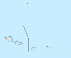
 Nu'uuli
Coordinates: 14°19′7″S 170°43′25″W / 14.31861°S 170.72361°WCoordinates: 14°19′7″S 170°43′25″W / 14.31861°S 170.72361°W Country  United States
Territory  American Samoa
Area - Total 3 sq mi (7.87 km2) Population (2000) - Total 5,154 Nu'uuli is a village on the central east coast of Tutuila Island, American Samoa. It is located on a peninsula several miles up from Pago Pago International Airport.
It is the fifth-largest village in land area in American Samoa and the second-largest on Tutuila Island. It straddles the line between the Eastern District and the Western District. This makes it the only village in American Samoa that occupies two districts. It has a total land area of 7.87 km², with 6.23 km² being in the Eastern District and 1.64 km² being in the Western District. Its total population as of the 2000 census was 5,154, with the Eastern District portion containing 2,844 persons and the Western District portion 2,310 persons.
References
 Territory of American Samoa
Pago Pago (capital), Fagatogo (seat of government) Topics Government Politics | Former Governors | Former Lieutenant Governors | Elections | Current Governor
Districts Villages Aasu | Afao | Afono | Agugulu | Alao | Alega | Alofau | Amaluia | 'Amanave | Amaua | Amouli | Anua | 'Aoa | Aoloau | Asili | Atu'u | Aua | 'Au'asi | Aumi | Aunu'u | Auto | Avaio | Faga'alu | Faga'itua | Fagali'i | Fagamalo | Faganeanea | Fagasa | Fagatogo | Failolo | Faleasao | Faleniu | Fatumafuti | Futiga | 'Ili'ili | Lauli'i | Leloaloa | Leone | Leusoali'i | Luma | Maia | Malaeimi | Malaeloa/Aitulagi | Malaeloa/Ituau | Maloata | Mapusagafou | Masausi | Masefau | Matu'u | Mesepa | Nu'uuli | Nua | Ofu | Olosega | Onenoa | Pagai | Pago Pago | Pava'ia'i | Poloa | Sa'ilele | Se'etaga | Si'ufaga | Sili | Taulaga | Tafuna | Taputimu | Tula | Utulei | Utumea East | Utumea West | Vailoatai | Vaitogi | Vatia |
Islands Tutuila | Aunu'u | Ta'ū | Ofu‑Olosega | Rose Atoll | Swains Island
Categories:- Villages in American Samoa
- American Samoa geography stubs

Wikimedia Foundation. 2010.